

Name: Mt Ugo
Jump-Off: Kayapa, Nueva Vizcaya
Exit Point: Brgy. Tinongdan Itogon, Benguet
Elevation: 2150+ MASL
Difficulty: 5/9 (Pinoy Mountaineer)
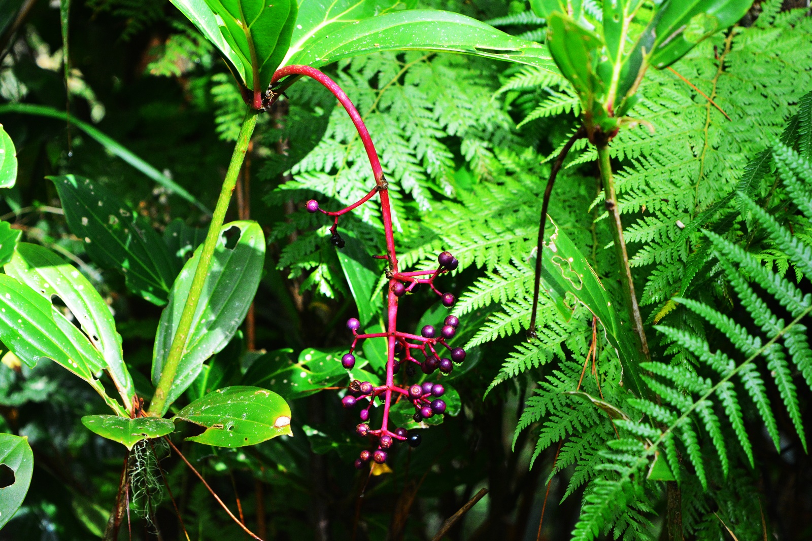
Features: Pine Forest. Highland rice paddies and villages. Marvelous view of the Cordilleras.
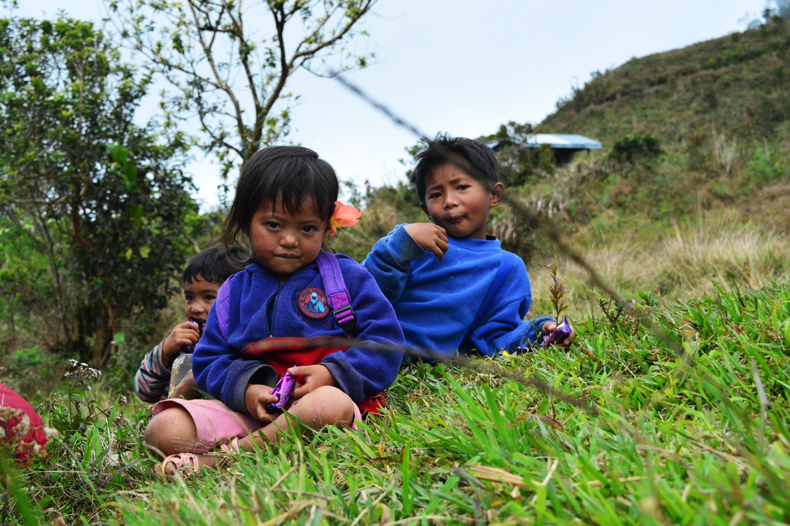
Mt. Ugo has a very rich history which even dates back to the Spanish era that one will find totally insightful. According to our guide, the word “Ugo” was derived from a native term which means beheading someone. It was said that the native people living in the mountains in the effort to defend their lands used to take their Spanish and American captives to Mt. Ugo to behead them. Now that I think about it! Isn’t it creepy? Bet thoughts of beheaded zombies running after you on a dark stormy night within the vastness of Mt. Ugo flooded your mind instantly upon learning about this like I did! Or… Am I all alone in this? 😀 But anyways thoughts of those horrible things (ever you had one) will simply vanish in the air once you get to marvel at the breathtaking pine infused scenery while trekking through the trails from Kayapa to the summit and down Itogon.
OUR MT. UGO CLIMB
I was battling with myself on whether or not I will still push through with taking on the challenge of Mt. Ugo days before the eventful climb as I was suffering from mild vertigo attacks and the fact that Ian (Boyfie) won’t be able to join me got me even more worried about becoming a liability to the group ever my worst thoughts come to reality. While I could simply back out of the plan, I didn’t do so since I had invited a friend (Brian), who was bringing his girlfriend (Rosie), to come along and I didn’t want to leave them in the company of people they barely knew. Like myself, this too was their first major climb and as the person who lured them into this madness, I felt greatly responsible of their well-being although I supposed they are more than capable of taking care of themselves. Despite my troubled mind and having come from a too exhausting day at work, off I went to Victory Liner Kamias Station to meet with Brian, Rosie, Sir Mharwin and the rest of the strangers I would call friends soon enough.
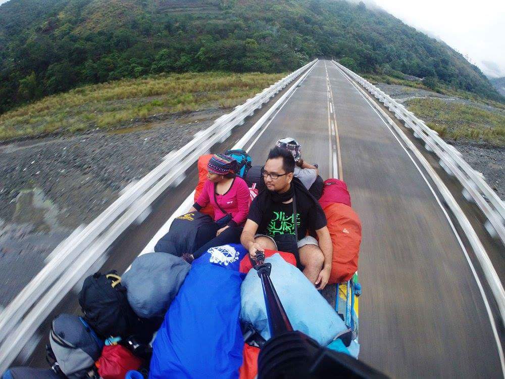
Our bus left to journey the roads bound for Nueva Vizcaya at 10:30PM while I took the opportunity to get me some sleep. We arrived in Aritao a little past the hour of 4 in the morning and waited for another hour for the others to arrive since some of our companions didn’t make it to the 10:30PM trip. While waiting we carefully arranged our backpacks on top of the jeep (our ride to Kayapa) coupling the task with some getting to know chitchat. When the others arrived, without further ado our ride to the jump-off began.
I didn’t bother to ride on top of the jeep (which I would normally do) as I wanted to get me more sleep. The ride to Kayapa was along a smooth concrete road which was in no way a disruption to my much-needed slumber. My eyes had opened numerous times catching glimpses of the rice paddies and the greenery we had passed by but I was in the most part unaware as we paved the uphill roads to Kayapa.
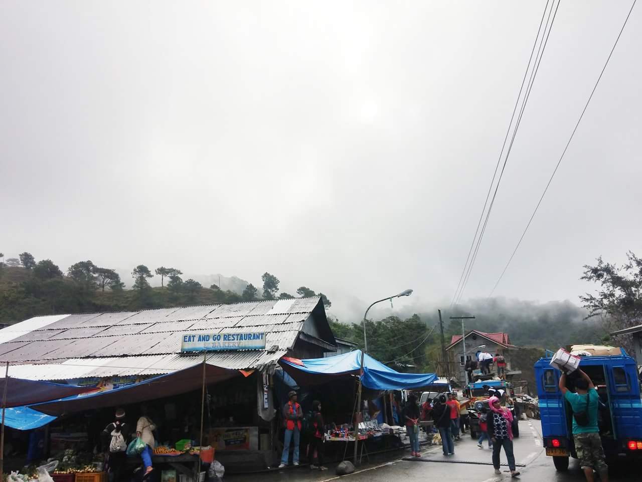
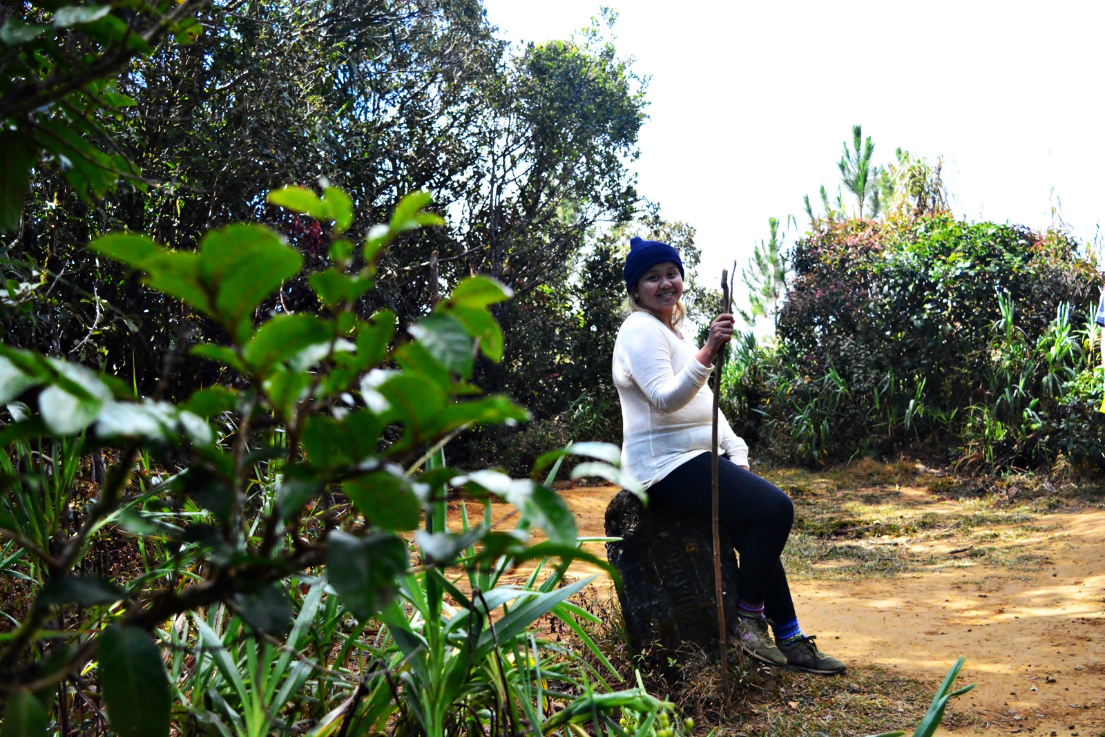
We reached Kayapa on a cold Saturday morning at 6:30 while the gloomy skies softly drizzled. We quickly grabbed our bags from the top of the jeep and settled in a nearby eatery inside the public market to eat breakfast. When everyone was full, we went through some last-minute prepping before heading out for the momentous part of the day. Outside the public market, we gathered around in a circle and silently sent prayers to the heavens to keep us all safe and for this climb to be a success. A few minutes later, we were already tracing the road leading to the trails of Mt. Ugo.
We walked along an uphill road for 5 minutes until we reached a narrow ladder pathway going up to the trails of Mt. Ugo. All those times of going up the concrete ladder in between locale houses, I was carefully observing myself. My bag was heavy but it won’t be an issue if only I was in my best shape. But that time, I felt like fainting anytime. I managed to hike up several meters until I was horribly panting and I felt like throwing up. I suppressed the urge to puke and went hiking several steps up until Sir Mharwin came to my rescue and without question took my bag from me. I didn’t argue. As much as I want to experience the challenge of this mountain in all its form with me carrying every bit of ounce I nonchalantly put inside my backpack, I didn’t want to spoil and take this precious moment away from anyone hence for my first major climb, I only had 81 kg (my weight) brought up to the summit.
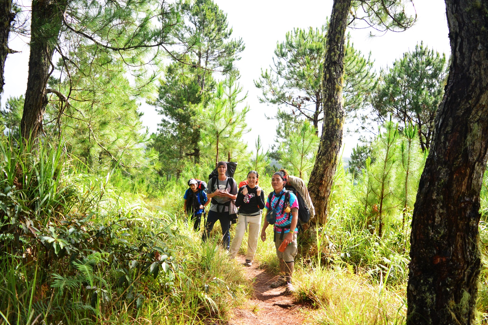
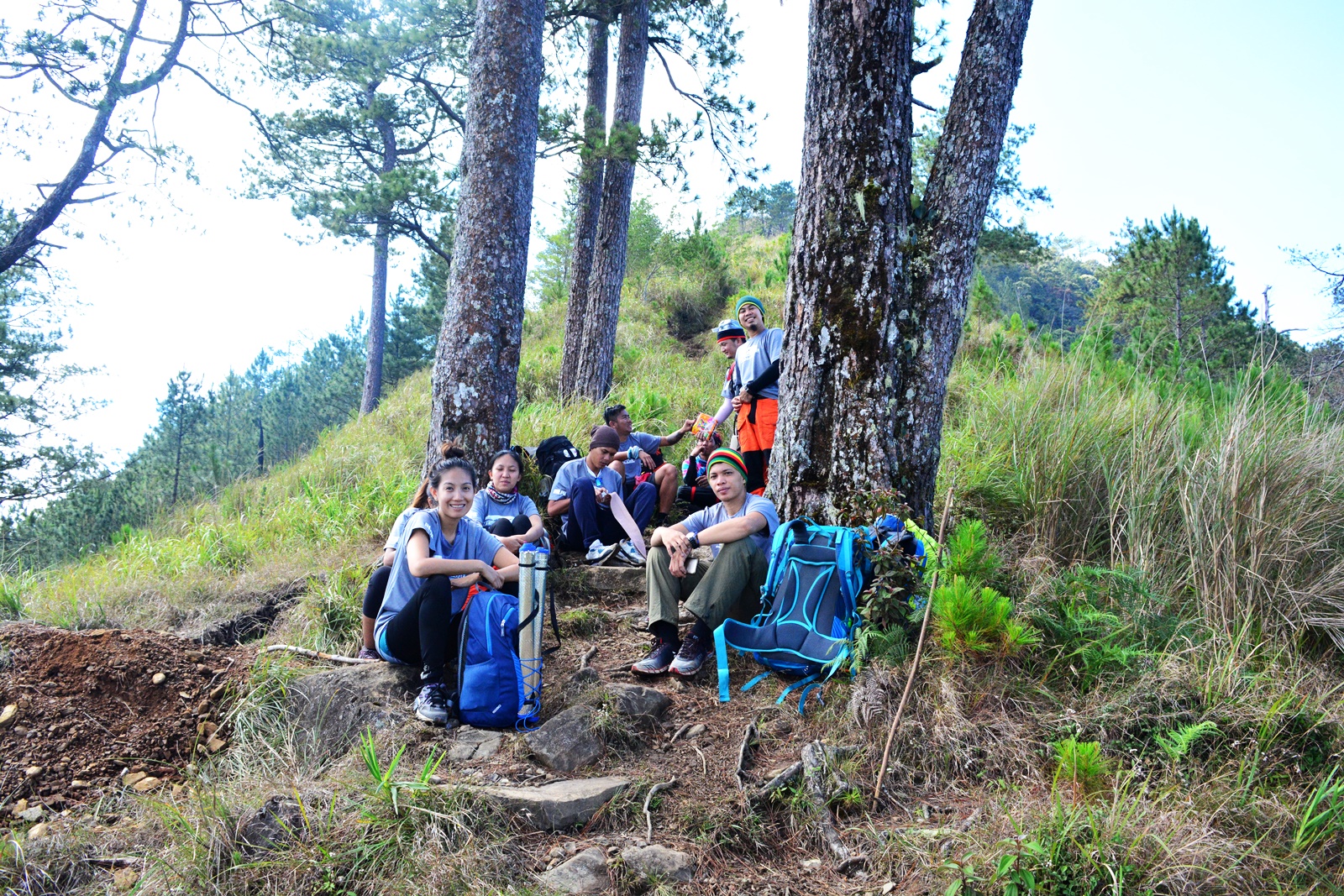
We continued to hike up the concrete ladder until our feet stumbled into the first mud of that day’s hike. From that point on, I knew that with or without a backpack, things are going to be tough. The trail was a bit damp and slippery due to the drizzle that had just subsided moments earlier before the start of the hike. We took 3 minutes to rest and I found it helpful to bag me some air. We resumed the trek and took another 10 minutes before reaching a residential house where we again rested. Several other hikers passed us by but shrugged the thought of being behind as we weren’t in a hurry. When everyone was rested, we resumed the hike until we reached a shed where we took another few good minutes to rest.
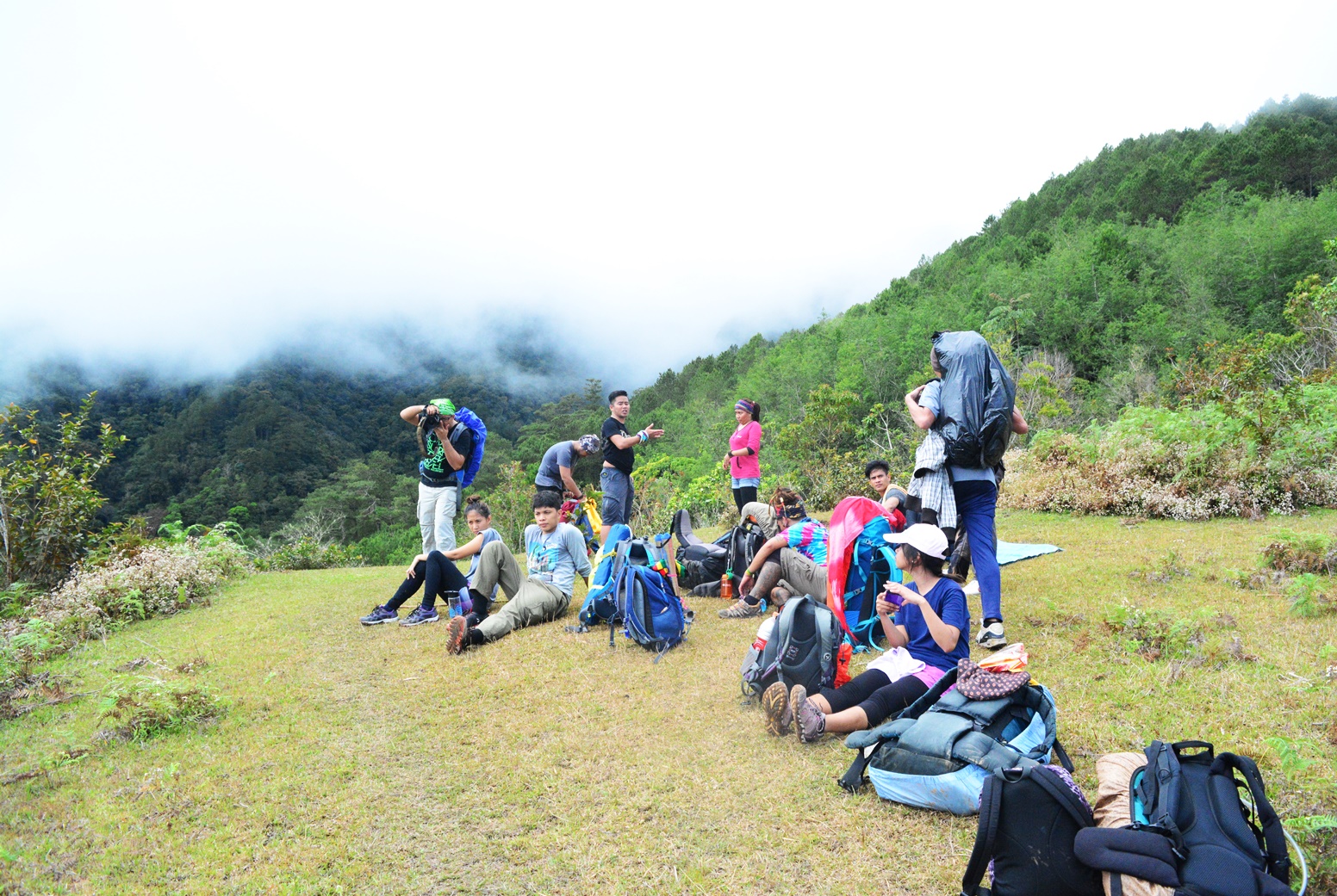
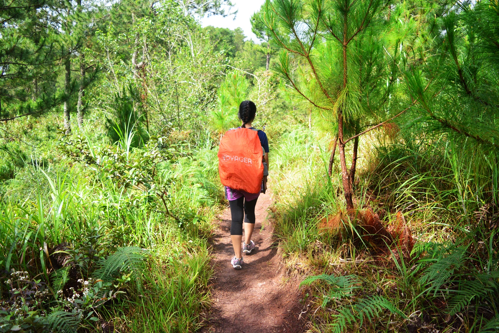
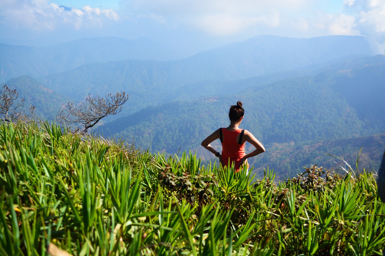
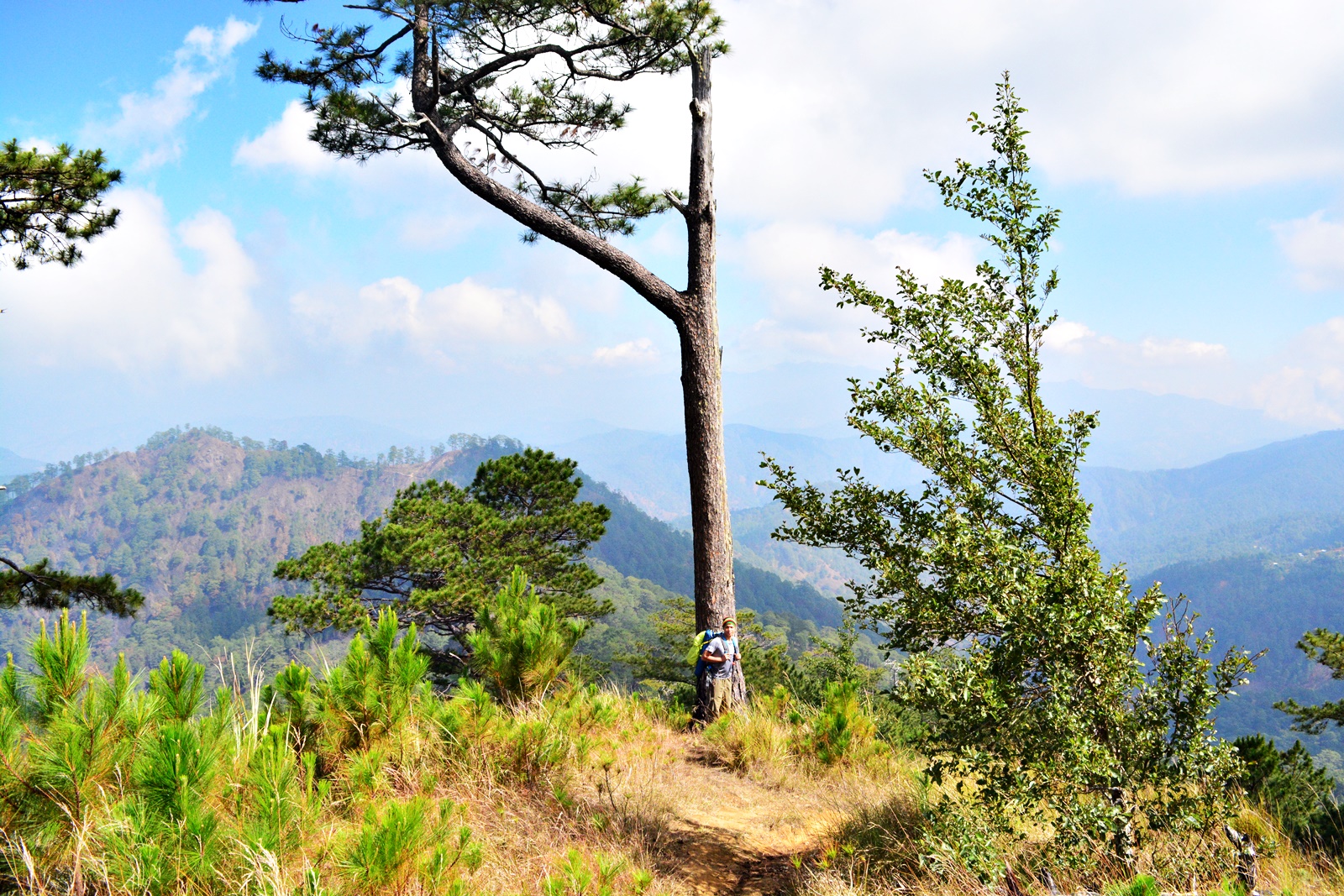
The trail was an assault of different levels. All were manageable but they weren’t at all easy. From the point where line of locale houses ended, pine trees dominated most of the scenery. The clouds were obscuring the view of the surrounding mountains and it seemed as if rain was about to pour down at anytime but it was unbelievably getting warmer as the clock ticked towards noon. Almost an hour after we started the trek, we reached a plateau of grassland where we lingered for several minutes to relish the warmth of the sun that had just battled it’s way out of the clouds. When everyone was ready, we head on to conquer more painstaking assaults.
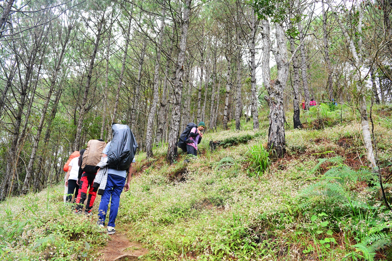
The trek that took place after was along an endless ascending pine tree streaked trail. This time little by little smiles were slowly vanishing from our faces and everyone looked like we really do mean business. Chitchats were gradually lessened as it was made impossible to speak while struggling to hike our way up. Many times we stopped for short breathers while hardly avoiding the urge to linger and rest way too long. After the seemingly endless assaults, we reached the ghostly Indupit Village minutes before 12 noon. There we had a sumptuous lunch munching over rice and sharing different chicken dishes!
After lunch, we took another 30 minutes to nap and didn’t resume the trek until 1:30 PM. Although the following task — walking on a rough road which stretches to about 12 kilometers under the scorching sun – was the easiest that day it was the most time-consuming. The longest walk of my life enabled me to marvel at the vastness of God’s creation and how tiny a specter I am compared to this world’s greatness. It took me to pass by Mt. Sarmiento and Dumolpos Village but it was still a long way to go before finally reaching the last stretch of the hike to the campsite. We took some recharging munching over sandwiches before heading down to the last water source. When everyone was feeling rejuvenated, off we went to refill our bottles and later on, take on the last series of agonizing assault to the campsite before finally capping off the day and indulge on our much-needed rest.
We started the assault to the campsite at 5PM minutes after we trekked away from the last water source. The blinding light of the sun atop the summit was slowly fading as the day end to give way to the night. I didn’t want to miss the sunset but the steep assault was in every way a hindrance to my desire to witness it. The skies were slowly being painted with orange and purple in the horizon which hinted me that dark was just around the corner. I gave up my quest for the sunset when it was only 10 minutes before 6 PM and I still had 2 more kilometers of assault to overcome. Brian, Rosie, and I hiked without our headlamps when dark finally took over but it was proven dangerous given how treacherous the final assault to the campsite was. We put on our headlamps and continued trekking which at first felt weird with us relying on what little light this battery-powered device emits. At 6:30 PM, the three of us could finally let out a sigh of relief having reached the campsite with the other groups of hikers getting on with their socials whereas ours was just about to cook dinner.
Our tents were surprisingly already set up courtesy of the fastest hikers of our group led by Jonah who reached the campsite at 2PM. Knowing that blew my mind away thinking how the hell did they do that? Oh well.. Guess there’s only a few slowpokes like me in this sport. I better learn to do that someday. 😀 We ate dinner as soon as it was ready and as much as I wanted to join in the socials afterward, I was just too exhausted to make things interesting so at 8PM I, along with Brian and Rosie, resigned to our waking dreams.


THE SPECTACULAR MORNING SEA OF CLOUDS
The following morning, Sir Mharwin woke us up at 5:30. Thought it was too early but when I heard him say something about the “Sea of clouds”, I hurriedly let myself out of the tent, grabbed my camera and some poor soul’s slippers (cause I ripped mine the night before) and ran to a spot where I can have a seamless view of the most spectacular show that morning. Nature didn’t disappoint as always. As soon as the sun rose above the horizon shedding light to everything my eyes could see, the sea of clouds covering the surrounding mountains became more visible. There’s tons of adjeective I can use to describe what I was seeing but only one is most suitable. IT WAS PERFECT!!!


THE ASSAULT TO THE SUMMIT
The exquisite delight of the morning sea of clouds was too hard to get over with but we needed to get going and head on for another long day. We quickly had breakfast, broke camp and made sure we left nothing behind as if we were never there. That was us adhering to LNT (Leave No Trace) Policy. We started the assault to the summit at 8AM and as expected, Jonah and some others went on ahead with the rest of the group following (way too far) behind. 😀 The assault lasted for about 30 minutes along a trail partially obscured by overgrown grasses. Unlike the previous trails which were pretty much dominated by pine trees, this mossy forest stretching from the campsite to the summit showcased various other species of trees. It was something I found unique about Mt. Ugo and why don’t I? Come to think of it. While every land around her has pine trees taking center stage, she saved the rest of the summit for another yet beguiling surprise.
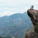
The highest point of Mt. Ugo is totally not the usual of what you would expect of a mountain summit. While in most of the other mountains the peak is shaved off of trees, Mt. Ugo on the other hand is gladly enclosed by luscious trees. The summit marker however was missing. Said it was ruined by other hikers who hiked up weeks before and is yet to be replaced. Sad. Guess some people really have to be whipped hard to instill discipline. Anyways, we only stayed for a few good minutes at the summit then off we went to start the descent along the steepest trails of this magnificent mountain.
THE STEEP DESCENT AND THE 15-KILOMETER HIKE TOWARDS THE END
The first 2 kilometers of the descent was very steep and slippery. Few steps down from the summit, the trail was a little damp. Past that, the trail turned dry and slightly eroded. There were parts emblazoned with rocks which at some point helpful in holding my foot in place. I had to be very watchful of each steps I took and I was just thankful Brian was there to my rescue whenever I find it difficult to go down without falling on my back. There were fences blocking the way which we needed to cross over. That part of the descent was such an arduous task which I feared might go on until the very end but turns out it would only stretched to about 2km and passed that, the rest would be literally a walk in a park filled with pine trees. I finally could let out a sigh after overcoming the steep descent and my heart couldn’t be more at ease upon knowing the hike moving forward would just be a piece of cake!
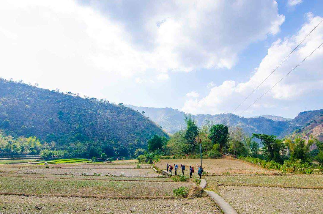
We continued the descent but it was hardly the case as the trail was on a flat surface that was barely going down with some short assaults in between. It didn’t bother me that we still had 13 kilometers more to cover before reaching the end of this eventful climb and six (6) kilometers more before Lusod village as I was having so much fun. Pine trees are all over the place and the scene was in every way breathtaking. We had come across a kine of cows after hours of wondering where the hell are the culprits behind those gigantic animal feces looking like huge chocolate frosting scattered everywhere along the trail. And Lo and Behold! There they were. The hike was really exhausting, painful even to the foot but it was bearable. It was the kind that doesn’t require too much focus and will let you marvel at the magnificence of nature along the way. Time didn’t seem to matter and it didn’t bother us that it was already past 12 noon but we weren’t even halfway through the nearest village! Gladly without even noticing, we reached Lusod village after coming out of the pine forest, passing by rice paddies and a few more walks towards the first set of houses. It was about 2PM and about time for LUNCH!
We resumed the trek at 3PM under the unforgiving sun. From Lusod village, we went down a concrete path passing along an aisle in between rice paddies towards the foot of the next mountain which we needed to cross to reach that place our guide call KM-00 (Shed). We went through a steep assault that stretched to about 15 meters then continued to hike along flat surface. There were about 10 steep descents along dry, eroded trail with the descent to the Grotto (water source) being the longest before covering half of the 7 kilometer hike. We were able to cover 4 kilometers after an hour and a half then went to rest at the spot near the entry to the final 3 kilometers going to the end of the hike.


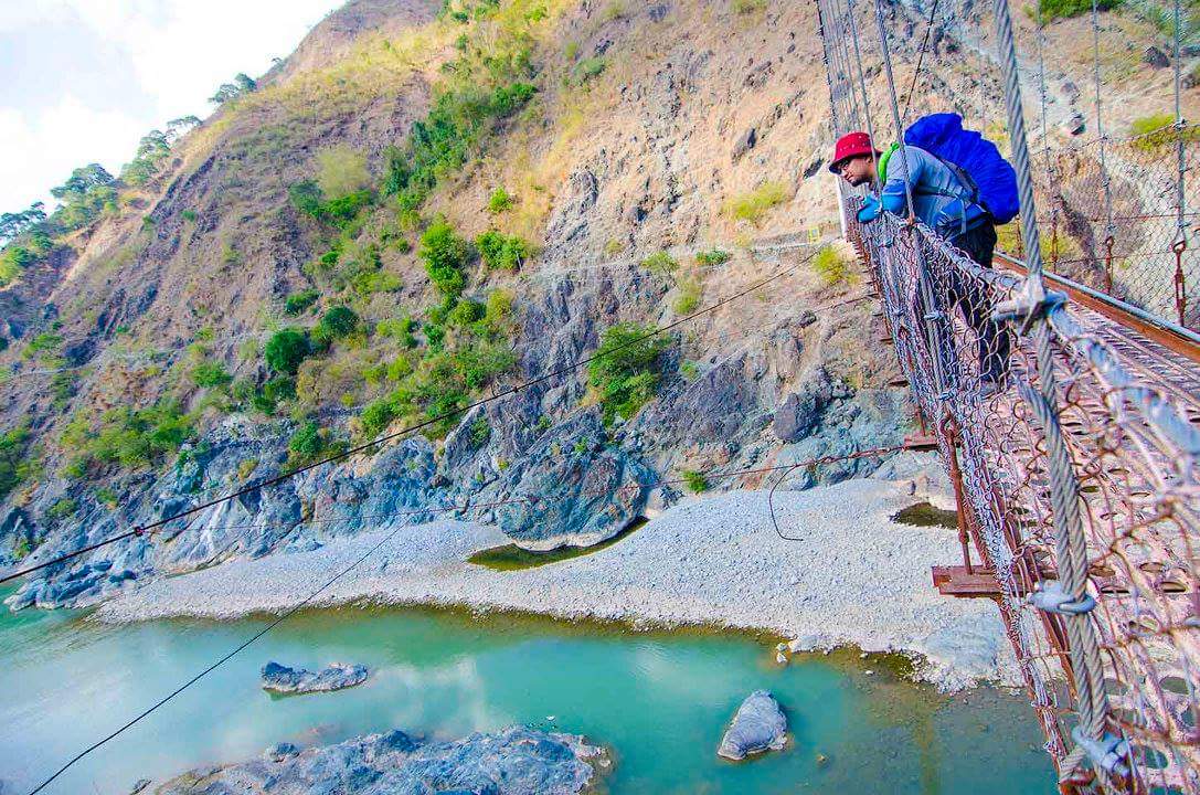
We took on the last challenge at 5PM starting with an assault which stretched to about 10 meters then continued the hike on some flat surface and steep descent along a ragged, slightly eroded trail. It was about dark when we reached Kawayan Village then we went on to pass by some rice paddies continuing to the path along local houses then to the steel hanging bridge and finally to the final stretch to the shed which was just half a kilometer away. We reached the resting shed and seeing that little concrete pillar that marked the end of the hike, I thought I couldn’t be any happier for making it to the very end. I might have been the last in our group to have reached it but it was hardly a matter since the time I had spent over the last 2 days was so far the greatest I had in the mountains. It was so great I will always cherish it. 🙂
HOW TO GO TO MT. UGO
- Commute – Ride a Victory Liner bus from Kamias terminal going to Aritao. Alight the bus in Aritao and hire a jeepney going to Kayapa. Better to prearrange transport to Kayapa before the climb as the jeepneys are not available early morning. You may also want to get in touch with the officials of Brgy. Tinongdan who looks after the care of Mt. Ugo to assist you with arranging your climb. Check out this link for contact information. Another option is to alight the bus in Bambang, Nueva Vizcaya (some 15km away after Aritao) and ride a bus or a van bound for Baguio at the gasoline station along Maharlika highway.
- Private – Drive via North Luzon Expressway (NLEX) then Subic Clark Tarlac Expressway (SCTEX) continuing to Tarlac Pangasinan La Union Expressway (TPLEX) exiting in Rosales exit. Then drive to MacArthur Highway all the way to Baguio via Kennon Road. Another option is to drive to Aritao via NLEX, SCTEX, TPLEX exiting in Rosales and driving all the way to San Jose. From Aritao, drive via Maharlika highway and Dalton Pass in Sta. Fe Nueva Vizcaya
GOOD TO KNOW INFO BEFORE HIKING MT. UGO
- The municipality of Itogon yearly holds Mt. Ugo Summer Climb for the purpose of further educating the youth to preserve and protect Mt. Ugo, its culture and history. This year it will be held on April 15-17. More information about the annual Mt. Ugo Summer Climb is available on this link.
- There is an ongoing deliberation pertaining to some violations of hikers and/organizers against the process of hiking to Mt. Ugo. Barangay Tinongdan officials felt that their authority is being undermined by hikers neglecting to get in touch with their Barangay before the start of the hike. While this may seem as additional baggage to some hikers, let us be more responsible in informing the authorities and adhering to the given process. After all if something out of our control happens in the mountains, the first ones to respond would be these authorities and it will be hard for them to act on their jobs if they are clueless in the first place. Adhering to the process is also one way of helping ease the tension between the two localities (Tinongdan and Kayapa), giving both equal opportunities.
BUDGET, THINGS TO BRING, ITINERARY AND OTHER INFO
| Bus Fare Manila-Aritao Bus Fare Baguio-Manila Chartered Jeep Aritao-Kayapa (P2000/18) Chartered Jeep Itogon-Baguio (P2000/18) Registration Fee (Brgy. Tinongdan) Guide Fee (P500/day/guide x 2/18) Food (Day1 Bfast & Lunch|Day2 Dinner) Camp Food (Day1 Dinner |Day2 Bfast & Lunch) Other personal expenses (Trail Food/Water) TOTAL | – P350 – P500 – P112 – P112 – P200 – P112 – P180 – P150 – P200 – P1916/pax (For a group of 18) |
| Thermal Jacket Weather gear (gloves/bonnet) Extra Clothes Toiletries and Wet Wipes Umbrella Trekking Pole Poncho/Raincoat First Aid Kit including personal meds and warming oil | Trail snacks 2L Trail Water Packed Lunch Camping gears (Tent with extra pegs, earthpad & sleeping bag) |
| Day 0 21:00 Assembly at Victory Liner Kamias, Q.C. 22:00 ETD from Victory Liner Kamias going to Victory Liner Stopover, Aritao, Nueva Vizcaya Day 1 04:00 ETA at Victory Liner, Aritao, Nueva Vizcaya 04:30 ETD from at Victory Liner, Aritao, Nueva Vizcaya going to Kayapa via chartered 06:00 ETA Kayapa. Registration at PNP Station. Breakfast 08:00 Jumpoff point. Stretching/Warm up/Group assignment 08:30 Start trek 11:00 Indupit Village – 1st water source. Lunch 12:00 Resume trek 15:00 Quick stop at Domolpos Village. Last water source 15:15 Resume trek 16:30 Campsite. Set-up Camp. Prepare dinner 17:30 Dinner 19:00 Socials 22:00 Lights out | Day 2 05:30 Wake up call 06:00 Sunrise viewing. Breakfast 07:00 Break Camp. Begin trek to summit 07:30 ETA at Summit, Photo ops 08:00 Begin descent 11:00 Lusod Village. Lunch 12:00 Resume trek 15:30 Kawayan Village. Quick break. Then continue trek to Footbridge. 16:30 Arrival at Waiting shed KM 00 18:00 Tinongdan Brgy Hall. Wash up. 18:30 Post climb meeting. 19:15 ETD from Tinongdan Brgy Hall going to Baguio via chartered jeep. 20:30 ETA Victory Liner Baguio. Dinner 22:00 Home Bound |
| CONTACTS | - Consider contacting Kuya Edwin: 09204697713 to arrange your ride. - itogon.gov.ph for further information - Mharwin Gimena if you need someone to organize your hike. - Kuya Celso for a very reliable guide. Unfortunately, I don't have his mobile number. |
There you go. Thought I’d never see another day after my first major climb but I turned out okay. Looking forward to more challenging mountains and sharing with you my incredible experiences. I hope you will love this post. Until my next adventurous trail. Ciao. 🙂
Credits: Some of the photos used in this post was from the brilliance of Jojo Policarpio.
16 Comments
Hi, may contact number po ba kayo ng guides sa Mt. Ugo?
Hi William. Nope. I don’t have. I didn’t get the chance to get the number of Kuya Celso since he hurriedly went home after the hike. Sayang mabait pa naman sana yun. 😥
Ngayon ko lang nabasa reply mo. Hehe. Its okay. We got a contact na na familiar po sa Trail patungo ng Pulag.
Ayt. That’s good. Have fun then! 😊
Hi Ms. Keza, i’m planning to climb mt. ugo next year 🙂 it is possible to commute from aritao to kayapa and from itogon to baguio ? to slash out the expenses of chartered jeep? in case 2 lang kami..
Hi Weng. Yes it is possible. Try to contact the local council of Itogon for updated transpo info. 😊
Hi Ma’am, May contact no po ba kayo ng Guide sa Mt. UGo? Thank u po 🙂
Hi.. I Don’t have a number but I’m trying to get it from my hiking buddies that day. Will get back to you on that. 🙂
hi mam, just want to ask.. wer planing to go to mt. ugo po sana this july via private van.. is der any regulation like we have to get transpo from them fr itogon to baguio kasi hindi po allowed ang private van sumundo sa itogon? thanks po
Hi Nicky. As far as I know, the council of Itogon would want to secure a livelihood for its people. That’s my interpretation of what the rep said during the orientation. They would want the people of Itogon to have the jobs which they think is rightfully theirs since Mt. Ugo is under their jurisdiction. You might wanna Try to get in touch with Itogon local council to clarify this matter. 😊
hi mam, kelan po kayo nag ugo?
Hi Ruth. March 5-6 this year po.
good read as always.
.
you sure bring fire in me pra umakyat pa.
.
ganda sobra.
.
i like the fact hindi k kagaya ng mga “hardcore” mountain people.
.
keep up.
God Bless.
Hi. Thank you for the positive feedback. 🙂
Hi… This was very inspiring. I do decided to hike now…. Any suggestion for me Madam,since I’m a 1sttimer.
Hi Ep. Glad I inspired you. For newbie friendly mountains, I would suggest Mt. Batulao. She’s kind of challenging but she’ll certainly get you prepared for more challenging hikes ever you would come to love this sport. You may also check some mountains in Rizal especially in Tanay area. Have fun. 😊