

As cliché as it sounds, Anagacian Falls is an embodiment of the quote, “The best things come after the hardest climb.” Hidden deep within a rugged stretch of emerald forest and towering cliffs, the falls reward every determined traveler with a view so breathtaking it feels like nature’s way of saying, “You’ve made it.” In this blog, I’ll share my experience of almost not making it to catch a glimpse of this enchanting waterfall.
OUR ANAGACIAN FALLS STORY
I first saw Anagacian Falls a few years back when my cousin posted a photo of herself beside this magical waterfall. It instantly captivated me. When I asked where it was, she warned, “It’s difficult to get to.”
I shrugged. “What the heck? I’m always ready for a challenge.” But when she mentioned 5–6 grueling hours of trekking on rocks plus several river crossings, I hesitated. I can handle mountains, but five hours on rugged terrain with multiple river crossings? That felt like a different level of torture.
For years, every time I went home to Cateel in Davao Oriental, I wanted to see Anagacian Falls, but I never dared to commit. I kept waiting for the day an easier trail would appear. Almost five years passed, and still no shortcut surfaced in any of my research.
Until one day, a waitress casually changed everything.
We were at our favorite restaurant, Cachang (back when prices were still reasonable and the food actually tasted good). I was venting about how I had explored so much of Baganga and Cateel, but never Anagacian Falls. She must have sensed the frustration because she jumped into our conversation while serving our food and told us that an easier, much shorter route existed in Brgy. Binondo.
Thrilled, I asked for directions—but maybe because we were starving, nothing stuck. Neither did Pani get the details. So when we finally left for Anagacian Falls, it hit us: we had no real information aside from “the trail is in Brgy. Binondo.” Haha. So we started asking around, but the locals we met along the way couldn’t point us in the right direction. That’s when we resorted to Google Maps.
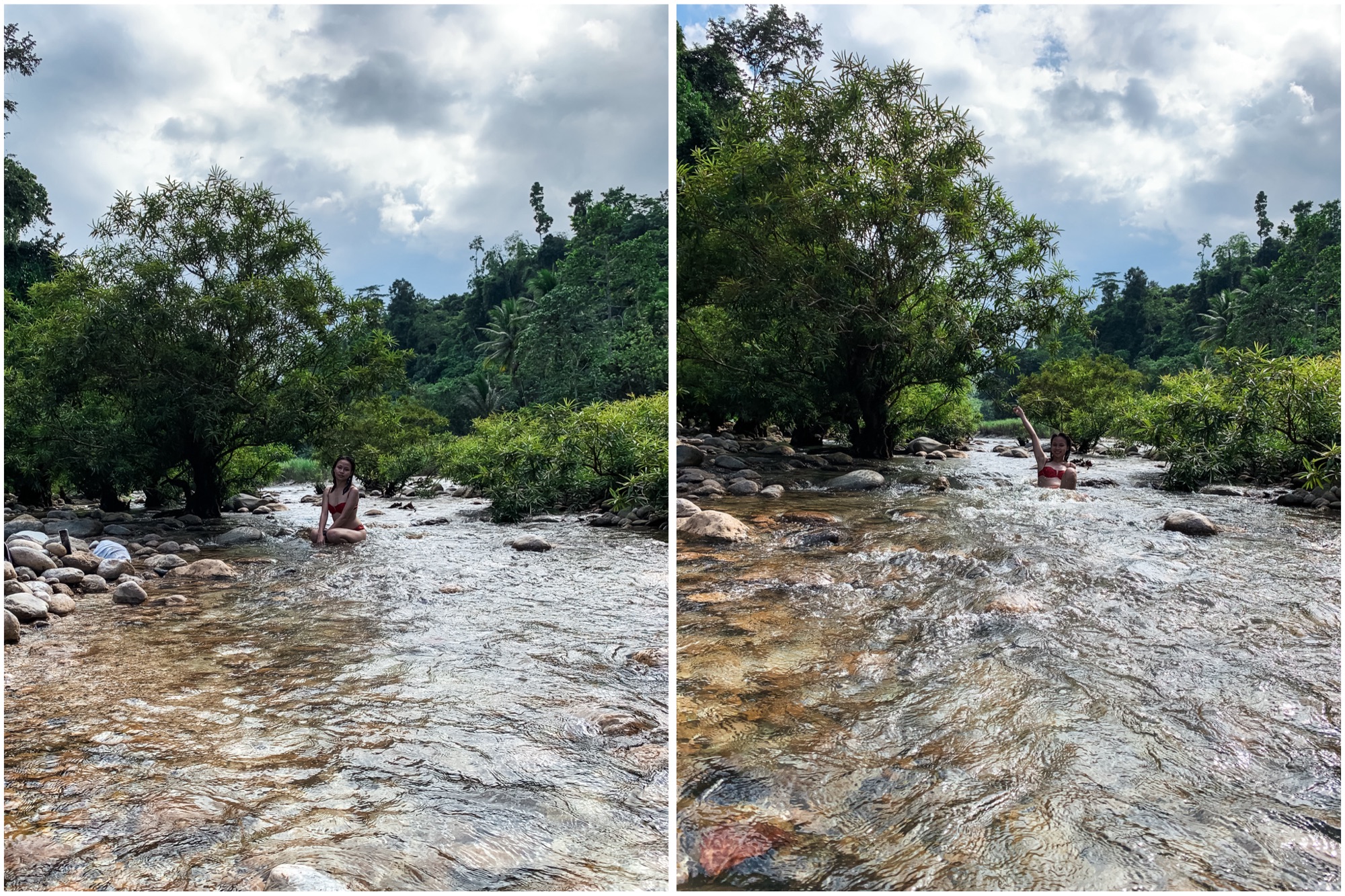
The road leading to Brgy. Binondo was on the same route as Batiano (the usual jump-off for the 5-6 hour hike), except we took the other road at the crossing. It started concrete, then abruptly ended. From there, it was pure rugged terrain—getting worse by the minute. The map said the destination wasn’t far, but the road condition made it feel impossible. Pani was cursing under his breath, comparing it to our torture trip to Kawil Falls. My sister (Oh yeah! I almost forgot to mention she was with us on this adventure) and I chuckled in the backseat, comfortably seated while Pani struggled with the tuk-tuk.
After an hour of suffering, we finally reached Brgy. Binondo. We asked a local for directions, and he told us to drive until the end of the concrete road—that’s where the trail to the falls begins. We followed his instructions, enduring curious stares and suspicious peeks from windows as we passed by traditional nipa huts lining the road.
When we reached the end of the concrete road, I was ready to start hiking right away. But Pani insisted we needed a guide. I half-joked, “Come on, we’ve always managed without a guide.” He shot back, “Yeah—after getting lost most of the day before finding the place.” Fair point. I just like a bit of chaos and giving Pani a hard time.
We drove back to the last house and asked for a guide. A man volunteered his son, a boy around fifteen, who frequented the falls. His sister tagged along too, which we didn’t mind. When I asked how long the hike would take, he said it would take about an hour, depending on our pace. I assumed he underestimated me—I always give off that “probably can’t handle it” vibe.
At first, the trail seemed easy enough—just gentle slopes and a few slippery patches. But as we went deeper into the forest, the hike became brutal. It wasn’t walking anymore; it was scrambling down rocks and holding onto tree trunks along cliff edges. Every time I asked if we were almost there, the boy’s innocent honesty crushed my spirit.
As we embarked on the grueling hike, my thoughts drifted back to that scene at the restaurant. When the waitress said the route was “short and easy,” I imagined a chill 30-minute descent. But this? This was hell. I genuinely wanted to turn back. But we were already halfway, and going home empty-handed felt worse. So reluctantly, I pushed through.
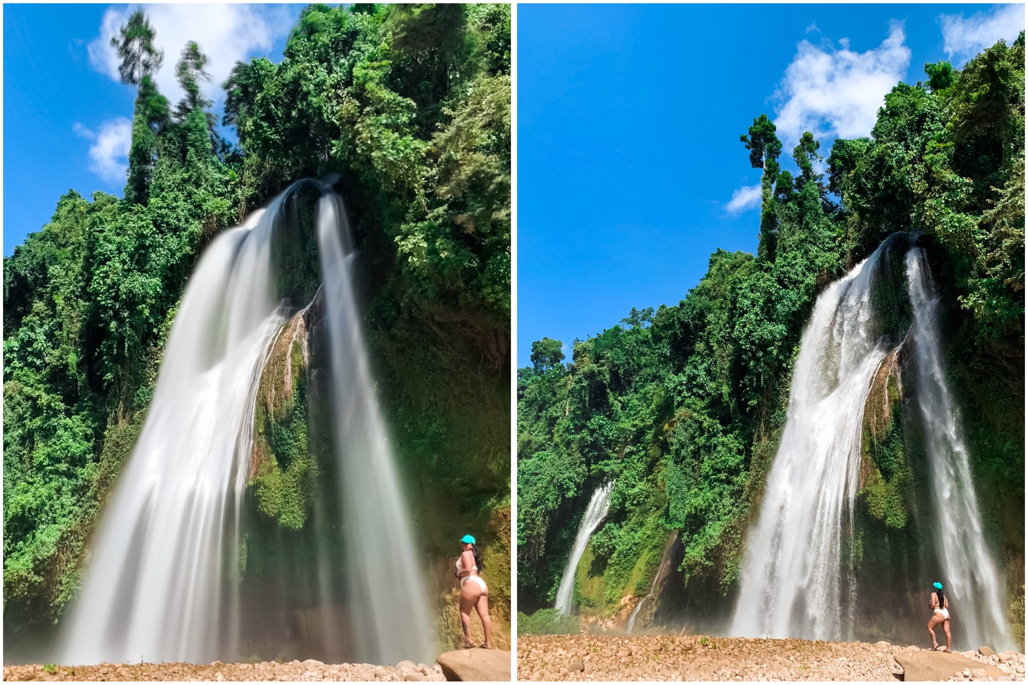
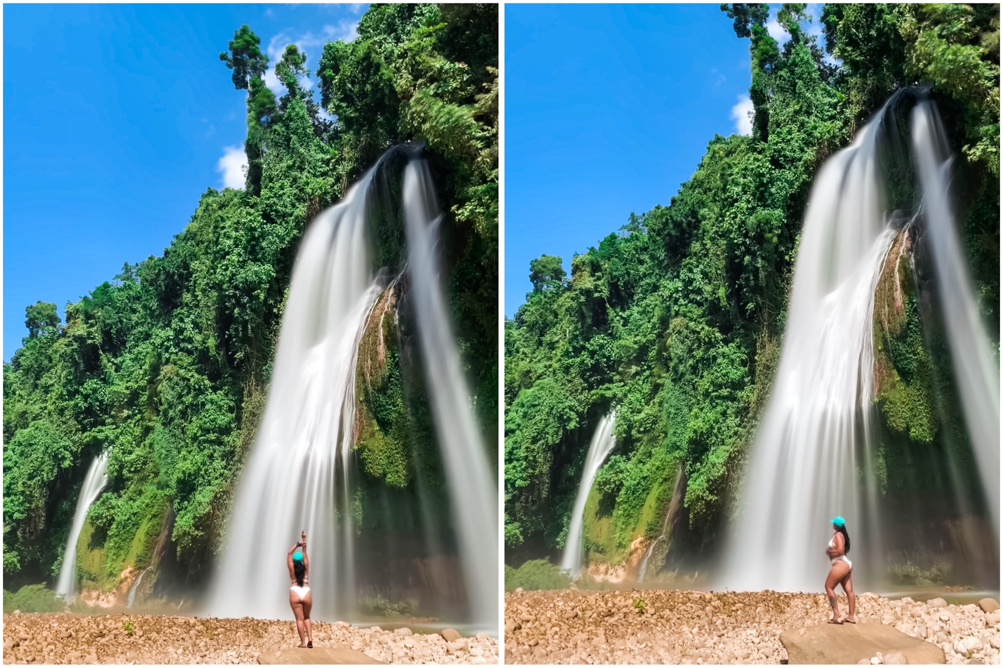
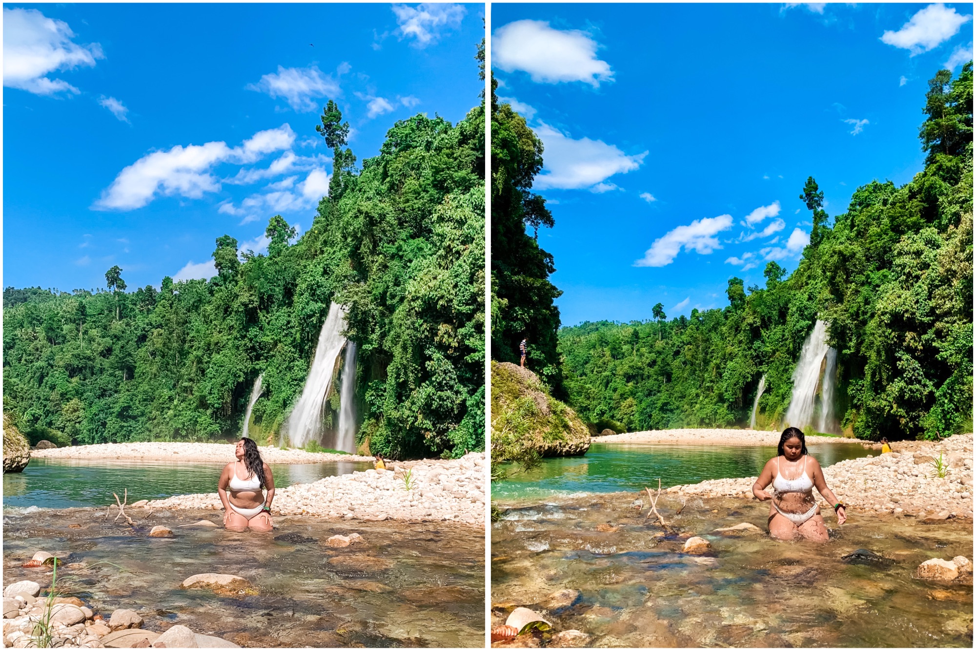
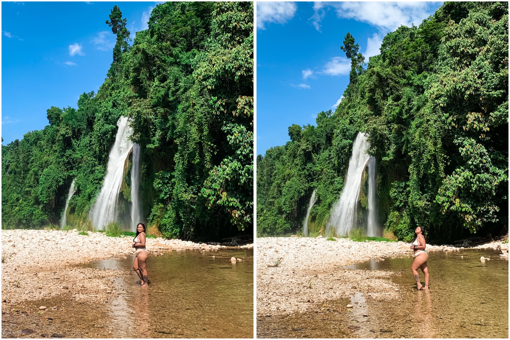
The final descent to the river was the hardest: a near-vertical 90-degree drop with no ropes, relying only on branches. That stretch felt like 150–200 meters of pure terror. My sister breezed through it effortlessly, but for my 170-pound body, it was a battle for survival. But I made it. I finally exhaled and immediately jumped into the river to cool off. And when I saw Anagacian Falls, I just stared in disbelief. Its beauty made every ounce of suffering worth it.
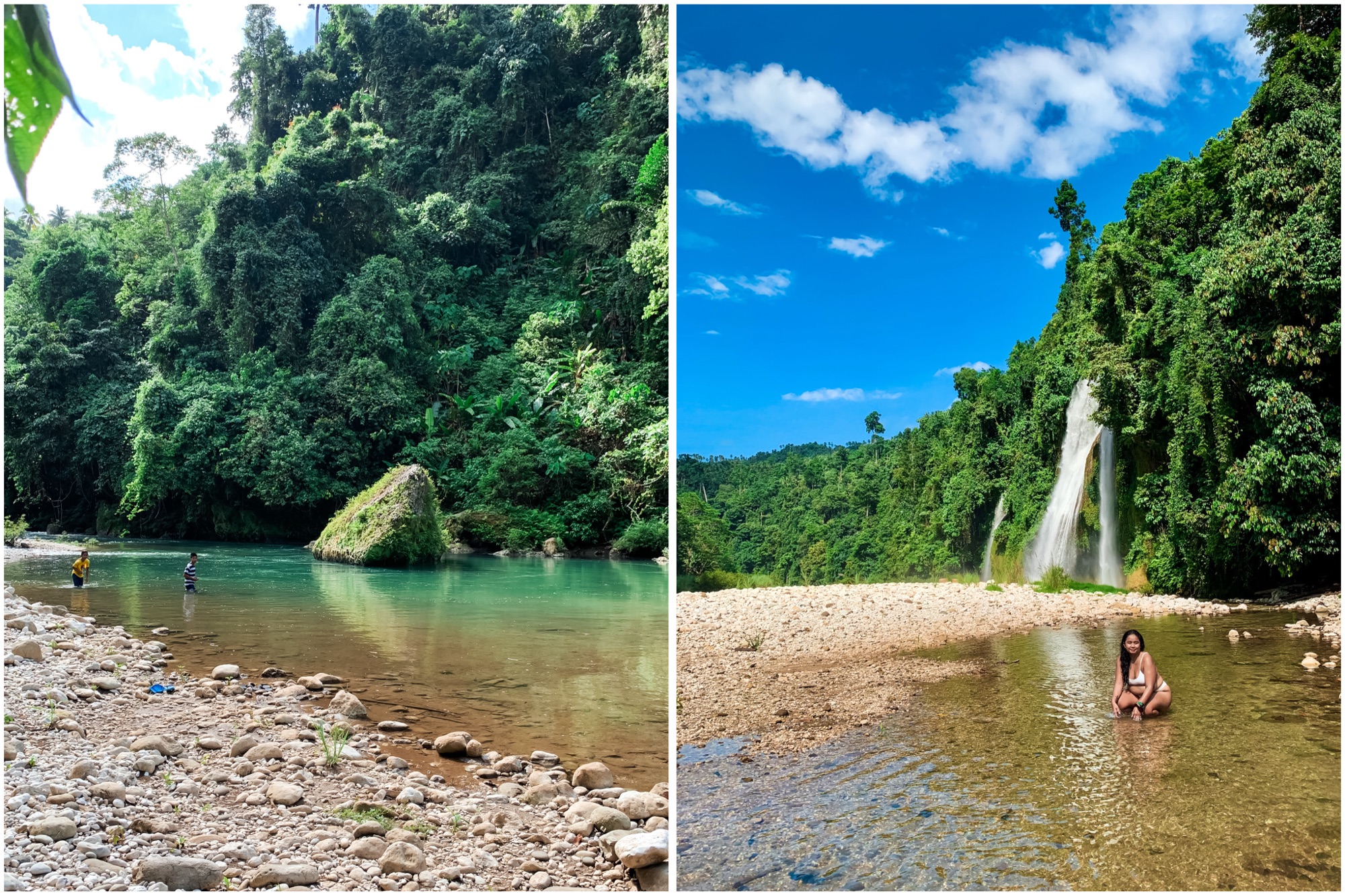
We stayed almost two hours, bathing in its cold emerald waters. The clarity, the crystal shimmer under the sun, the twin cascades flowing against a wall of lush green—God, it felt like paradise. I wanted to stay longer, but by 2 PM the wind turned unusually cold, sending sharp chills through me. I asked the group if we could start heading back.
The climb up was another ordeal. I refused to burden the guide. His thin structure looked so frail and unable to withstand my weight, so Pani took the brunt of my struggles. No guilt whatsoever. Torturing Pani is half the fun. But for some reason, my body felt unusually weak that day. My mental stamina was gone; I was constantly on the verge of giving up.
We eventually made it out of the forest, but I was a mess. I felt so tired and every part of my body was screaming in exhaustion. Everything became clear on the drive home when the fever hit me hard. So that was why the hike felt ten times harder. My sister, knowing my history, teased, “Yan kasi. Ingay mo. Nainis na naman sayo mga engkanto.” I just rolled my eyes and tried to sleep the rest of the way. Anagacian Falls has finally been crossed off my bucket list. I can probably go a month without traveling.
HOW TO GO TO ANAGACIAN FALLS
Reaching the trailhead in Brgy. Batiano can be quite challenging, especially if you’re not familiar with the area. However, I can guide you to an easier route than the one we previously used.
First, head to Lake Carolina in Baganga, Davao Oriental. From there, find the road leading to Batawan Elementary School, which is about 300 to 500 meters from the lake toward the town center of Baganga. Follow the road as it winds up into the mountains. At a junction, ensure you take the road on the right; this will lead you to the Binondo Barangay Hall.
Be cautious, as Google Maps may direct you to a more rugged road. You can pin Batawan Elementary School on your map, but remember to take the alternative route leading to Barangay Binondo at the junction. Safe travels!
USEFUL TIPS & TRAVEL INFO FOR ANAGACIAN FALLS
Trail Overview
Difficulty: Difficult
Distance: 3-5 Km Round trip from Brgy. Binondo.
Terrain: Forest paths, uneven ground, occasional slippery rocks near the falls, near vertical cliffs
Estimated Time: 1 hour depending on pace and stops
Tips Before You Go
- Getting a guide: Not required, but recommended if you’re unfamiliar with the area. Guides can help you locate hidden spots and ensure safety. You can hire a local to guide you for ₱300, depending on negotiation.
- Trail markers: Non-existent. Stay close to your guide.
- Start early: This allows you to avoid crowds and gives more daylight for exploring.
- Weather check: Trails can become slippery after rain. Avoid during heavy rain or storms.
- Best Time to go: As a general rule, waterfalls are best seen during the rainy season. In Baganga, rain is frequent from late December to March.
- Footwear: Wear sturdy hiking shoes or sandals with good grip.
- Navigation: Phone service may be weak; offline maps or a compass are useful.
What to Bring
- Water: At least 1–2 liters per person. No drinking water source in Anagacian Falls.
- Snacks: Energy bars, nuts, or fruit. You can also bring a full meal if you plan to stay long. Anagacian Falls is a secluded place so no stores are nearby.
- First aid kit: Include band-aids, antiseptic wipes, and any personal medications
- Rain gear: Lightweight jacket or poncho in case of sudden showers
- Sun protection: Hat, sunglasses, sunscreen
- Bug repellent: Forest areas can have mosquitoes and ticks
- Camera or phone: To capture the waterfalls, but keep devices protected from water
- Backpack: Lightweight with secure straps
Safety Tips
- Stay on the trail to protect wildlife and prevent getting lost.
- Avoid climbing slippery rocks near the waterfall.
- Leave no trace: pack out all trash.
- Hike with a buddy if possible.
Optional Extras
- Trekking poles for stability on uneven terrain
- Waterproof bag for electronics
- Binoculars for bird watching
Planning a day pack of adventure? You can also check out other waterfalls near Anagacian Falls. See the full list here.
Mabuyong Falls lies quietly behind the shadows of Aliwagwag Falls. Get to know this little gem in Maglahus, Cateel using this travel guide.
Davao Oriental is blessed with many stunning waterfalls. See them all using this guide complete with useful travel tips.