

With the mountaineering sport being on the rise, uncrowded mountains are now hard to come by especially those which are easily accessible from the country’s capital. Say Mts. Binacayan, Pamitinan & Daraitan in Rizal. These mountains are no doubt gorgeous but are always teeming with young, enthusiastic souls who are either there for selfies or searching for “The One” and often times accompanied by loud music and boisterous chatter. Not that I think they shouldn’t be in the mountains as people tend to be different in perspective and understanding. I just personally prefer solitude and peace. With that being said, I knew there’s only one way I could achieve such a goal and that is to go on roads less traveled. Hence the unforgettable journey to Mt 387.
Mt. 387 opened to the public a couple of years back but I didn’t know about it until last year. It is a reserve previously maintained by an LGU (local gov’t unit) but their operation ceased due to undisclosed reasons (according to our guide). Compelled by the love for this mountain and its treasures, locals of Brgy. Puncan swore to protect it against deforestation and other hazards that threaten its existence. They have initiated tree planting activities and have restored the once barren parts of Mt. 387 into full health. They plan to continue their efforts until the bare grassy area of this mountain is covered in trees. To help them with this advocacy, they decided to share the wonders of Mt. 387 to the world in the hopes of getting support and I think this is prolly the best thing they have done. Seeing how beautiful this mountain and how great of a promise it is, it’s really hard not to share the dream. So if you love serenity and would like to dedicate an hour or two for an awesome cause, head to Mt. 387 for a day you certainly would never regret.
THE CLIMB

Still restless coming from an 8-hour shift and barely 5 hours of sleep while on the bus, we arrived in the darken road of KM 175 at 15 before the clock hit 3 at dawn. Sir Roy, our contact, said we should be seeing an Iglesia Ni Cristo chapel at the jump off but we could not see one anywhere we looked. I spotted a shed nearby so we decided to stay there until we see a soul who could give us directions. I didn’t feel safe strolling the unfamiliar streets of this new place during the wee hours of the morning. While waiting, I reached for my phone to quickly dial Sir Roy’s number but I hesitated, thinking it might be too early to be ringing someone’s phone so I decided to send a text message instead.
 Ten minutes passed yet no response. Being the impatient and impulsive human beings that we are, Ian (my boyfie/moody travel buddy) and I decided to take a walk. We headed towards the lit area of the highway while careful to stay at the sidewalk as to not get hit by speedy vehicles passing by. As soon as we got passed the 10-wheeler truck parked at the sidewalk, we finally saw the INC chapel. Now all there is to do is to find the registration site but it got a bit confusing as we could not see its marker. Just as I was about to pull out my phone to give Sir Roy a ring, one of the guides saw us and directed us to where the registration site was.
 The road leading to the registration site is situated just across the road from the INC chapel but we didn’t see it as it was obscured by a cargo truck parked in front of it. The registration site was still closed. Guides were still asleep at the benches there. No food nor coffee was available as the stores were also closed. I figured we went a bit too early but I still asked if we would be allowed to start the hike but was told not until 4AM. We waited patiently until the head of the association arrived. We went through a short but detailed orientation with him which include the do’s and don’ts and a bit of the mountain’s history. We were then asked to sign a waiver, register our names, pay the fees and finally was assigned a tour guide. After sending a short prayer to the heavens, our hike commenced.
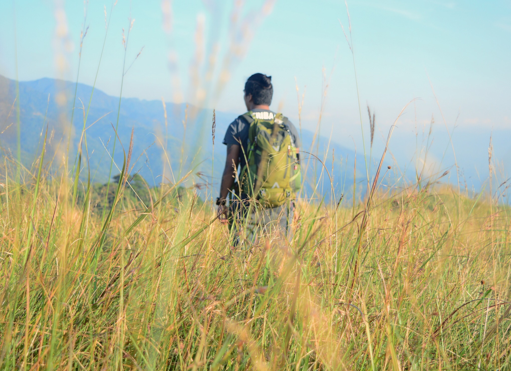
 Hikers are supposed to be carrying seedlings up the mountains to be planted in designated areas but that day was an exception. Said the weather has not been very ideal for tree planting during the past couple of days due to heavy downpour. Rainwater tend to wash the sapling away hence tree planting was suspended until the weather improves. I was a bit disappointed about it though since I really wanted to experience it but I was still excited see what adventure awaits us. The hike started over muddy flat surface that stretched to about 150-200 meters. After that a straightforward assault follows.
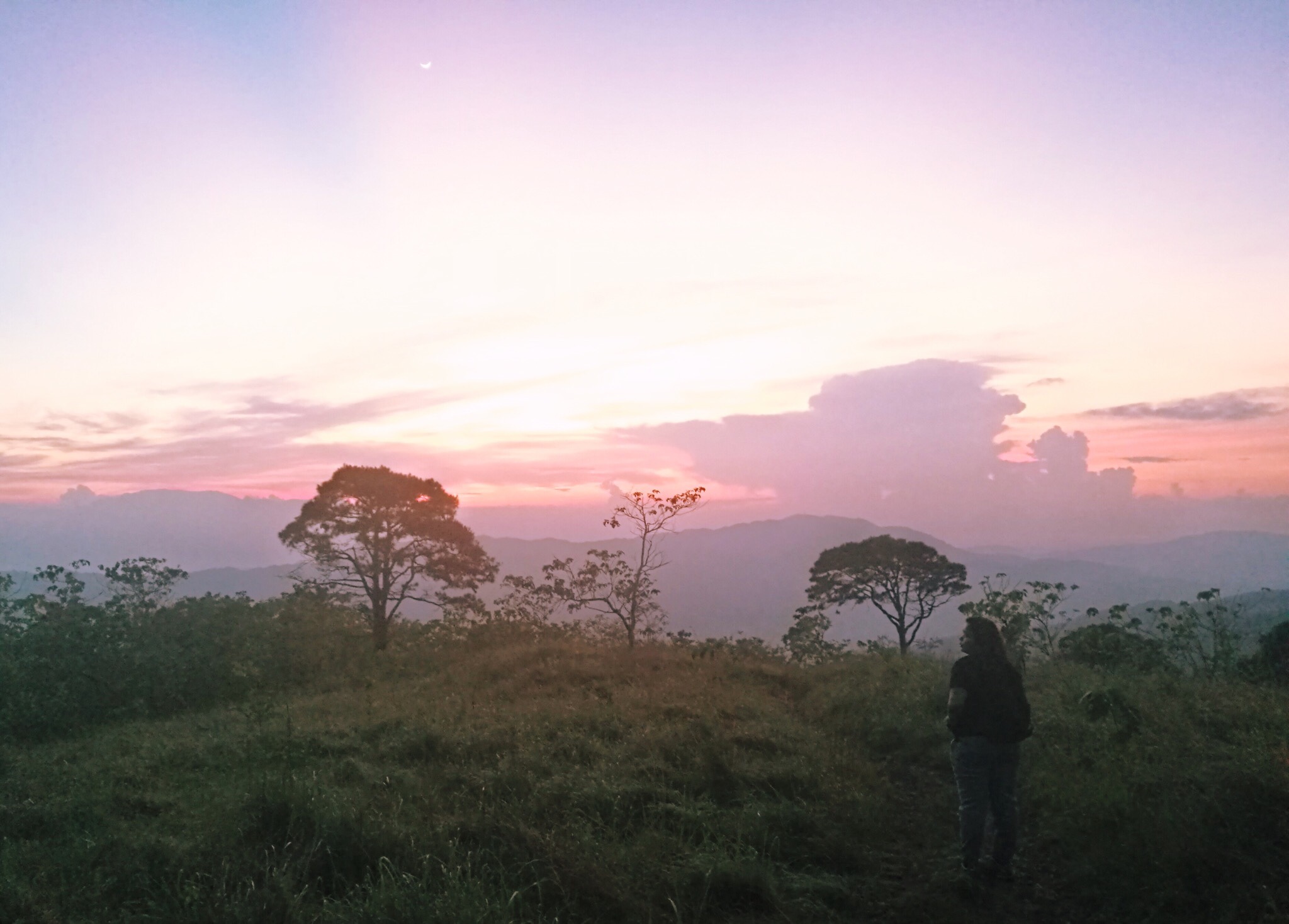
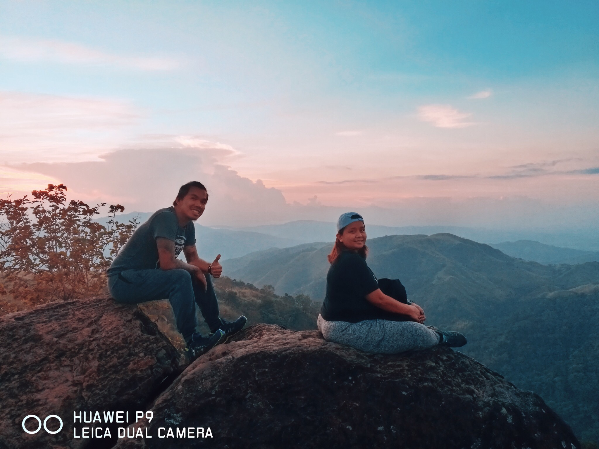
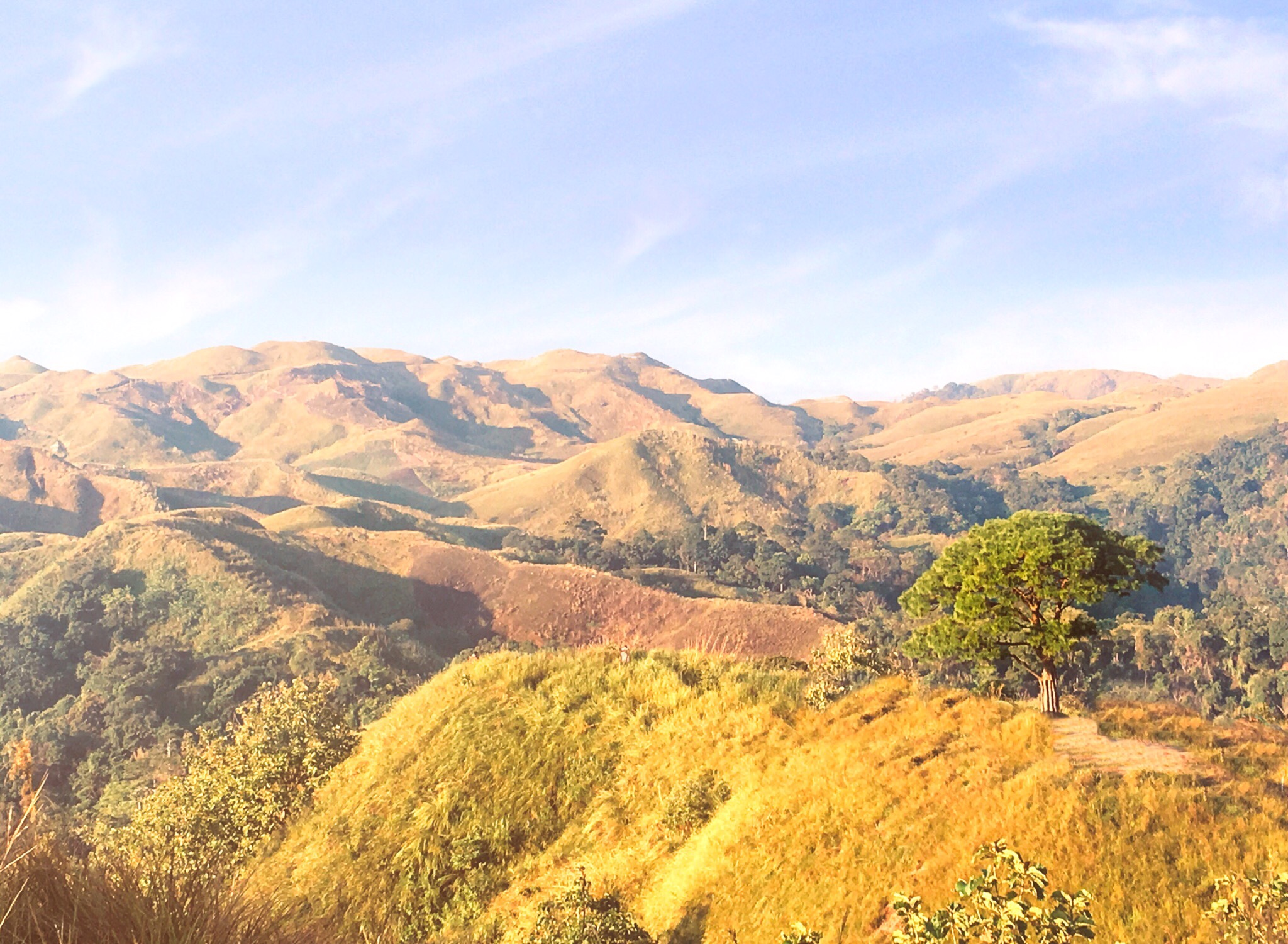
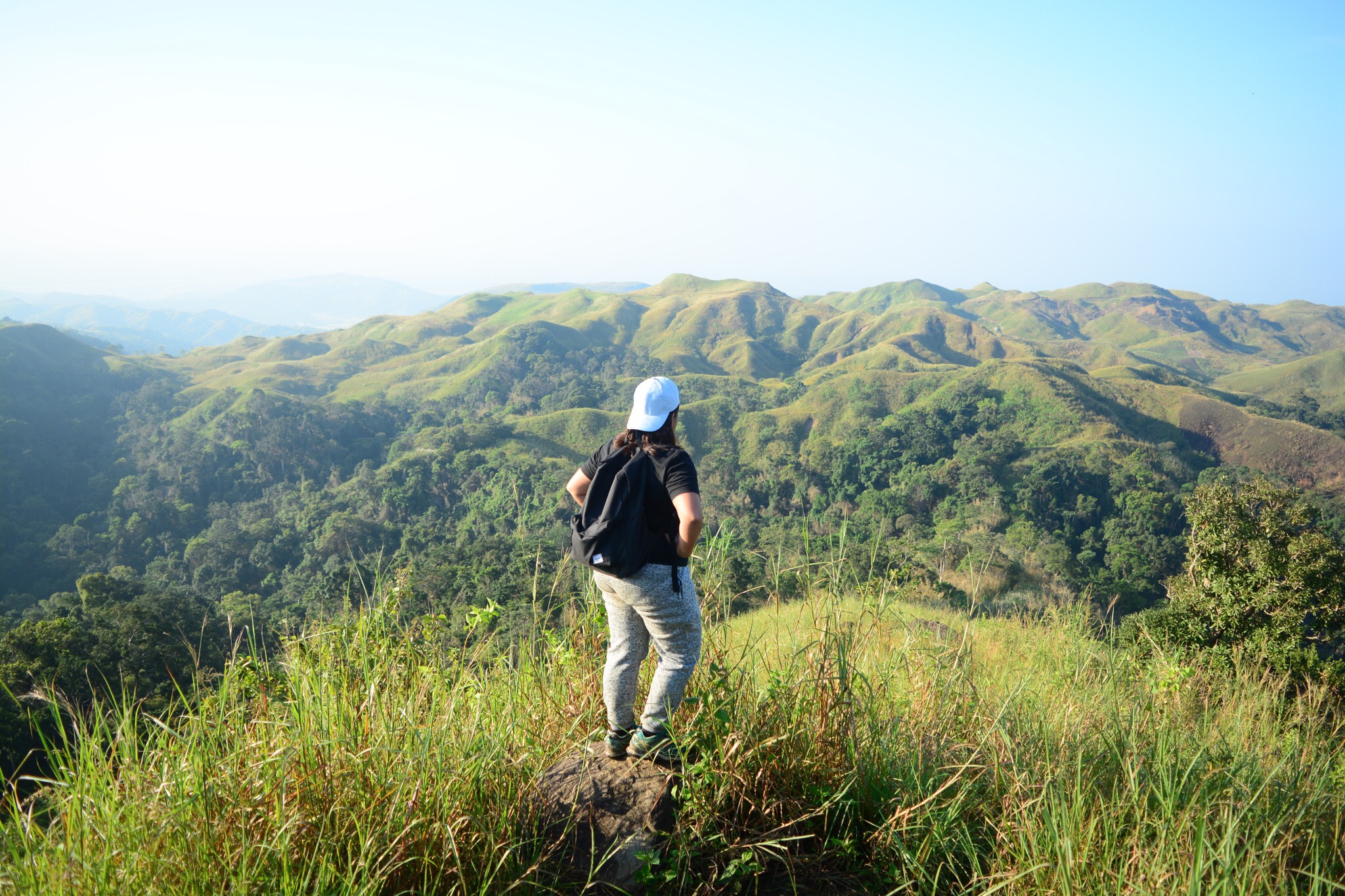
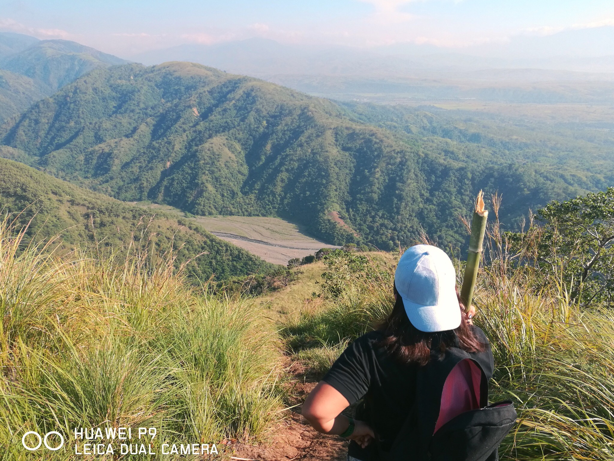
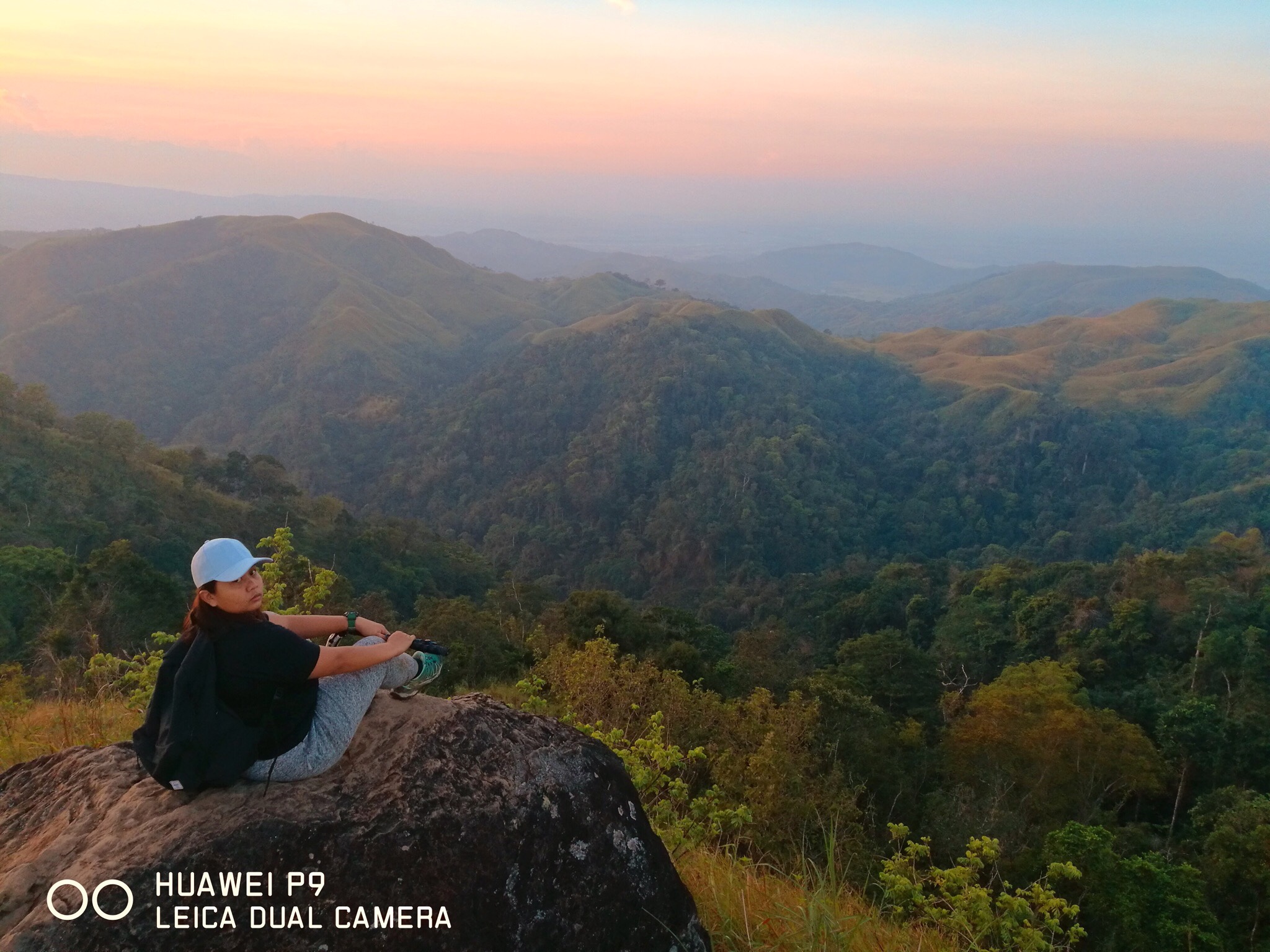 The assault dominated this hike with some flats in between. Some assaults are a stretch of about 100-150 meters and are very steep. Other ascents were short and were easy to cover. The final stretch to the summit were marked by distinct pine trees which are at least 75-100 meters apart. Once all three pine tree markers were covered, a steep assault would follow. Past that is a stretch of grassy flats then a short and easy ascent to finally reach the summit. The summit is characterized by huge rock formations situated on a cliff. It normally takes two hours to reach it but only took us an hour with minimal rest since our guide was so pushy and he didn’t let me take long breaks. Haha. It all came from good intentions though so I was just OK despite the pressure. It paid greatly as well as other than the marvelous sunrise we were able to witness undisturbed, we had the summit to ourselves for as long as we wanted to.
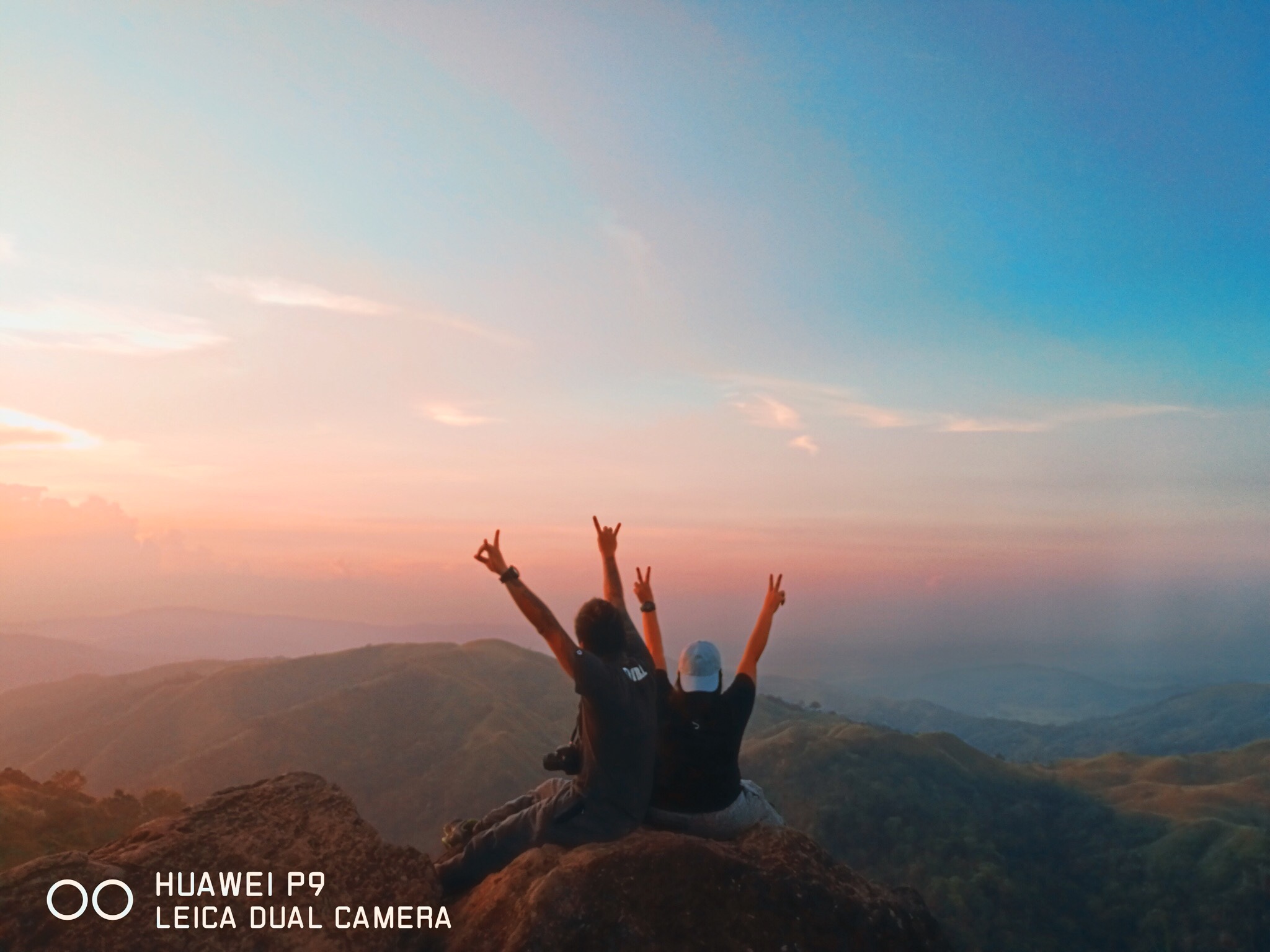
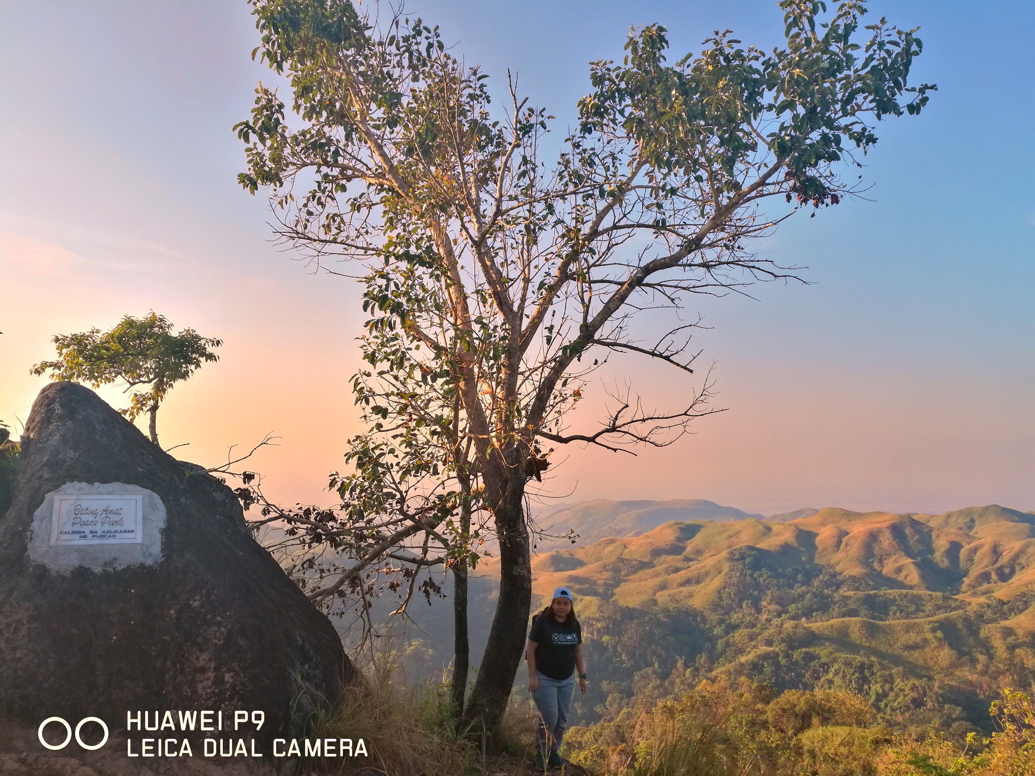
 We took so many photos at the summit while we exchanged chatter, laughter, jokes and a lot of non-sense. Our guide was Chad, a young lad who was fun to be with. Talking to him was easy. He was never awkward nor were we to him. It felt as if we’ve known one another for a long time. This setup went on until other hikers came. That became our cue to get going. Past the summit was another grassy flat of 20 meters and a short descent to the campsite where the famous lone tree stood. We quickly shared smiles and greetings with other hikers then went on to snap some more photos under the “Lover’s Tree”, as what many hikers call it. After that, we commenced the traverse to Aloha Falls.
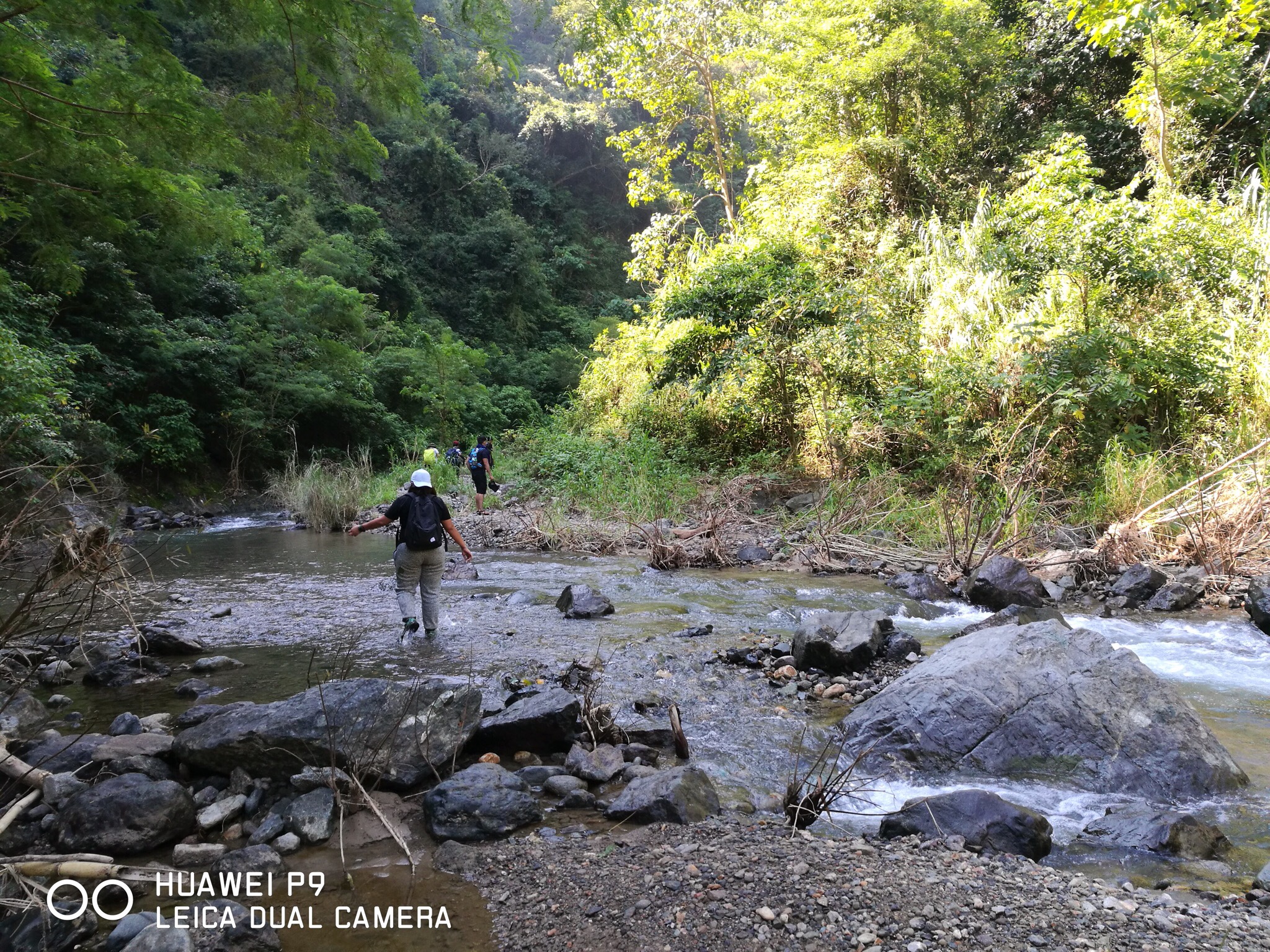
 From the campsite, we took several grassy slopes before we emerged into a lush forest. Inside the forest was a steep descent that stretched for about 100 meters. Past the descent were easy flats and moderate ascents. Covering the easy parts of the traverse, we were then taken to the most challenging part of this hike, the long and steep 80-degree descent. The descent was over a grassland, bare and humid but with a magnificent view of the surrounding mountains. It stretched for over a kilometer and had continued until we reached a bamboo forest where the steep descent transitioned from soft earth to a rugged terrain. The rocky descent was easier to navigate than the soft earth that preceded which was too slippery at times. Finally covering the descent, we then emerged into a river bank where some food vendors awaited. Wasting no time, we traced the shallow stream to where Aloha Falls is.
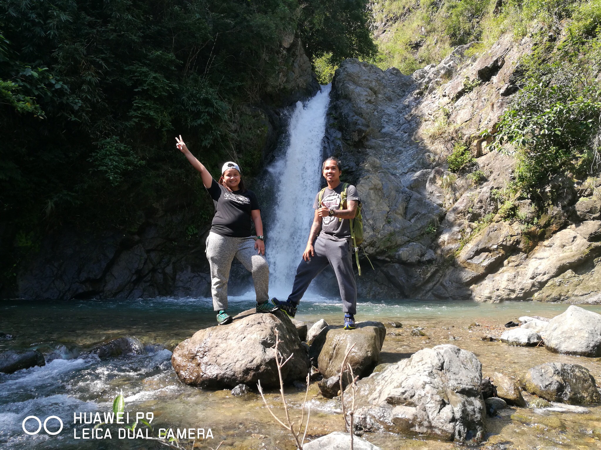
 Aloha Falls was a magnificent sight to behold. The cascade was strong and relentless. The pounding of the gushing water to its basin, just like other waterfalls, was music to my ears. She was yet another gorgeous waterfall but with an infectious charm distinct only to her. The water at her pool was so cold and refreshing. She was our happy place for a little while. Our giggles were only for her to hear. Our eyes adored her and our hearts filled with so much gratitude. Our minds flooded with memories and our cameras with photos I could no longer count. This day couldn’t have been better. In fact, it was perfect.
 Tired of snapping photos, we settled in one of the rocks to munch on our food. The traverse to the falls took us longer and wore us more than the ascent to the summit. It got me dead hungry that it took me a while to notice other hikers have already arrived. Looking at the crowd of people with each one vying for a photo, I was just glad to have descended way ahead. I normally hate being surrounded by so many people but at that time, I was enjoying their company. I just sat at the corner and observed in silence. Their boisterous laughs and banters that usually irritate me became my entertainment. Wow.. I guess there are really some things only nature can let you appreciate.
 It was 10AM when we decided to leave. The sun was up and was already becoming too hot. At first I had no qualms about it since I read it would only take 15 minutes to trek to where the ride back to the jump off awaited. Now came the unexpected twist. The usual 15-minute hike back to the registration site turned out to be another hour of pure torture. Not that it was any more difficult than what we had gone through, I was just surprised and hungry and a little upset! Thinking I won’t be getting my fill and still be hiking under the scorching sun for another hour made my knees turn all jelly. (Cries) Chad, our guide must have noticed my worry so he took the time to reassure me that it was gonna be totally easy!
 And easy it was! The hike back to the reg site was along the river banks and involved several river crossing. It was along easy slopes with short steep ascents. The only challenge was the part where we needed to crawl our way on rocks like Spiderman as it was impossible to cross the river anymore. Past that was a chill hike over flat surface that stretched to about a kilometer. We then emerged into a rice field that led to the highway where our ride back to the registration site waited. The trek may have been fairly easy but the sun made it twice as hard. Had it not for my umbrella shielding me from the sun, I wouldn’t have lasted the last part of the trek. Another great thing that got my mind off the tiresome hike were the numerous colorful butterflies that flew along. If only I had taken photos but they were so beautiful and fascinating I forgot to even take one. This hike far exceeded my expectations and was best ended with a sumptuous lunch over a bowl of sinigang, grilled pork liempo and lots of steamy rice shared with a new friend.
HIKING TIPS AND OTHER INFO
- This hike is easy but it still require you to prepare physically especially if it is your first time to climb/hike mountains.
- Booking or early reservation is not necessary. Hikers can simply walk in and secure a guide at the jump off/registration site.
- In getting to Aloha Falls, hikers have the option to do a traverse or back trail from the summit and take another route to the falls. The traverse involve a steep and difficult descent while the other route is a long trek with several river crossing.
- This mountain is ideal for beginners and kids as it is pretty easy and is not hard to navigate. If you have kids, back trail hike is ideal instead of doing the traverse to Aloha Falls.
- The ride getting to and from Aloha Falls may be restricted until the highway in some months due to difficult road conditions that prevent access to vehicles further down the stretch.
- Hikers are normally required to plant a tree but this activity may be suspended during days with heavy rain fall or in dry season. Should it be ongoing, seedlings are provided at the registration site.
- Mt. 387 is locally known as Mt. Batong Amat but was named such since it covers 387 hectares of natural reserve in Talavera, Nueva Ecija.
- Mt. 387 was a famous spot for treasure hunting. It was even rumored to be the place where the famous Yamashita’s treasure was buried. Hence plenty of holes would be found in some parts of the trail.
- Vendors are restricted at the registration site and at the foot of the mountain so it is a must to bring with you packed food and enough water to consume during the hike.
- If you would bathe/take a dip in Aloha Falls, for safety, avoid swimming under the cascade or near it and in deep parts near the stone wall as the strong current is too much even for good swimmers.
- As always, Leave No Trace. Let’s help the locals in preserving this mountain. If you cannot pick up trash, at least don’t leave one. Bring reusable water bottle. Put your food in reusable containers.
HOW TO GO TO MT. 387
In Kamias Bus Terminal, ride any bus lines going to Tuguegarao (5Hrs ; P287.50). Alight the bus in KM 175 in Brgy. Puncan, in front of Iglesia Ni Cristo Chapel. Just across the road is the way to the registration site which can be reached barely five minutes of walking.
Alternatively, you can ride a Baliwag Bus going to San Jose, Nueva Ecija (4Hrs ; P260). Once in San Jose, ride a tric going to the jump off (30 min ; P100/tric). Since transpo option from Brgy. Puncan going back to Manila can be pretty limited due to high demand especially on weekends, you can take this same route in going home from your hike.
Tips: If you prefer to ride Victory Liner, better secure your booking in advance as slots could run out pretty quickly. No need to worry though as there are many alternative liners available which could cater to you even without reservation.
BUDGET, ITINERARY & OTHER ESSENTIALS
| MOUNTAIN INFO | Name: Mt. 387 | Batong Amat Elevation: 724+ MASL Jump Off: KM 175 Brgy Puncan, Carranglan, Nueve Ecija Difficulty: Backtrail 2/9 | Traverse 4/9 Feature: Rolling hills, grassland, bamboo forest, waterfalls |
| SUMMARY OF EXPENSES (2Pax) | 2-Way Bus Manila-Brgy. Puncan - P575 Registration Fee - P30 Guide Fee @ P500 - P250 Food - P300 4x4 Ride - P20 Total - P1175 |
| SAMPLE ITINERARY | Day 0 2100 Meet Up Kamias Bus Terminal 2200 ETD Brgy. Puncan (Jump Off) Day 1 0300 ETA Brgy. Puncan (Jump Off) 0315 Register. Orientation 0400 Start Trek 0500 Summit. Lite Breakfast 0530 Sunrise Viewing. Photo Ops 0630 Start Trek To Lover's Tree 0700 Lover's Tree. Photo Ops 0730 Start Traverse To Aloha Falls 0900 Aloha Falls 1000 Start Trek to Jump Off 1100 Jump Off 1200 Lunch 1300 Wash Up 1400 ETD Home 1900 ETA Home |
| THINGS TO BRING (Day Hike) | 2L Trail Water Trail Snacks Extra Clothes First Aid Kit Toiletries Slippers Camera Umbrella/Cap Poncho (Rain) |
| WHAT ARE THE FEES | Guide Fee 1:7 Day Hike - P500 Overnight - P1000 Registration - P30 Seedling - P20 |
| CONTACT | Association Pres. Sir Roy - 09175712152 Recommended Guide - Chad (Lost his number but you can ask for him upon registration) |
")
")
")
")
")
")
")
")
")
There you have it lovelies. That is our Mt. 387 adventure for you. Some people like to call this mountain as the Chocolate Hills Of The North but for me, its features are more reminiscent to Mt. Pulag. But it doesn’t really matter. Anyway we see it, it is without a doubt gorgeous. Should you have questions, suggestions and violent reactions, just drop them on the comments below. Until next time! Ciao!

10 Comments
Thanks for this super helpful guide! Going there later with a bunch of our friends. Mas maganda po sana kung more pictures with aloha falls kasama ng depth but great post overall! Salamat 🤍
Thanks Anna. Keep safe and have fun
Hello po, pwede na po ba ulit mag hike sa mount 387? And mga ilang oras po yung aabutin sa pag hike?
Hello po. Better consult the numbers on the blog to know whether or not pwede na maghike. 5-8 hours to finish to and from summit. Depende sa pacing.
Commuters po kami.
Plan to hike this Dec 20.
Any suggestions po tulad ng Kung paano sumakay pauwi?
Hello. May mga bus po along the hway outside of the registration na dumadaan pabalik ng Manila. If mejo late na like 3-4pm, recommended na magtricycle papunta sa terminal ng Baliwag sa San Jose para dun na sumakay ng bus pauwi ng Manila.
If we decide to go there by private car is there a parking spot in the hiker’s station? Thanks!
Yes. There is Marq. ☺️
Very interesting subject, thank you for posting.
You’re welcome 😉