
Why do I recommend Mt Balagbag? Let me share a piece of my mind first. When I initially got interested in hiking mountains, my first thought was if I’m even a cut for it. I have weak lungs. I’m overweight. I can’t carry heavy packs due to my spine stricken with scoliosis. I’m definitely a loser and a 5-year old could easily give me a run for my money. I didn’t have any friends who were into hiking at the time. Among my peers, I was the only fool who dreams about what it’s like to be atop a mountain peak. And it was at the time a norm. Mountain climbing didn’t seem to fit in the lives of our generation. Finding someone with the same silly thought as I was nearly impossible. Some ten years ago, these were few of the challenges one would have to overcome before their very first mountain.
Then social media came. Along with it was the emergence of several mountaineering groups. A list of easy mountains to hike near Manila surfaced the internet one by one with Mts. Batulao and Pico De Loro being the top two favorites followed closely by Mts. Maculot, Manabu, and Gulugod Baboy. Shortly after that, mountaineering was a hype. It didn’t take long before the province of Rizal where a good portion of the Sierra Madre is located opened its door to thrill-seekers. The Sierra Madre didn’t disappoint and so quickly, Mt. Daraitan became an instant hit with the trio of Montalban -Mts. Binacayan, Pamitinan and Hapunang Banoi- trailing in a close second. Then, there was Mt. Balagbag.
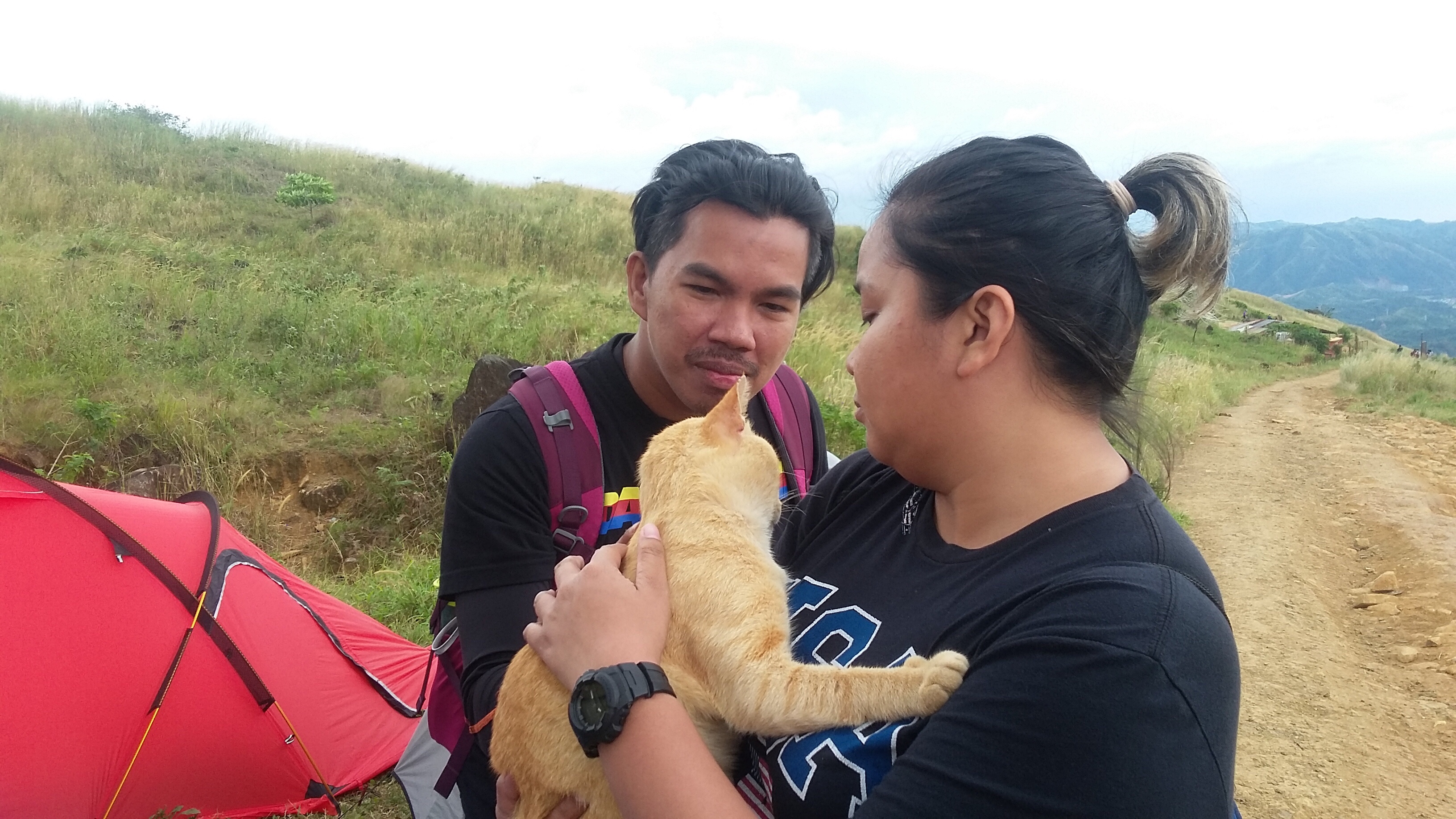
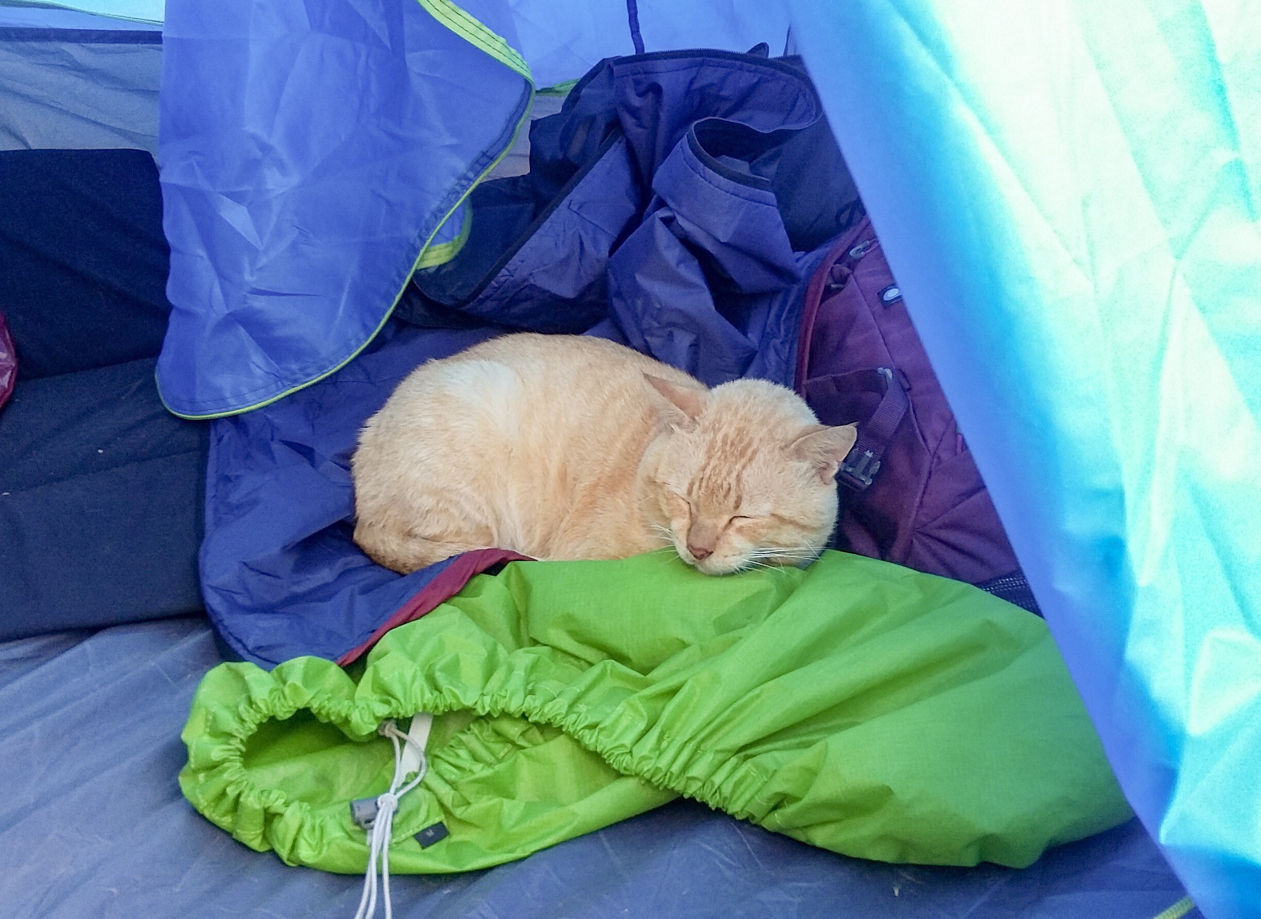
If it wasn’t for an adorable ginger cat everyone was raving about, I wouldn’t have known Mt. Balagbag. Some say it is a mountain but barely. That it was too easy they didn’t even break a sweat climbing up its summit. I on the other hand already learned the consequences of underestimating a mountain the hard way so I did my research. What I found blew my mind away.
Mt. Balagbag is simply the best mountain for beginners out there. Yes! Its trails are certainly one of the easiest among the mountains of Rizal. If you are the type to believe the harder the climb the greater the reward, this stunner would make you think otherwise. Verdant rolling hills, luscious mountain ranges of the Sierra Madre and a magnificent view of the metropolis await you at its peak. I am happy with Mt. Batulao being my first mountain but had I known of Mt. Balagbag before, I would have saved myself from the trauma.
MT. BALAGBAG CLIMB
The hike to Mt. Balagbag started at 4AM from the tricycle drop off point in Licao-Licao. The registration site is situated up in the hills and could be reached after a 30-minute hike from the drop off point. We could ride another trike to go there but realized we still got plenty of time so we chose to walk instead. The road leading to the Barangay outpost was of rocky and moderate slopes. It was too dark even under a full moon. There was not a single light post in either side of the road and houses were a little distant from one to the other.
From the way it seemed, the darken road along with its eerie silence would fit perfectly in a scene of a suspense movie where a serial killer stalks her prey, waiting patiently for his time to attack. The pitch black road along with the whistling of the air as the trees sway with its every blow could have easily given me a heart attack had I been hiking alone. But I was with my forever hiking buddies that what could have been a creepy hike turned out to be a fun jump start.
We continued to walk the stretch of the road leading to the Barangay outpost, passing by local houses with one too many dogs snarling at us that if only they weren’t leashed they would probably make good of my legs for breakfast. I figured we were already walking far too long and over thirty minutes but the outpost was still nowhere in sight. Twenty little steps further came some locals headed our way so we took the chance to ask for directions. We were relieved to learn that we were still in the right track and that ten more minutes and we will be in the outpost.
We figured ten minutes probably relate to the locals’ speedy walk, sort of them being thrice as fast than most of the hikers nowadays so we didn’t really get our hopes up. Few minutes after bumping with some locals came a tricycle. The driver offered us a free ride to the outpost and how am I just glad he did since looking at the remaining stretch of the road, I realized it would have taken us another thirty minutes to finish.
We reached the outpost at 4:45AM where we spent few minutes talking to the locals regarding Mt. Balagbag and options to get there other than taking the usual route in Tungko while we registered and paid the fees. Few more chatters later, we headed out and continued the hike. We didn’t get a guide as it was not required. We also wanted to save as much as we could since the tricycle ride already ate a good portion of our budget.
We covered about 150-200 feet from the outpost before reaching an intersection. We took a left and from there the hike went on a straightforward path that stretched as far as the campsite. The trail or should I say road to the campsite is a gradual ascent along huge rocks emblazoned on soft earth. It was still dark but lights from the nearby houses helped lighten up the path.
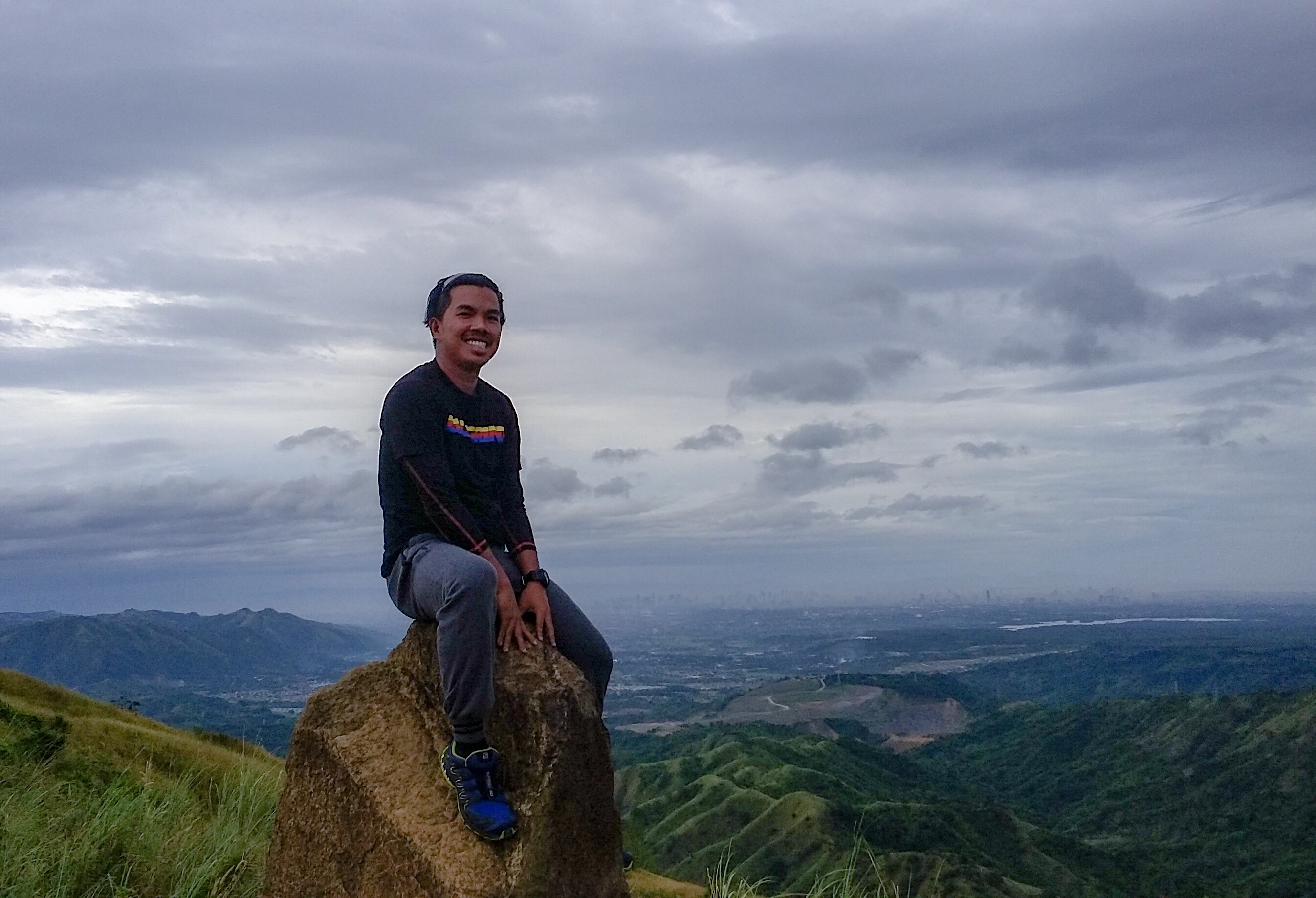
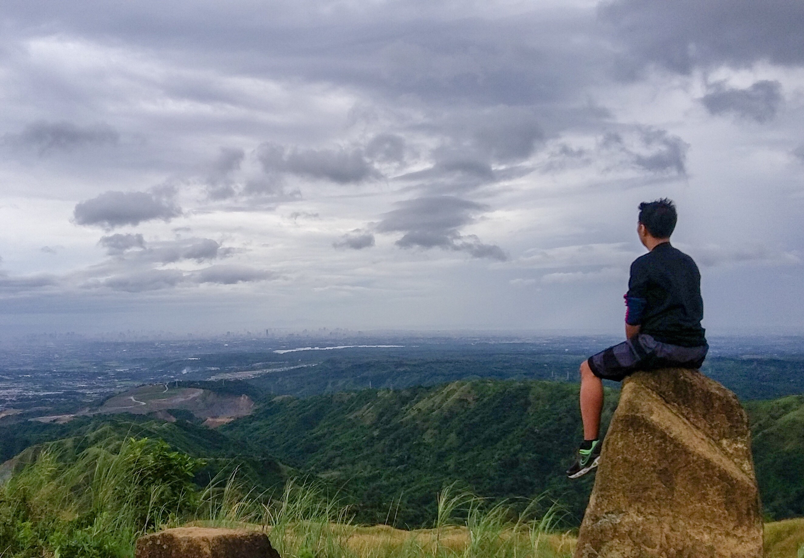
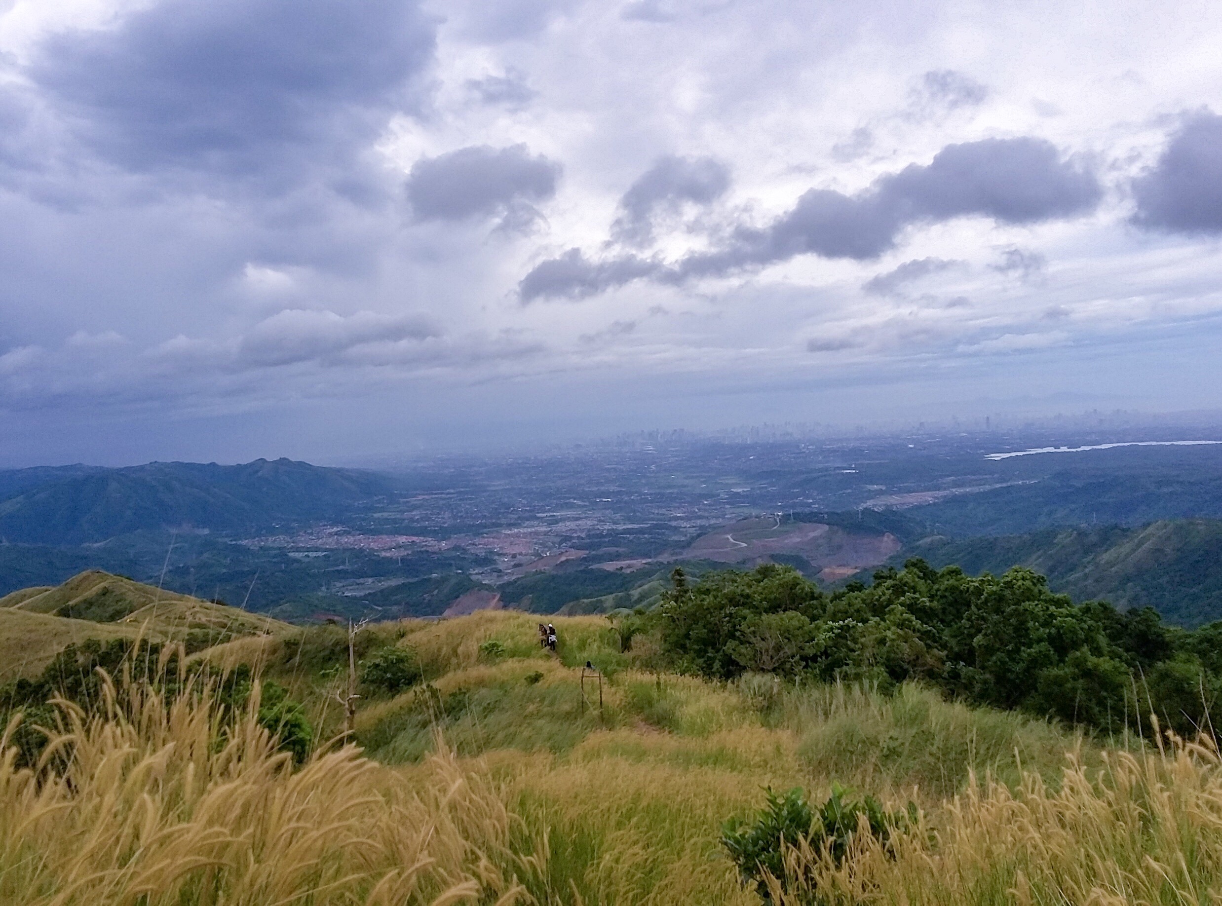
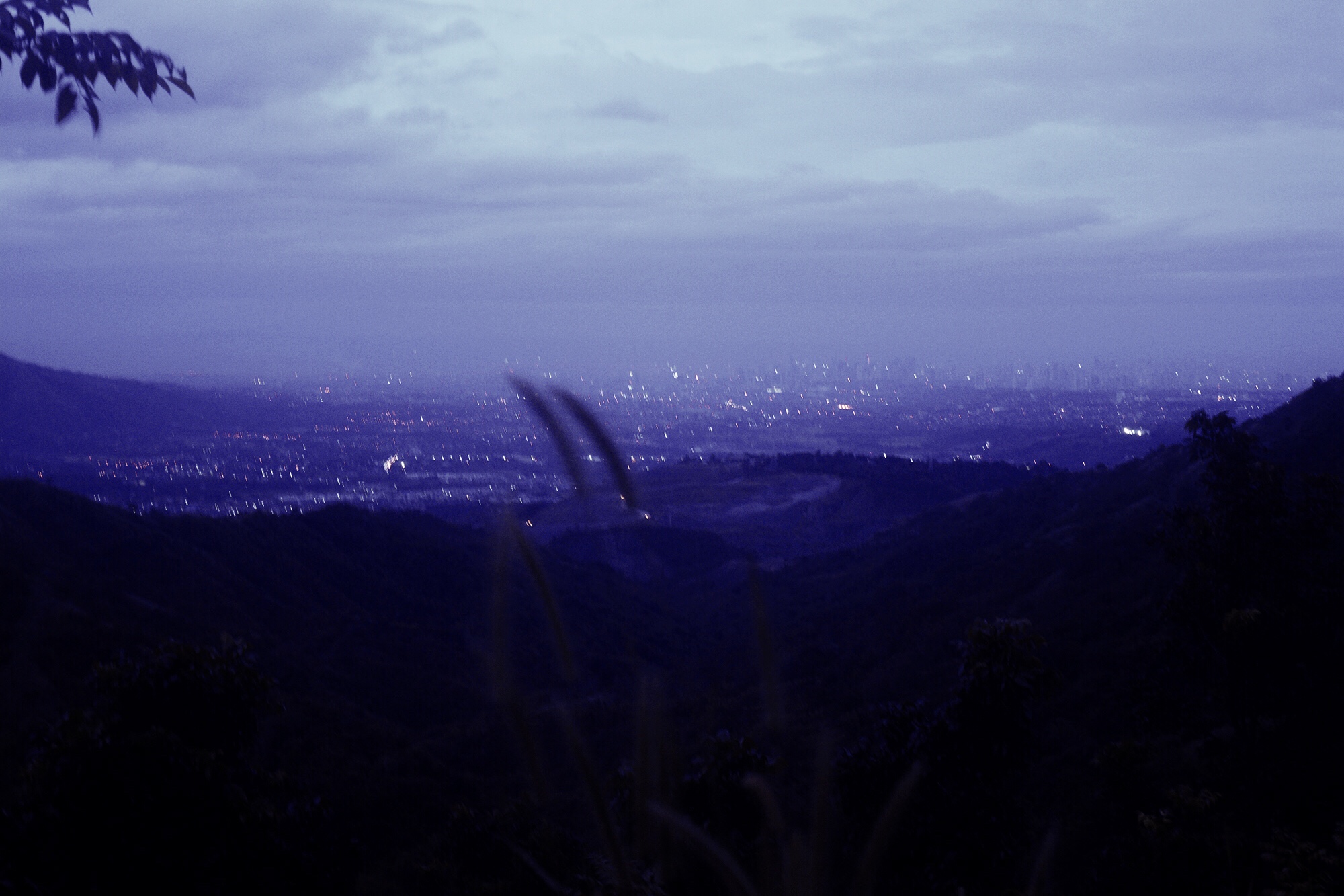
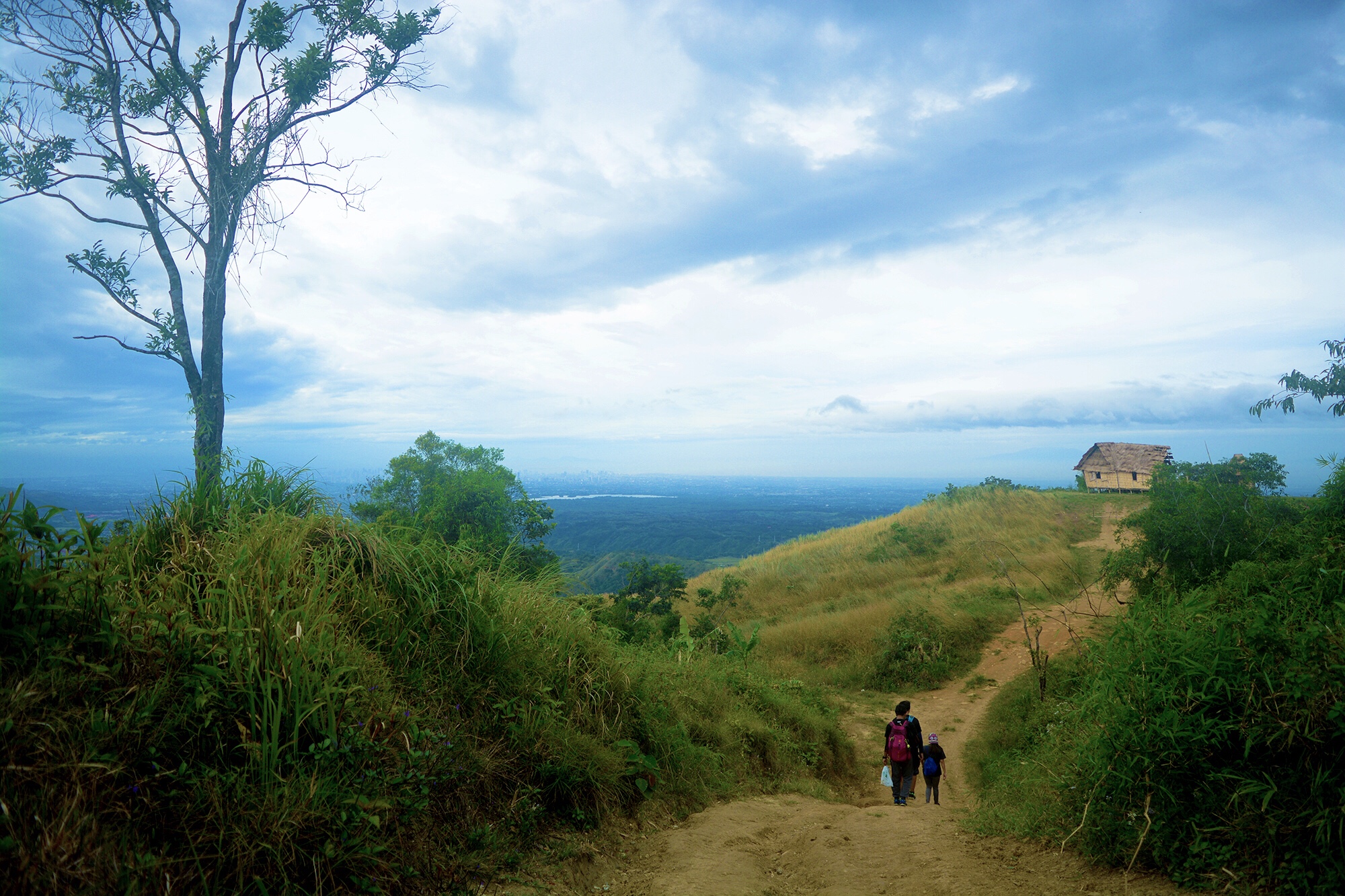
We covered at least a quarter of the trail to the campsite when we decided to rest a moment and basked at the stunning view of the metropolis. The blinding lights of the city was such an amazing sight. The skyscrapers towering in the distance reminded me of the first view I have of Manila ten years ago while I was aboard a Super Ferry ship on my way to the city to seek bigger opportunities. Flashbacks of that day filled my mind before I was finally taken back to reality by a voice urging me to get going.
We hoped to witness Mt. Balagbag’s sea of clouds but given how empty the horizon under the gray skies was, we suspected our chances to zero. We reached an inverted T-Junction twenty-five minutes from when we resumed the hike. Little did we know that we already covered half of the trail to the campsite. We continued with the hike and when we felt like our knees were already giving up, we settled to rest at a rock just a few steps up.
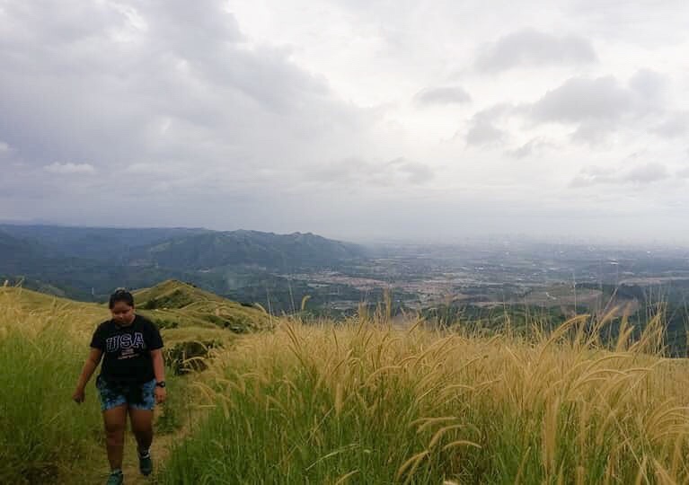
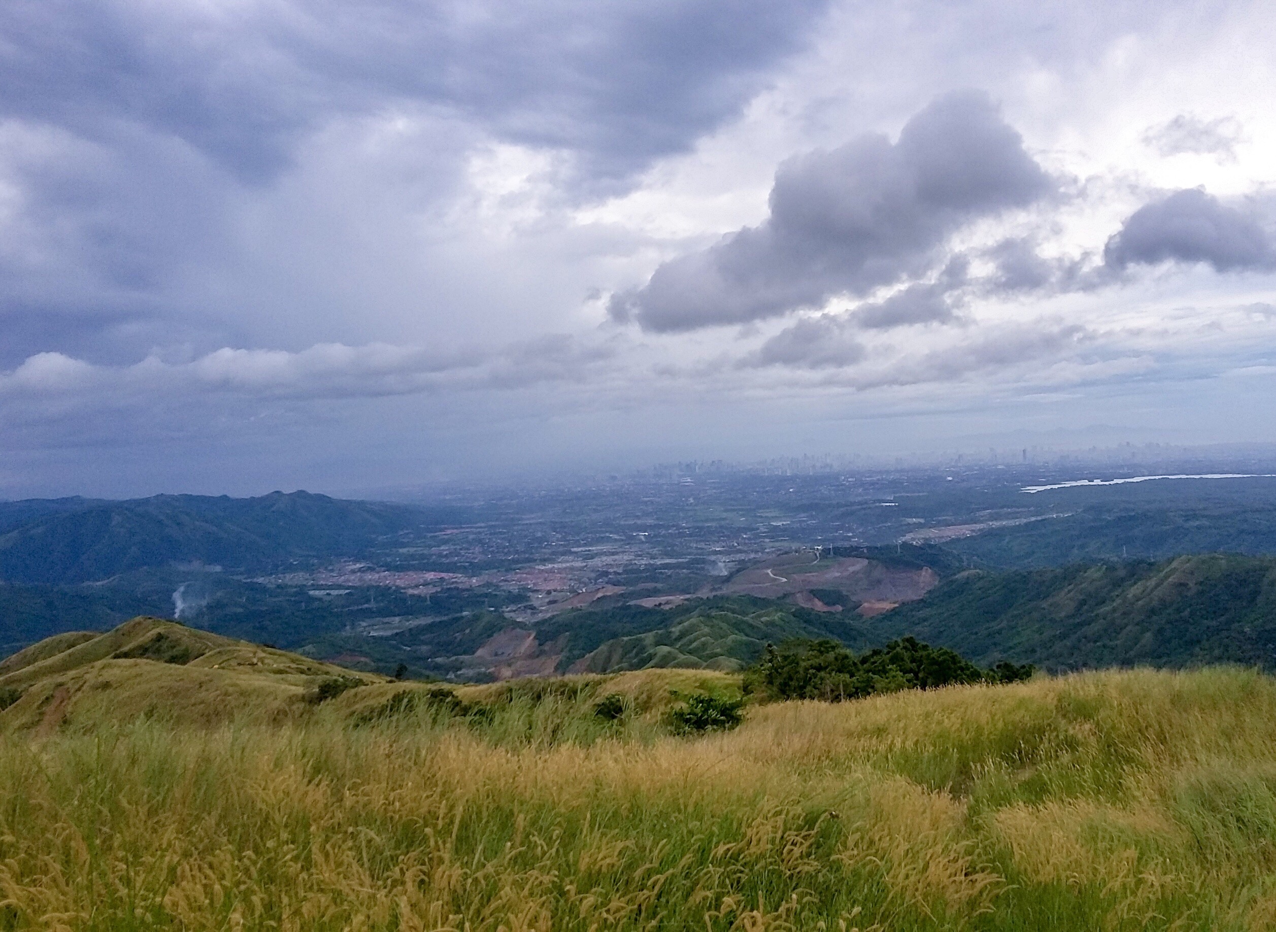
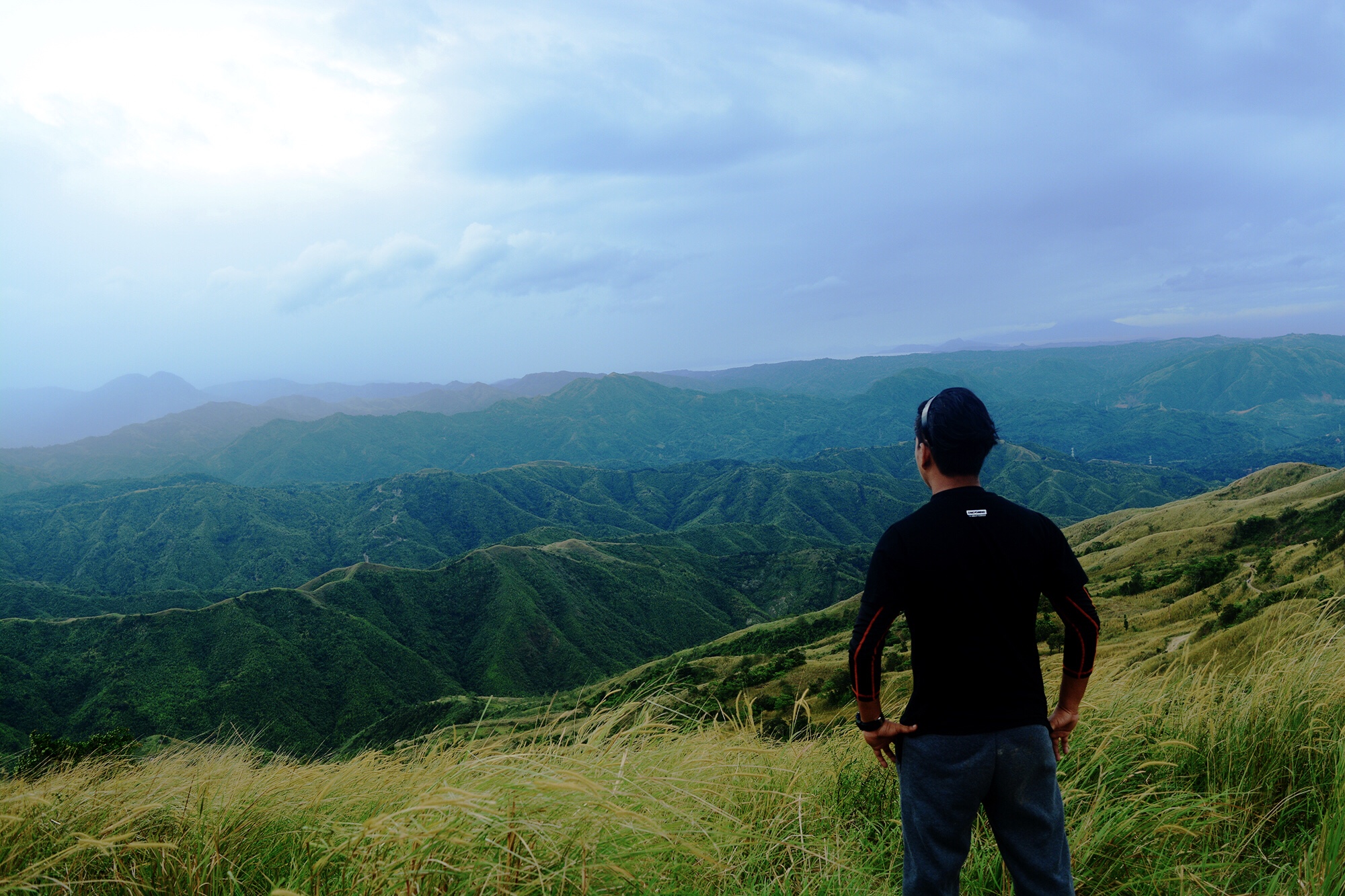
We could already see the vastness of the Sierra Madre from where we rested. The campsite was already within sight as well. We figured a cup of coffee would help chase the cold morning away so off we hasten to the campsite. We were kind of slowpoke hikers but this time, we kinda have taken it to the extreme that what could have been an hour hike already took us a little over two hours.
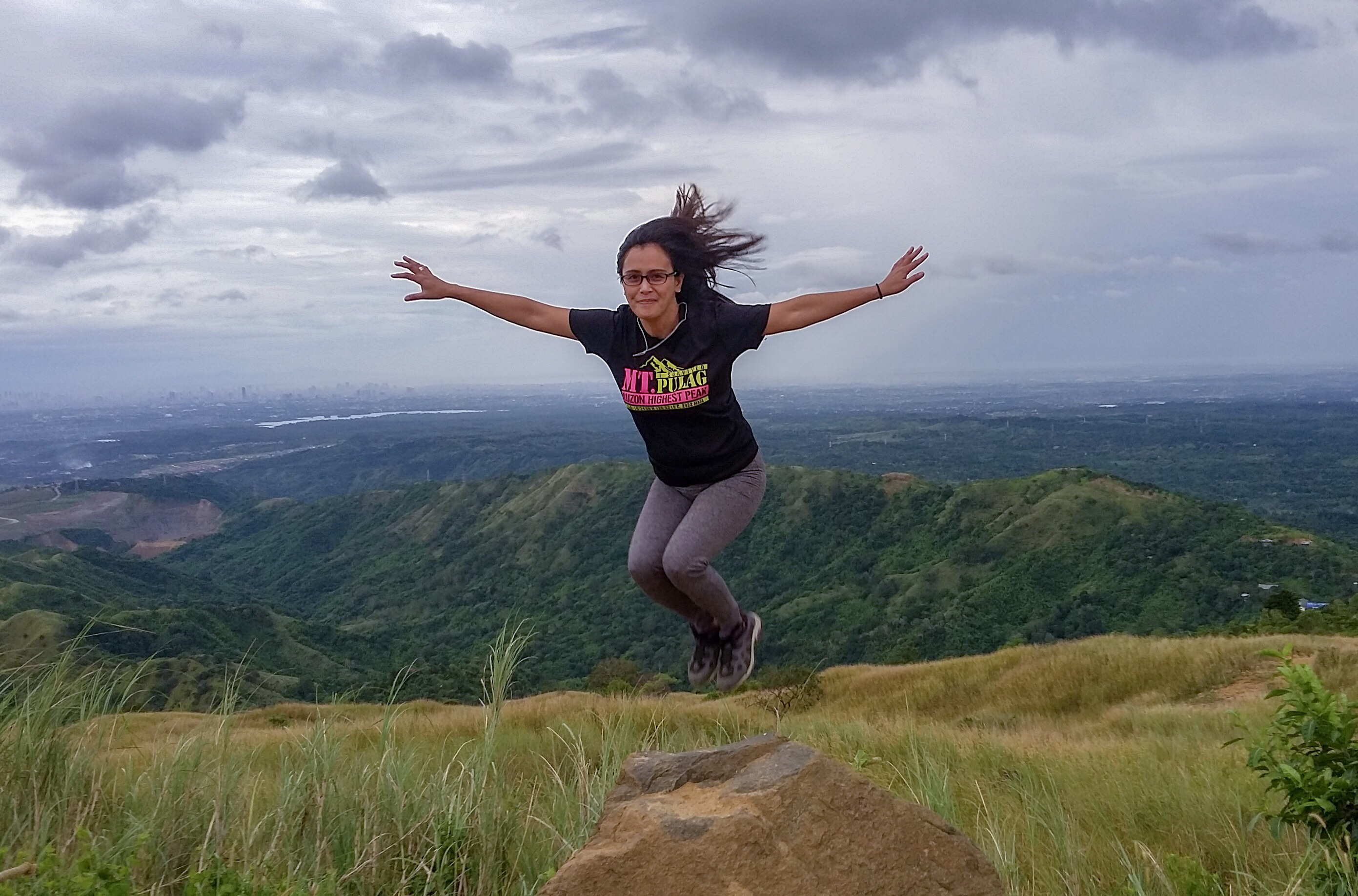
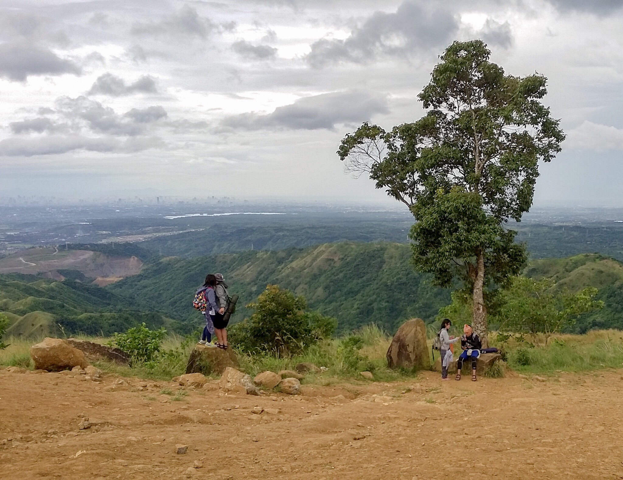
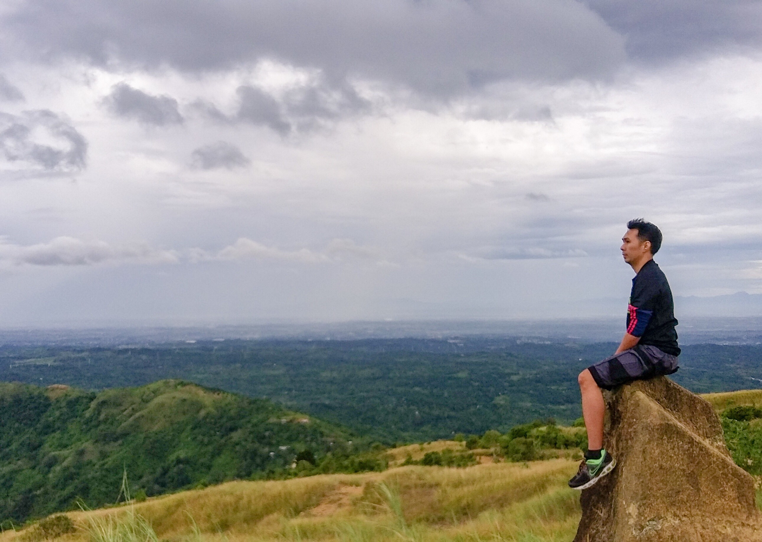
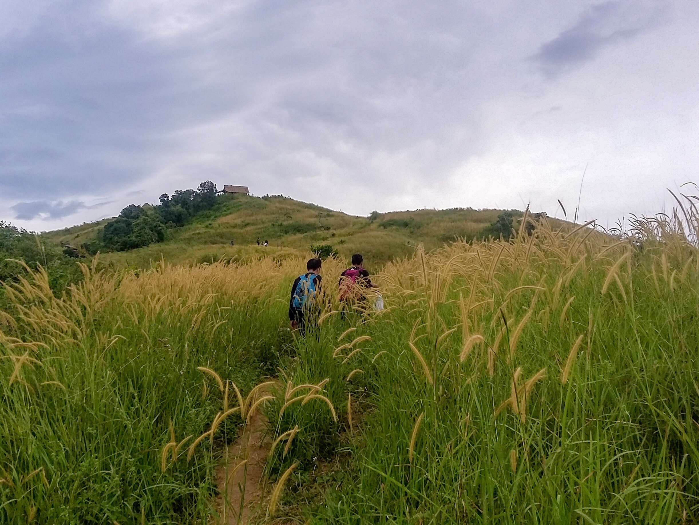
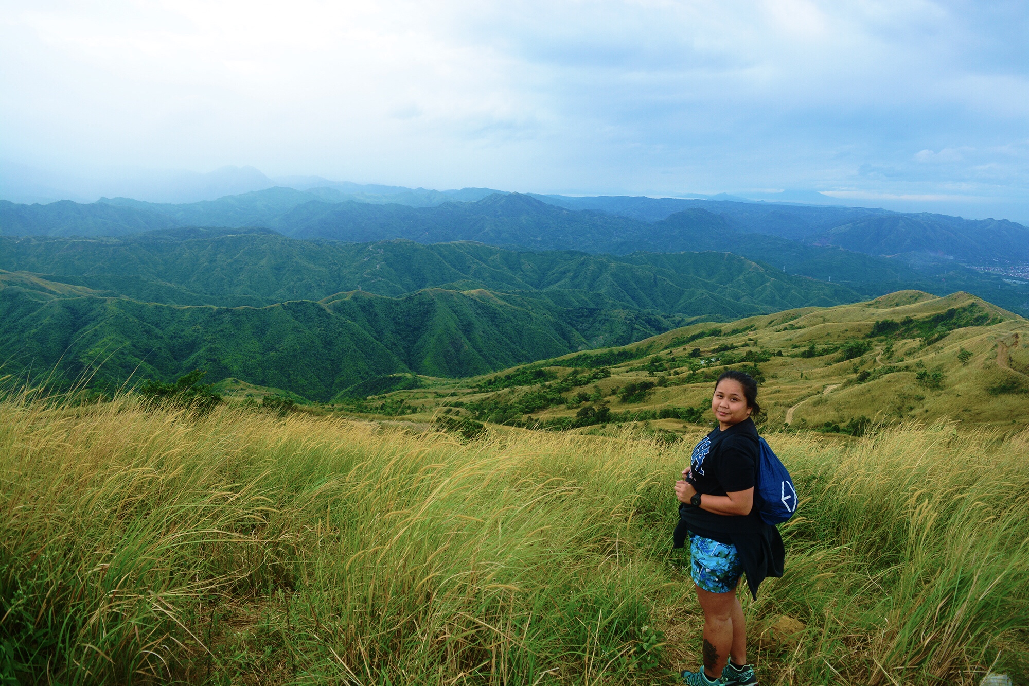
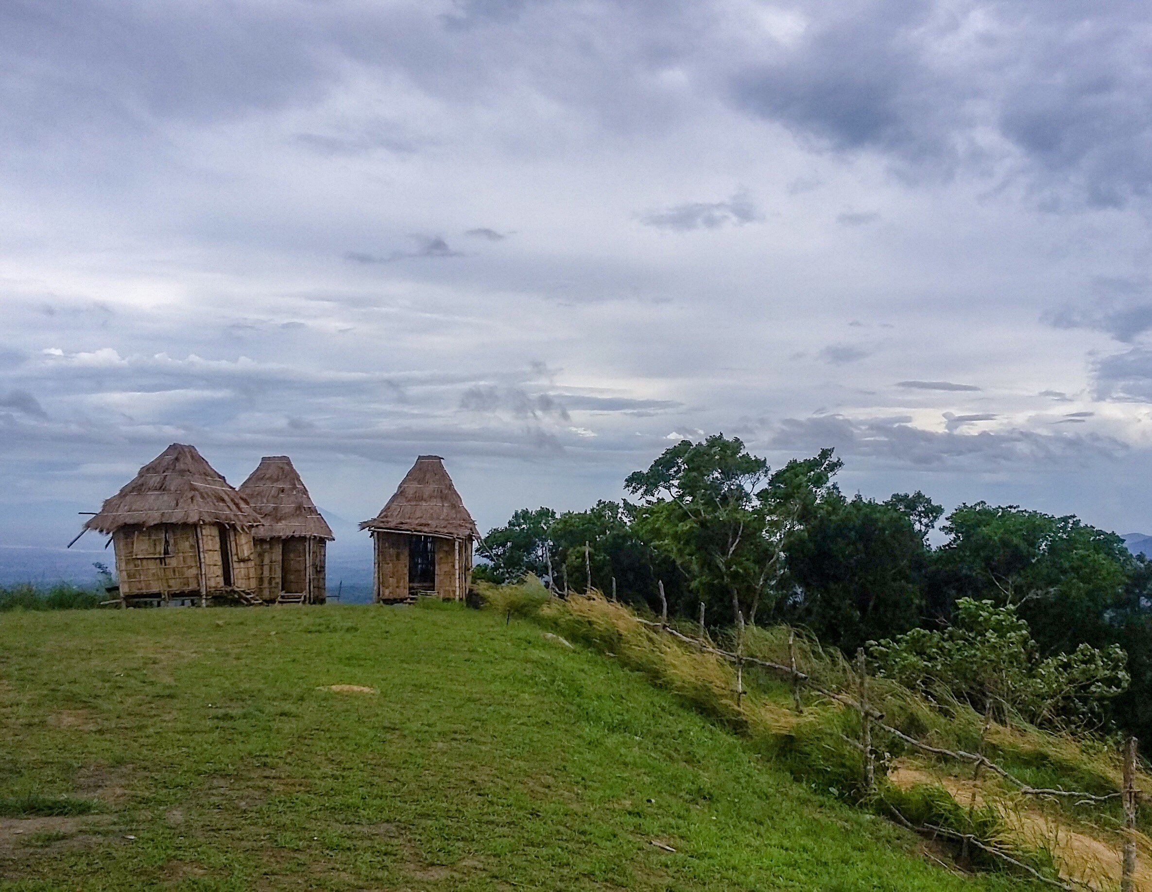
We finally reached the campsite and there indulged on some instant noodles, bread, boiled eggs and a cup of coffee over convo with the other hikers we just met. We also took our time to snap us some photos. We were after the sea of clouds but Mt. Balagbag was barely a let down even without it. Those rolling hills covered in tall amorseco grasses were this mountain’s very distinction. It could easily be mistaken as Korea’s Hanuel Park if you would put in some creativity in your shots.
From the campsite we braved the strong winds to finish the hike to the summit. The wind was wild and it felt as if it was slapping my face in full force. I might as well call it a tornado, given how it could easily blow me away and send me flying off the ground. It was the scariest part of the hike that if we let our guards down, the wind could easily drive us off a cliff.
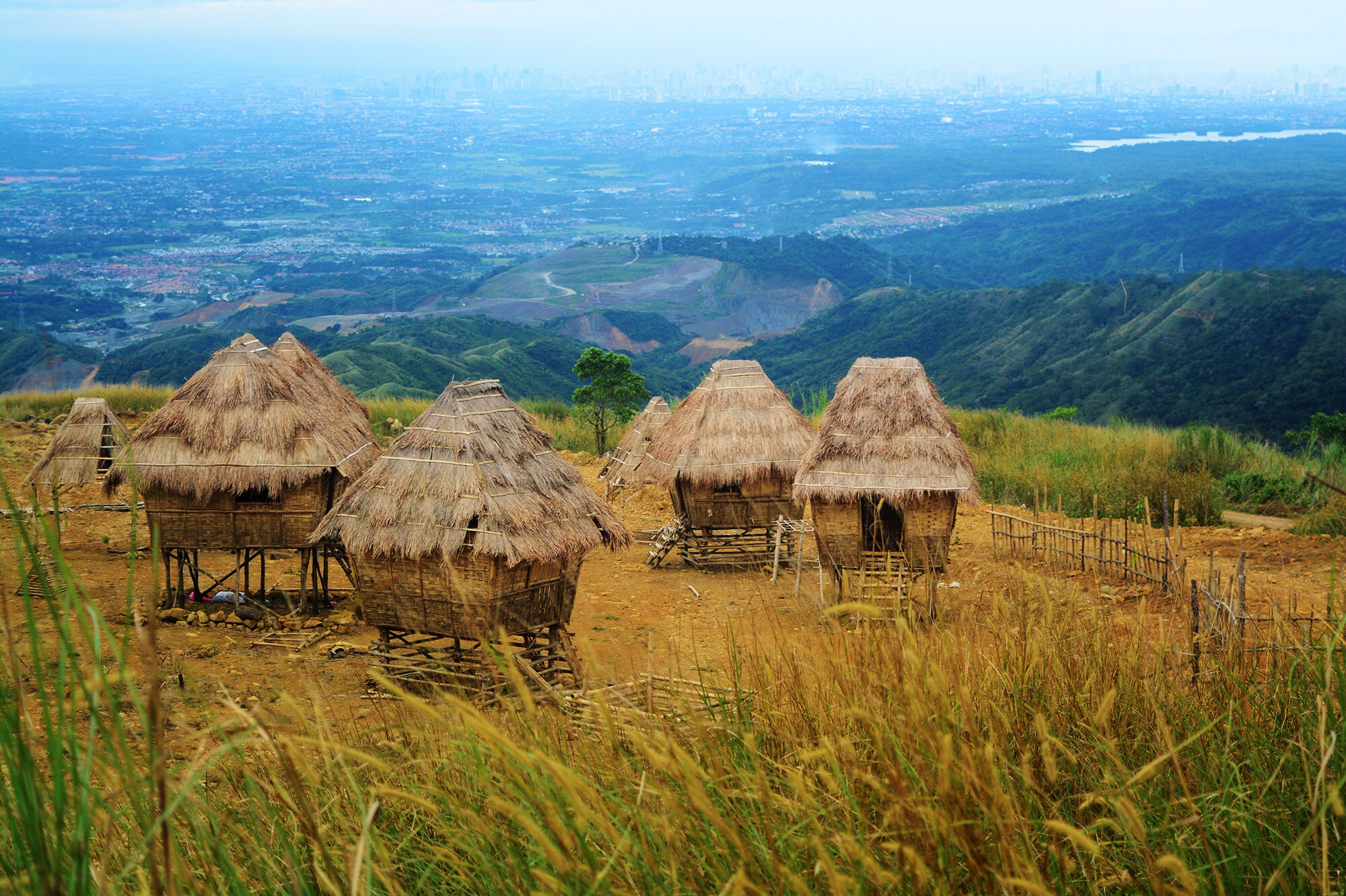
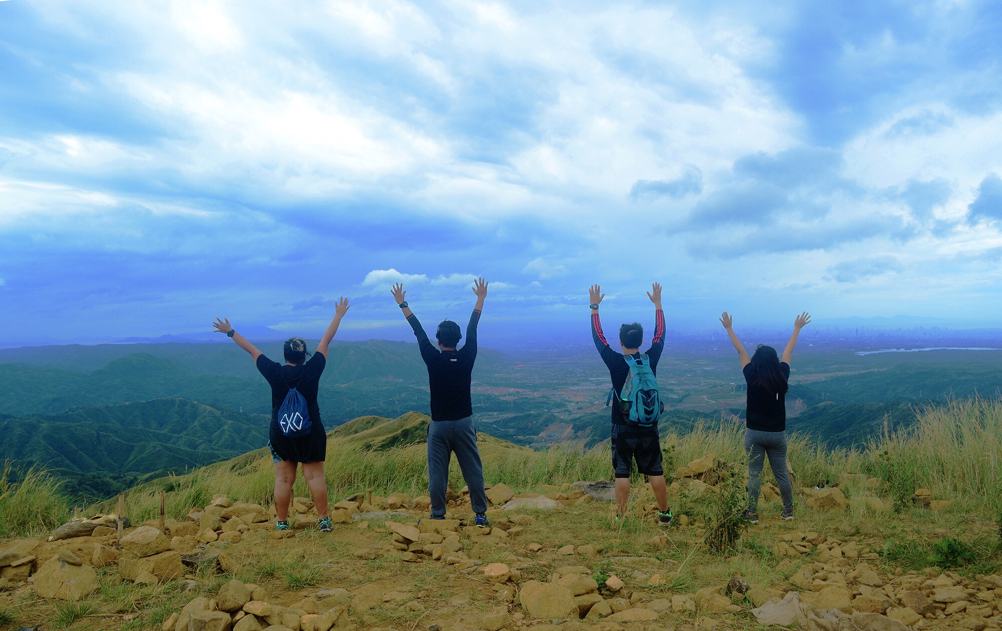
We wasted no time and quickly hiked our way to the summit despite the challenge of a mighty wind. It has not slowed down a bit and was getting stronger by the minute that not even those native houses atop the hills could withstand it. The trail to the summit was similar to the first set of the trail we have covered from the outpost to the campsite. It was a gradual ascent in the middle of overgrown amorseco grasses. We happened to encounter Garfield while on our way but he could not be bothered since the wind was causing him stress. So we went on and reached the summit barely an hour after leaving the campsite. A few minutes after, we headed down content and excited to binge on beers and burgers we have been craving for so long.
HOW TO GO TO MT. BALAGBAG
From Manila – wait anywhere along Edsa North bound lane for buses bound for Tungko. Ride the bus and alight in Jollibee or BDO Tungko. Ride a jeep bound to Licao-Licao. Once you reached Licao-Licao, ride a tric to the registration office or simply hike your way there.
TRAVEL TIPS AND USEFUL INFO FOR HIKING MT. BALAGBAG
- Mt. Balagbag is truly one of the easiest mountains available for newbies who want to get started with their hiking adventure. The trail is simply an uphill walk all the way to the summit. It doesn’t require navigational skills but you would still do best to train before even attempting to summit it.
- Mt. Balagbag is known to be a place where a morning sky filled with the dreamy sea of clouds can be best viewed. To save cost, it is best to go there in the afternoon and camp for the night at the campsite since jeepneys plying the Tungko-Licao-Licao route are only available from 5AM-5PM and the other and only option which are the tricycles could be very expensive.
- For safety, it is best to hike in big groups of 5-10 members. Avoid hiking alone or in small groups of less than five or in an all-girl group especially in the late hours of the night or the early hours of the dawn since hold-ups are very common in this mountain.
- From the drop off point in Licao-Licao, the registration site can be reached after a 30-45 minute hike. Taking a trike costing P250/way is another option.
- Be a responsible traveler. Always follow the LEAVE NO TRACE POLICY. Carry your trash away from the mountains with you and dispose it properly when you get home.
BUDGET, SAMPLE ITINERARY & OTHER ESSENTIALS
| SUMMARY OF EXPENSES | 🚌 2way Bus Cubao-Tungko - P110 🚙 2way Jeep Tungko-Licao-Licao - P60 💲Registration Fee 1 - P10 💲Registration Fee 2 - P20 🍔Food - P100 Total - P300 |
| SAMPLE ITINERARY | 0400 Meet Up 0430 ETD Bus Tungko 0530 ETA BDO/Jollibee Tungko 0600 ETA Licao-Licao 0630 Brgy. Outpost. Register 0700 Start Trek 0800 Campsite. Breakfast 0900 Assault Summit 1000 Summit. Photo Ops 1100 Start Descent 1200 Brgy. Outpost. Wash Up 1300 Head Home/Side Trip |
| FEES & OTHER EXPENSES | Guide (not required) Fee: P500/5pax Registration Fees: 1st - P10 (Collected at the outpost) ; 2nd - P20 (collected at the campsite) Fare Bus to Tungko - P55/way Jeep Tungko-Licao-Licao - P30/way Tric to Licao-Licao-Outpost - P250/way/4pax |
| THINGS TO BRING | 2L Trail Water Trail Snacks First Aid Kit Toiletries Extra Clothes Flipflops Garbage Bag |
There you have it lovelies. Did you enjoy our adventure? Then follow us for more on Instagram and Facebook. Show me some love and share this post with your friends. For questions, suggestions and violent reactions, drop them on the comments box below. Until next time! Ciao!
Discover more from A Wanderful Sole
Subscribe to get the latest posts sent to your email.
23 Comments
Hi Ms. Kate. Safe and friendly ba ang Mt. Balagbag for infants?
Hello Jess. Okay nman sa Mt. Balagbag. It’s easy to hike so you can bring your baby din.
Hello Keza, may I ask kung merong bilihan ng food sa campsite doon sa mismong summit? 🙂
Yes. Meron pong tindahan near the campsite before the summit.
Do you think Mt Balagbag is still open now for hiking? How about if we have a car going to the registration area, is there a parking area there?
Hello Clare. Parking is available at the registration area but space is pretty limited.
My kids went up Mt Balgbag without being carried.
Hello this could be exciting but u said Hold ups abound in the area and so it’s scary and dangerous right?
and u have to be in a group of 10 maybe but still what if they have guns? well I would probably abandon the idea of scaling Mt. Balagbag if this will be the case
May pwede po ba makuhang guide coz i’m planning to hike alone.
Yes. Sa reg site pwede ka kumuha ng guide. 😊
Hassle, I used to ride up with my bike here alone. Too bad the place is not that safe anymore.
Hi is it safe for foreigners to hike in mt Balagbag? Thanks.
Hi Lovelie. So long as they have company and they don’t hike on wee hours.
Naexcite ako, pero nong sabi mong medyo may mga hold up natakot ako, i usually hike alone kasi, hehe introvert.
Hi Jerome! Yeah a lot of people say na common ang hold up dun especially pagmagisa ka lang at alanganing time ka naghike so just to be on the safe side, try to be with other people. You don’t have to hike along with them. Yung tipong may kasabayan ka lang sa trail pwede na basta you shouldn’t be alone.
hi maam, i just want to ask if they are not requiring a guide if I am planning to clim alone.
Hi Nathan. They dont require a guide.
Hi. Do you have a contact number for a guide to Mt. Balagbag?
Hi Mika. Sorry I don’t. We didn’t get a guide kasi during our hike.
thanks Ms. Keza Enriquez for the information.GBU.
Thanks Katherine 😊
i want to go to mt.balagbag on a day hike alone. i am just hoping it is safe for me..thanks
Hi Katherine. Be in a group. Mt. Balagbag is not the safest place for a woman to be alone. 😊