
Mt Binutasan is one of the few offbeat mountains in Rizal despite the myriad of things it could offer. It was first introduced in 2016, enticing the mountaineering community for a visit with a promise of a magnificent morning sunrise over the sea of clouds. Despite efforts of the local community to promote this amazing mountain, it remained one of the least visited among the numerous choices in the Sierra Madre which makes Mt. Binutasan ideal for those who seek peaceful and less crowded mountains. It’s also perfect for newbies who are still testing the challenges of the outdoors since its trail is fairly easy. Though viewing the sea of clouds with the sun rising from the horizon is an epic experience in itself, Mt. Binutasan gladly has way more up its sleeves. Rolling hills. Sprawling grasslands. A panoramic 360-view. The list goes on. So if you are contemplating a quick adventure, Mt. Binutasan surely won’t disappoint.
THE CLIMB TO MT. BINUTASAN
Registration – Trail Head – Peak 1
This climb in Mt. Binutasan was long overdue. We first tried to scale this mountain in 2016, just weeks after it was first opened to the public. We were successful in scaling its twin, Mt. Sapari, but failed to scale Mt. Binutasan due to heavy rainfall and treacherous trail infested with blood-sucking leeches (limatik). I was just glad to have successfully climbed it with my friends a few months back as it finally closed that chapter of my mountaineering adventure which has kept me feeling rueful all this time. I can no longer count the times I have planned to go back to this mountain only to fail in fulfilling it due to last-minute changes brought about by our fickle minds and impatience just like that fateful day which led us to Mt. Talamitam. (Laughs)
Related Read: MT. TALAMITAM: DIY Budget Travel Guide + Itinerary & Useful Tips

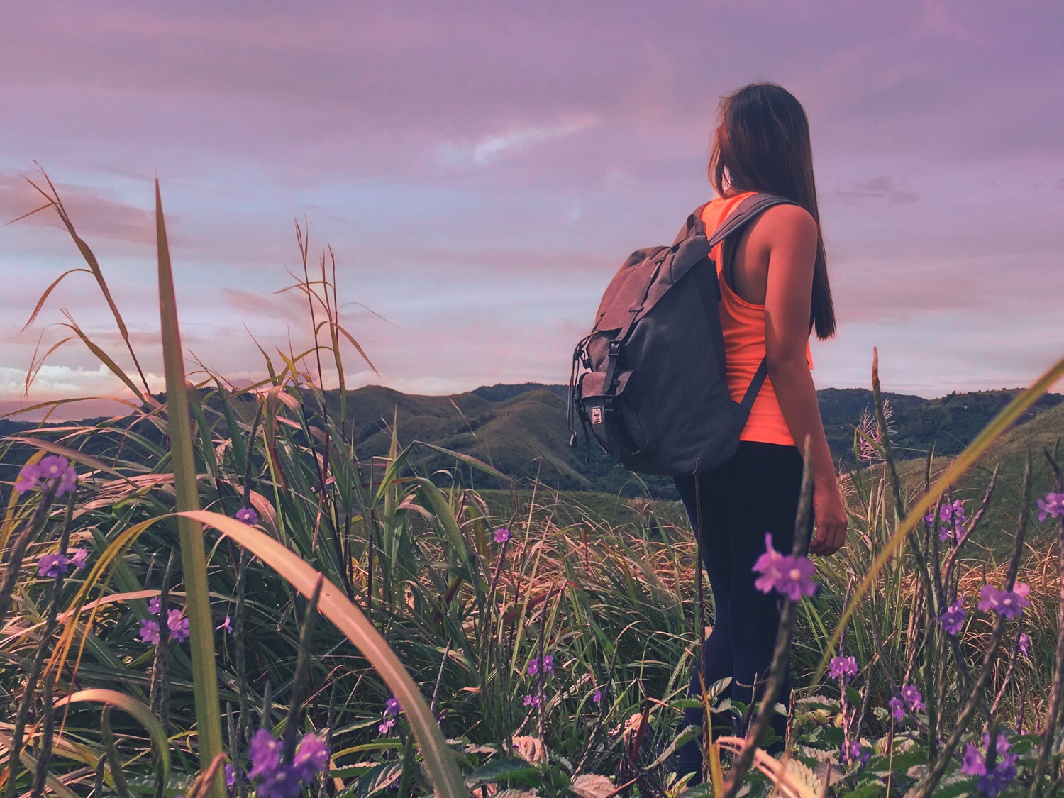
A few months ago, my travel peers were longing to spend a morning atop a mountain and Mt. Binutasan topped our choices. We wanted a chill and easy hike near the Metro and among the mountains, we haven’t scaled yet, Mt. Binutasan stood out the most. The original plan was to go on an overnight hike but unforeseen circumstances delayed our trip that we didn’t arrive in Tanay until it was 10PM. We spent another hour eating our very late dinner in Jollibee and at 11PM, hired a tricycle to go to the registration site. We got lost for several minutes, circling without direction before finally spotting Cuyambay’s Barangay Hall. The hall was under renovation at that time and so much has changed since the last time I went there. The old nipa hut which used to be an eatery and the station for guides and porters is gone. Now stood there is a white two-story house of modernistic design.
We jump-started the adventure as soon as we finished all the formalities. We had no room for slacking as we were running against time. If you must know, none of us had ever slept yet that day. We all came from work and had endured over 7 hours of travel. Our bodies were already longing for that much-needed rest and we didn’t wanna wait until our system completely shut. Just like before, we rode a motorcycle from the registration site all the way to the trailhead. It was necessary considering how far apart the hall was to the start-off point. And for the record, the roads were pretty steep too. And I hate hiking steep concrete roads! They’re a nightmare to my weak lungs and feeble legs.
Now one surprising thing I found out during this hike was that Mt. Binutasan actually shares the main road leading to its trails with Treasure Mountain. If you are on social media, it would be hard-pressed to miss how everyone raves about this place. Effortless Sea Of Clouds as what most people describe it. While I personally have nothing against it, sadly, the rise of Treasure Mountain to fame made everything else in the area fade into the background. It made Mt. Binutasan more irrelevant and less known even to some locals of Tanay which hurt Cuyambay’s tourism a bit more. It certainly caused drawbacks to the locals but I am not at all complaining. Given how humans tend to destroy beautiful things, it’s better for this jewel to stay unnoticed. Maybe Mt. Binutasan was simply made for the more adventurous spirits.
Anyhoo, we finally reached the trail head and quickly started the hike with a descent along a rugged path. The descent was gradual and easy. It was along rocks, big and small. Some parts were slippery but it’s nothing even newbies couldn’t handle especially with a good pair of trekking shoes. The descent went on for about an hour with us passing by distant local houses and lush forest. I was so relieved to know that even after two years, the path leading to Mts. Sapari and Binutasan hasn’t changed a bit so I knew exactly where we were going or how far had we covered. Almost an hour of trekking, we reached the resting camp, a solar-powered house that stood adjacent to where the road breaks in two with the trail on the right leading straight to Mt. Binutasan summit. It usually marks the transition from a seemingly never-ending downhill to gradual ascent. There, we rested for a moment.
After about 15 minutes of rest, we decided to continue with the hike. I was about to hurriedly make my way to the trail on the right but was surprised that our guide led us straight instead. Out of confusion, I asked him why we went the other way. Well, it turns out that the trail is now off-limits with it being private property. With hesitation, I followed my friends and our guide as we made our way to the next part of the hike. I was so skeptical about going straight as the memories of our hike two years ago was still vivid in my memory. Given how it was raining during the past several days, I knew exactly how ridiculously muddy that trail could get. We might as well be swimming in puddles! Now if the trail condition is not at its worst as I fear it would, then wading through knee-deep mud is the less gruesome situation.
Five minutes into the hike, the gradual ascent became so grueling. The trail was exactly what I expected it to be. Muddy. Filthy. Slippery. It was insane! Every step must be careful and calculated. Otherwise, we suffer getting stuck with our feet buried a foot deep and mud splattered all over our legs. What made it worse was that it was twice as hard for my 180-pound self that no matter how cautious I was with me carefully considering where to put my feet next, it was still futile. Like there’s no amount of careful calculation could help me and I always end up being stuck. I could just roll my eyes in exasperation as I troll myself in silence. You know that feeling when you realize the situation is dire that you’re thinking about something you won’t normally consider during better days? Funny enough, I was actually thinking I should have taken losing weight more seriously!
The hike over mud-splattered uphills went on for over an hour before we reached another resting hut. We were relieved to have known we were only 15 minutes away from finally taking that rest our bodies so achingly desired. We thought about hiking all the way to the summit to set up camp but Peak 1 was also not a bad idea. Seated at a bench waiting while my friends clean themselves, I battled the urge to sleep. I know my body so well. Giving in to a nap meant waking up 12 hours later which equates to another plan ruined and another failed chance to witness the majestic sunrise atop Mt. Binutasan. Afraid of becoming too weak to resist dozing off, I urged my friends to get going. I struggled to find the momentum to take on that steep 15-minute assault to Peak 1 after resting for over 30 minutes but I had to force it.
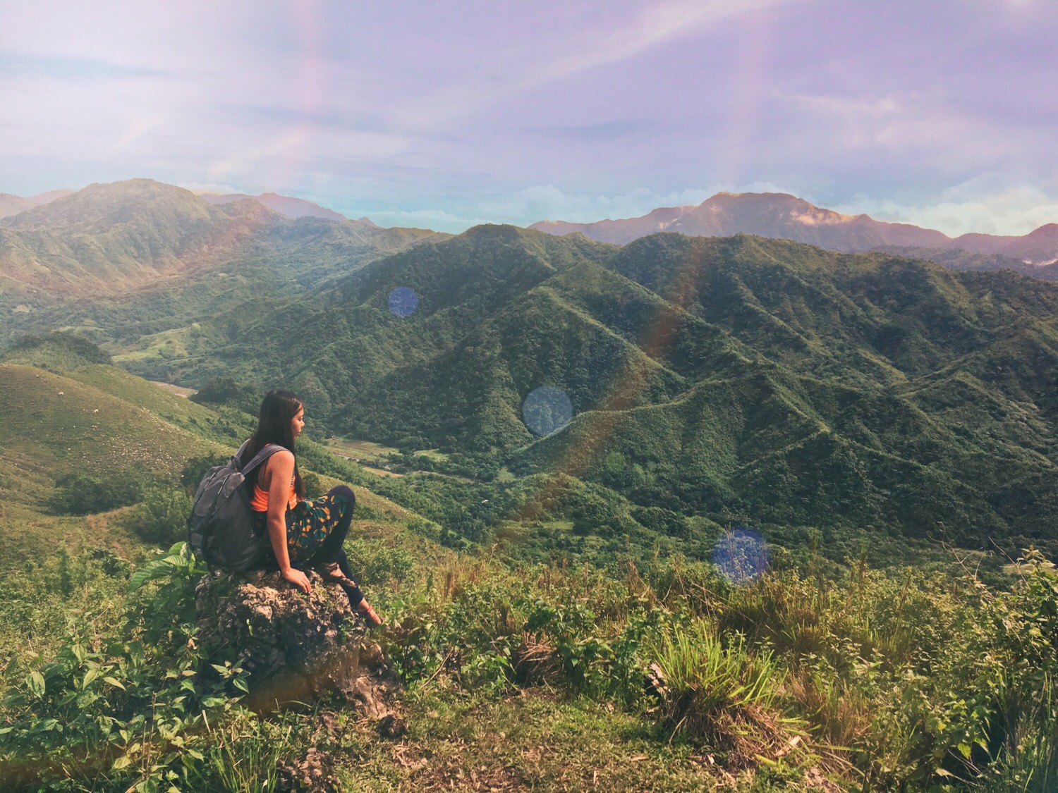
Unlike the previous two hours where the trail mostly consisted of moderate up and downhills, this time it was more challenging. It was steep and was too difficult to trek due to the soil being too soft and slippery. Relieved to have overcome the first straightforward assault of about 40 meters, I rested a moment. I slowly made my way through a cornfield while also trying to catch my breath. We continued to hike over a flat surface for about a minute or two. Then came the final ascent to Peak 1. It was steep but was less challenging. It was along rocks and was shorter by several meters. Exactly 15 minutes after, we reached Peak 1. It would have gotten me giddy to wander around the peak searching for some scenery but the thick fog made it hard to appreciate anything. The cold was also seeping through our skin that we hurriedly pitched our tents. At 3AM, four too exhausted souls went to a deep slumber sending the heavens a prayer to wake them up 2 hours later.
The Breathtaking Sunrise
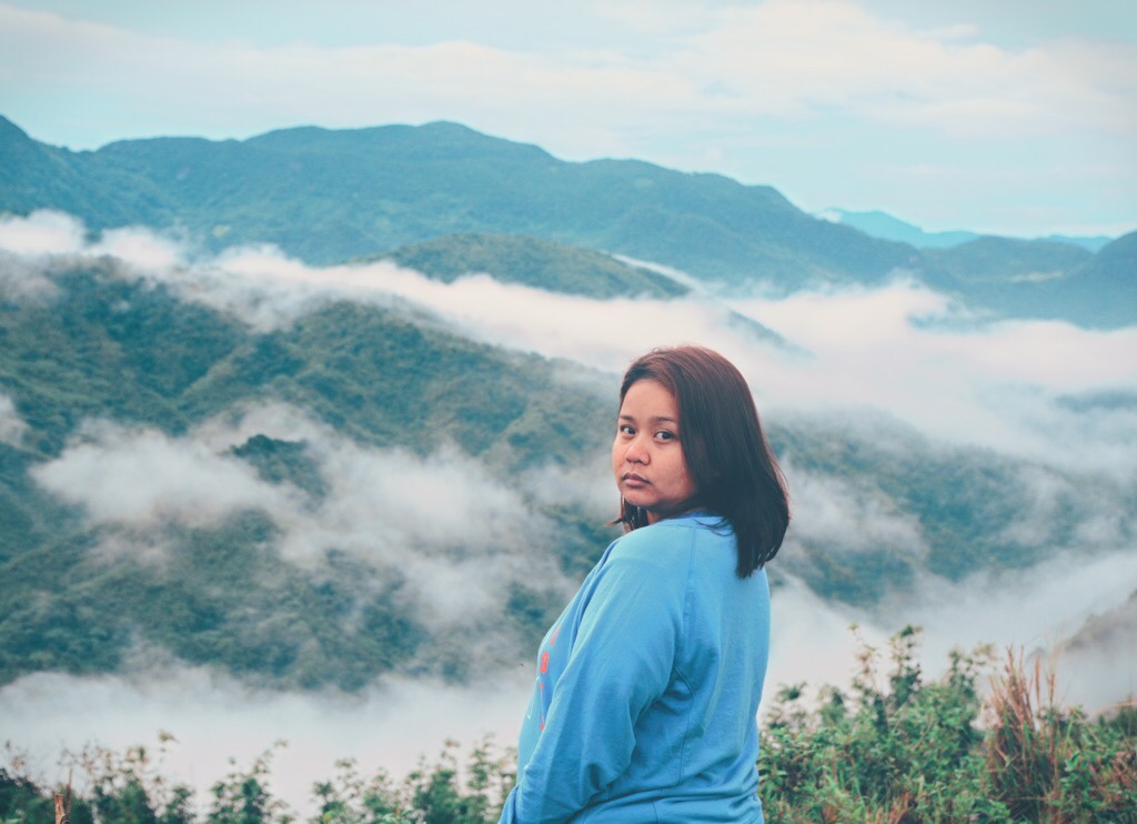
I set my alarm at 5AM but I was too deep in my sleep to even hear it took off. If it weren’t for our guide who persistently woke us up, none of us would have witnessed that amazing morning. It was 5:30AM on my phone when I managed to open my eyes, rise and get out of our tent. It was freezing outside but I couldn’t care less as the scene in front of me warrant no less my full attention. It was almost perfect had the sun shown up but it barely made its way out of those thick clouds. Nevertheless, we were still blown away by what we have seen. It may not have surpassed my standards set so highly by Marlboro Hills and Mt. Ugo but it was more than enough to make me grateful for every wonderful thing we were so fortunate to be bestowed. I couldn’t have asked for a better morning that day. A breathtaking sea of clouds shared with friends over a cup of coffee and bread. Some precious little moments money can’t buy.
Peak 1 – Summit – Jump Off
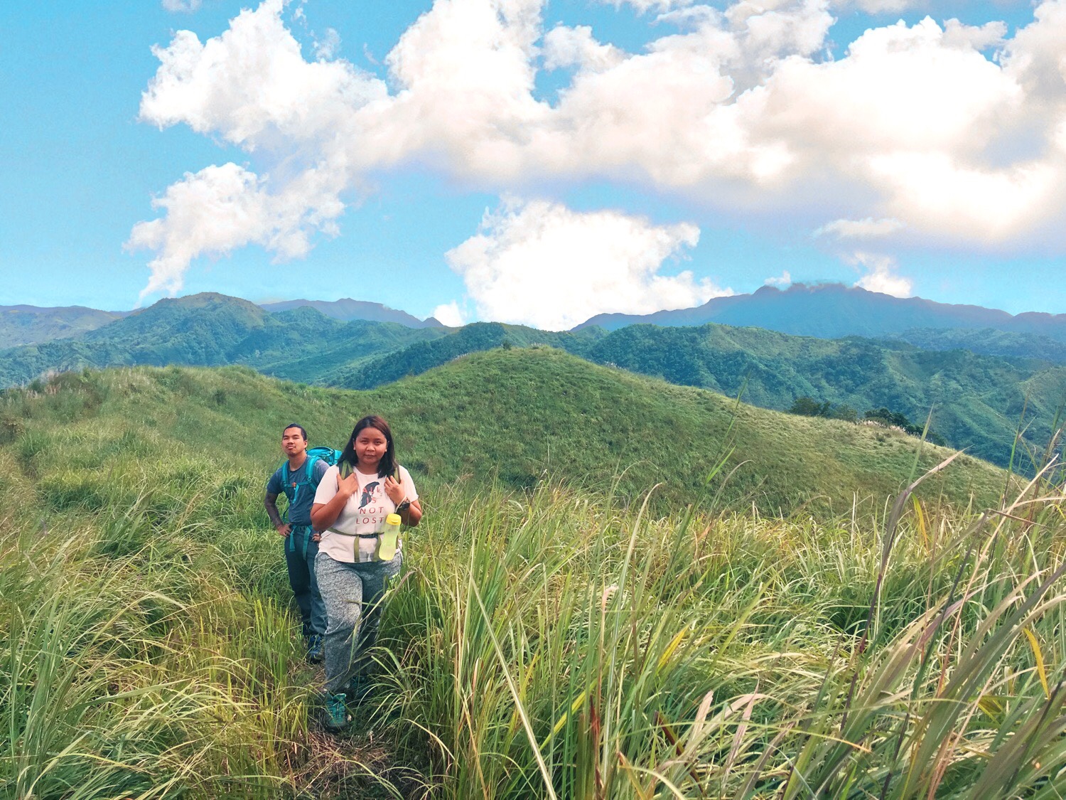
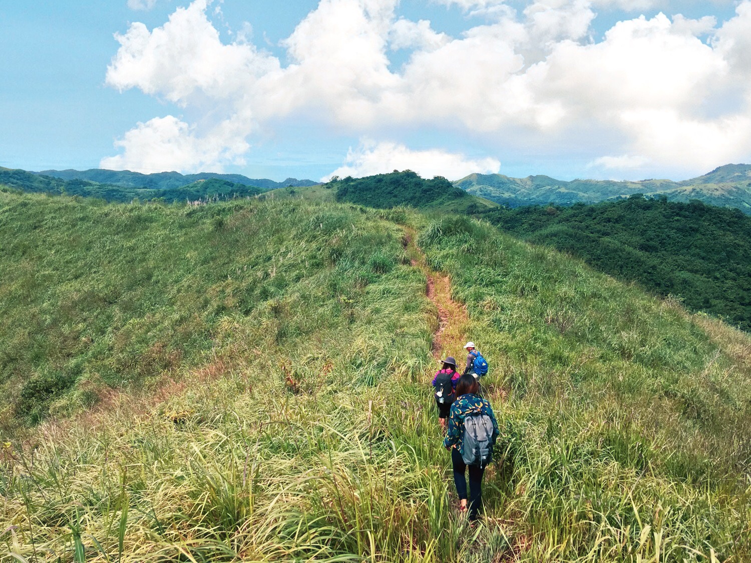
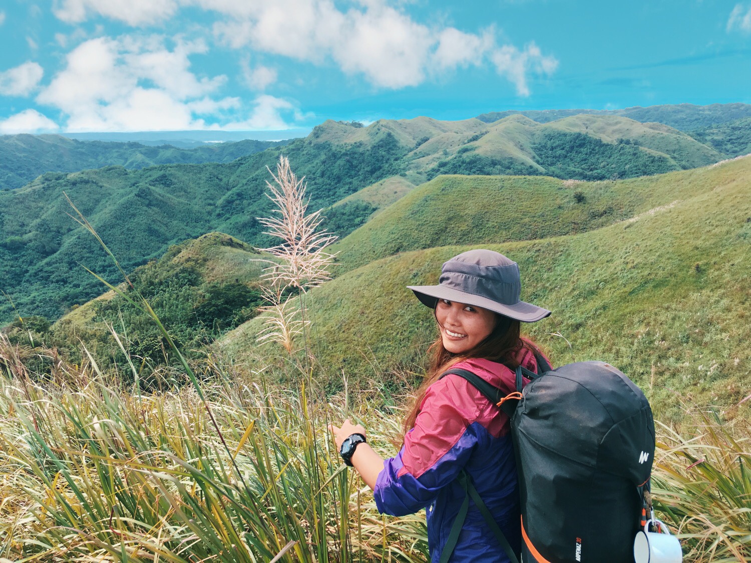
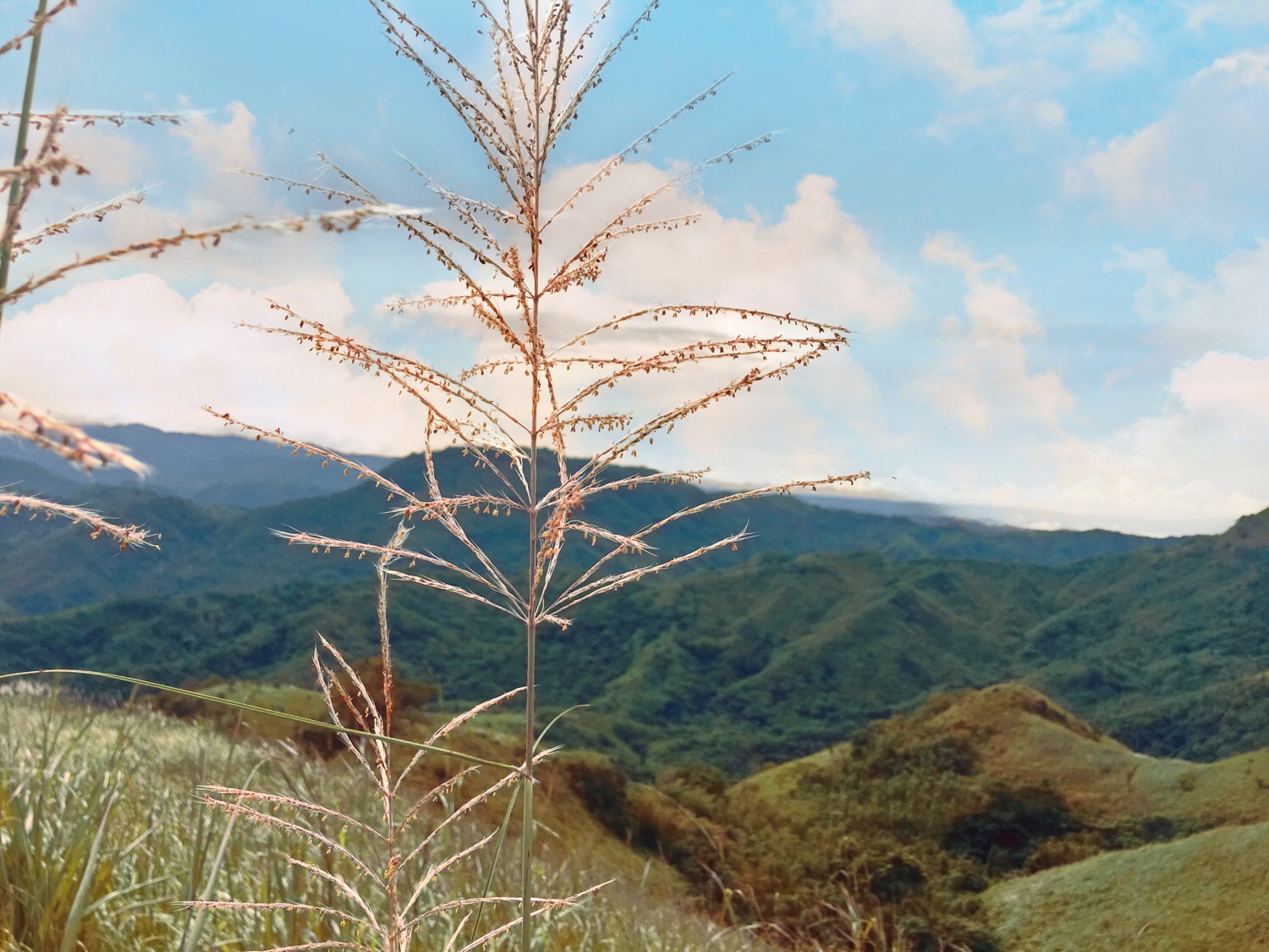
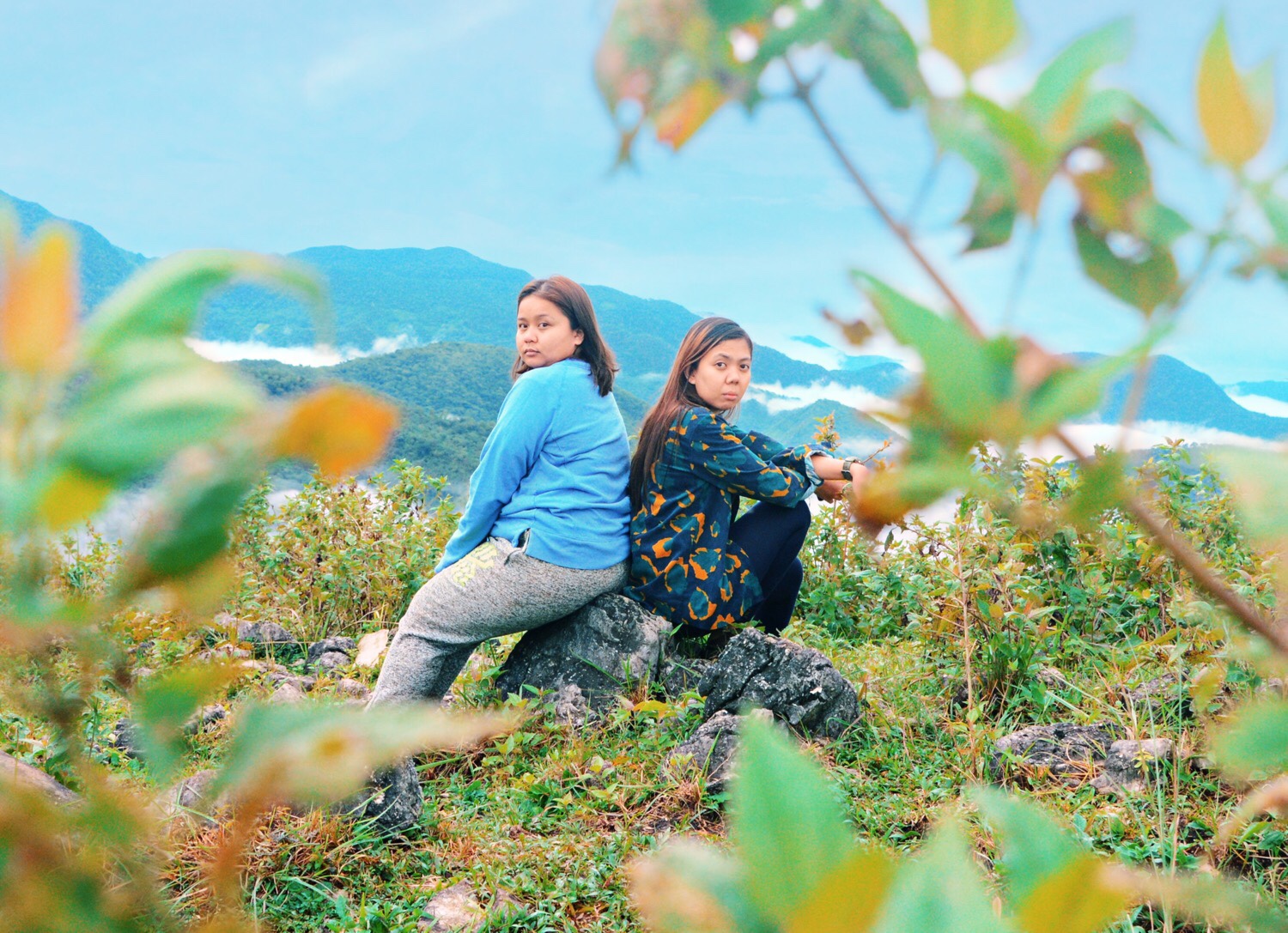
The sun had finally battled its way out of the clouds. The cold slowly chased away by its warmth. We just finished our breakfast and were packing up so we could continue the hike. From Peak 1, we ascended to Peak 2. It was a moderate uphill of bout 15-20 meters that took us no longer than 2 minutes to cover. After Peak 2, a short descent followed. Ascending to Peak 3 was sort of a challenge but not much. It took us 10 minutes to trek along a steep trail that was a combination of soft earth and rocks. Finally reaching Peak 3, we were entertained by a stunning view of rolling hills and ridges of the mountains nearby. We took some time to rest and snap some photos. Once ready, we continued to hike to the summit.
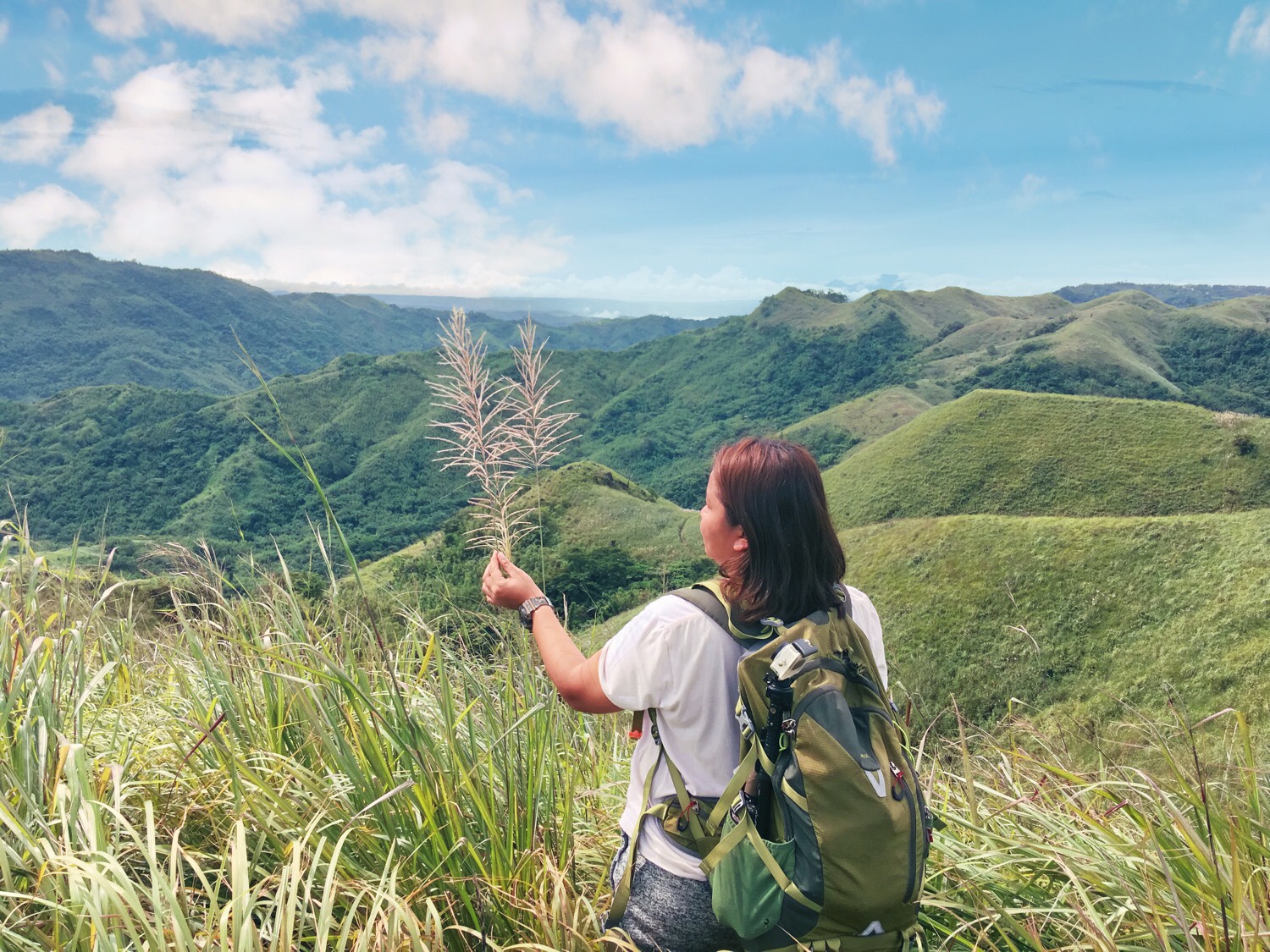
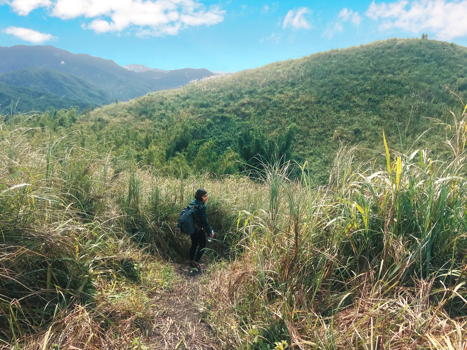
From Peak 3, we walked along moderate slopes with the trail in some parts concealed by thick bush. It lasted maybe 5 minutes before we took a quite steep and slippery descent. Covering the descent with little difficulty, we went on to the final stretch of the hike to the summit. The assault to the summit lasted for about 10 minutes. It was through a steep, rocky trail covered in thick and tall bush. The trek was not too challenging but the scorching sun was. We were directly under it as there were no trees to protect us from it. Finally reaching the summit was a relief not only because of the gorgeous view up there but because it meant the end is near and food and refreshing shower await.
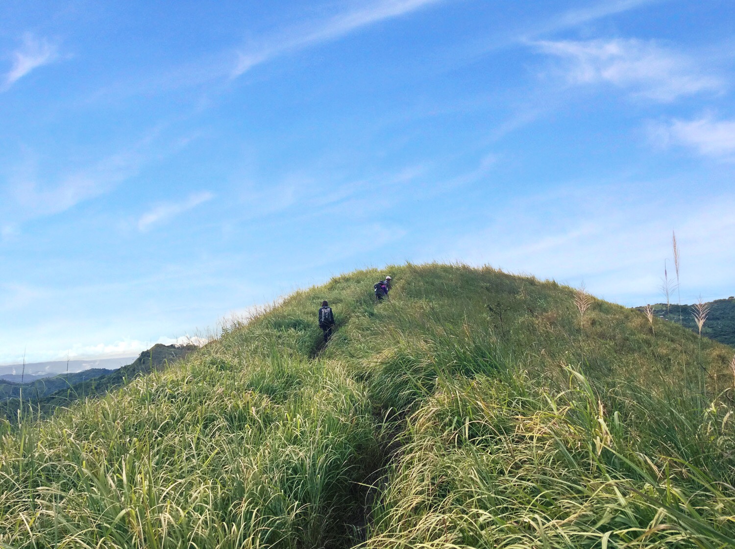
After snapping several photos at the summit, we started the descent. We covered a quick and easy downhill before taking on the uphill walk to another peak. From the last peak, the next part was a steep descent along a trail covered in grass. It stretched for about a kilometer and took us 10-15 minutes to cover. Past the steep descent were moderate slopes passing by a handful of houses, several puddles and a stream. Covering the last stretch of the descent, we emerged into the main road, only a few walk away from the junction where several hikers rested. We didn’t bother to rest and went to continue with the hike covering the final moderate uphill back to the trailhead. At least that was the plan but as soon as we spotted a motorcycle halfway through, we figured we could save our legs from further torture and one by one rode that lifesaving machine to where food and shower awaited.
TIPS & OTHER USEFUL INFORMATION
- Hiking Mt. Binutasan and its twin mountain Sapari requires no reservation. You can simply make your way to Brgy. Cuyambay, register, secure a guide and hike. Hiring a guide in advance is also not necessary. Guides can be acquired upon registration and is mandatory.
- Hiking Mt. Binutasan is really easy. The trail consists mostly of downhills and moderate uphills. There were only a handful of steep assaults. Note that the situation could change drastically during rainy days and the insanely muddy trail could post challenge especially to new hikers.
- The trail is infested with limatiks or blood-sucking leeches especially the muddy or wet parts. Wear appropriate trekking shoes and clothes as they tend to easily stick to the skin unnoticed.
- Mt. Binutasan accepts both day and overnight hikers. The registration is open even in the late hours of the evening. Should you wish to camp at the summit, make sure to bring your gears and provisions.
- The trailhead is quite far from the registration area. Hikers have the option to ride a motorcycle for a fee of P50/motorcycle.
- Always practice LNT to lessen our negative impact. Bring a reusable water bottle instead of disposables. Put your food in a reusable container instead of one-time-use plastics. Should you still have trash, make sure to throw them on the designated trash bins in the area or when you get home.
HOW TO GO TO MT. BINUTASAN
Option 1: From Cubao, ride a jeepney going to Cogeo Gate 2. In Cogeo Gate 2 Terminal, ride another jeepney going to Sampaloc in Tanay and alight in Brgy. Cuyambay junction. From the junction, you can either walk or ride a tricycle to the registration site.
Option 1: From Starmall Edsa in Shaw Boulevard, ride a van going to Tanay. In Tanay, ride a motorcycle to Brgy. Cuyambay for P600 that could fit 5 passengers.
BUDGET, ITINERARY & OTHER ESSENTIALS
| MOUNTAIN INFO | Name: Mt. Binutasan Elevation: 562 MASL Jump Off: Brgy. Cuyambay Tanay Rizal Difficulty: 3/9 Feature: Rolling Hills, Grassland, Scenic View Of The Sierra Madre Range |
| SUMMARY OF EXPENSES (4Pax Via Shaw Blvd-Tanay Route) | 2-Way Van - P140 2-Way Tric @ P650 - P325 Registration - P30 Guide Fee @ P500 - P125 Food - P200 Total - P820 Note: We used our rented tric in going to and coming from the trail head. The tric struggled in going up to the highway so we ended up walking on steep parts. |
| SAMPLE ITINERARY | DAY HIKE 0100 Meet Up 0200 ETD Brgy. Cuyambay 0300 ETA Brgy. Cuyambay. Register 0400 Start Hike 0530 Peak 1. Sunrise Viewing 0600 Breakfast At The Peak 0700 Start Trek To Summit 0800 Summit 0830 Start Descent. Backtrail If Continuing Hike To Mt. Sapari. 1000 End Of Hike. Shower. 1200 Lunch 1300 Sidetrips (Daranak Falls, Windmills Or Regina Rica) 1600 ETD Home OVERNIGHT Day 1 1300 Meet Up 1400 ETD Brgy. Cuyambay 1500 ETA Brgy. Cuyambay. Register 1530 Start Trek 1730 Peak 1/Summit. Sunset 1800 Set Up Camp 1900 Dinner & Socials 2200 Lights Out Day 2 0500 Wake Up. Sunrise Viewing 0600 Breakfast 0700 Start Descent. 0800 Hike Mt. Sapari (Optional) 1000 End Of Hike. Wash Up/Shower 1200 Lunch 1300 Side Trips (Daranak Falls, Windmills Or Regina Rica) 1600 ETD Home |
| THINGS TO BRING | 2L Trail Water Trail Food (Fruits, Chocolates Etc) Extra Clothes Extra Cash Camera Toiletries Cap/Umbrella Poncho (In case it rains) Cookset Tent/Hammock (Overnight) Earth Pad/Sleeping Bags (Overnight) |
| WHAT ARE FEES? | GUIDE Day Hike - P500 Overnight - P1250 Registration - P30 Motorcycle To Trailhead - P50 |
| CONTACT INFO | Brgy Cuyambay Tourism Ms. Rose - 09093379673 |


There you have it lovelies. I hope our adventure inspires you to give this jewel a visit. Should you have questions, suggestions and violent reactions, just leave them on the comments. Make sure to share this post with your friends! Until next time. Ciao!
Discover more from A Wanderful Sole
Subscribe to get the latest posts sent to your email.


2 Comments
May i know how will i contact the guide in Mt Binutasan?
Hi Kathy. Guides are avail upon registration. You can contact Ate Rose for other details. Her number is there on the blog. 👆🏻