

Why do I climb mountains? Why do I keep challenging myself? Is it for the love of nature? Or achieving something spectacular? What do I get from climbing up a mountain summit? Exhaustion. The same damn view of the valleys below. Scars. I don’t have definite answers to each of these questions but whenever the mountains call, I always heed and go. It’s the same for this hike in Mt. Daguldol. I have not hiked a single mountain since Mt. Mapalad six effing months before and I felt like I have been slacking more than I should that my body badly needed some beating. Since nothing good ever comes out from planning a trip, I decided rather abruptly to go on a day hike with whoever would be able to come along among my friends. It didn’t really matter if I end up going alone. Since I failed to summit Mt. Daguldol during my first try last summer, I chose to give it another shot.
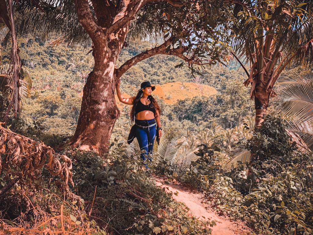
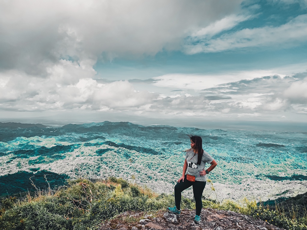
Mt. Daguldol is among the many less popular mountains in Batangas, for newbies at least. The famous choices were always Mt. Batulao and Mt. Maculot. But if you’re one of those who have come to love the outdoors, Mt. Daguldol could be one of your favorites. It’s the kind of mountain that offers a balanced terrain. Just the right amount of challenging trails to make you drop to your knees and equal amount of easy parts to let you breathe. This mountain is also home to a small community that you will get to interact with good-natured locals, have a meal over a hearty conversation and videoke and get plenty of snacks on every stop. The view up its summit is also one of the best you’ll see. Deep blue water of the coast on one side and lush greens and peaks of the nearby mountains on the other.
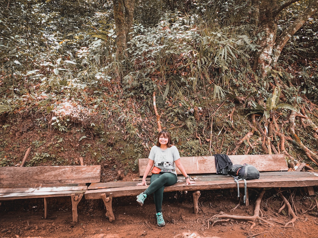
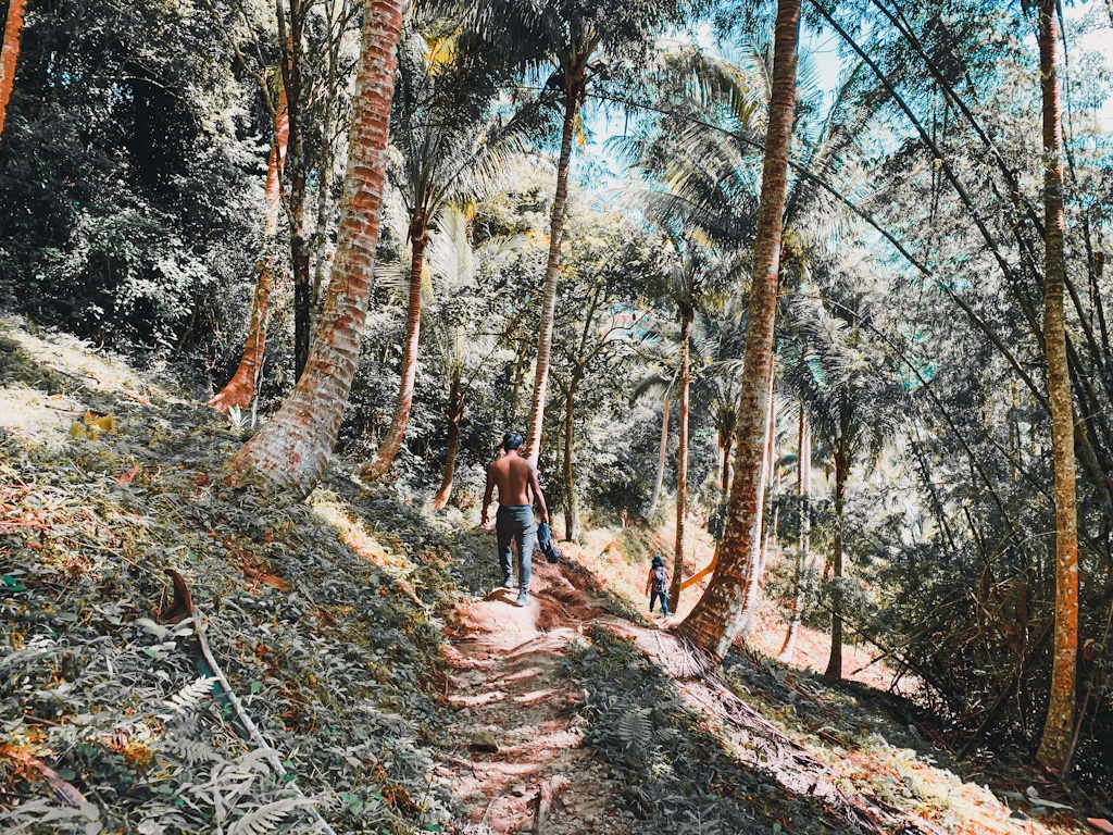
The hike would start from the Barangay registration area with a gradually ascending path that stretches to about a hundred meters to a concrete highway. From there, the trailhead should only be about thirty steps away. The trail would start with a short walk on flats and would quickly shift to a steep ascent along boulders. The ascent will take about 15-20 minutes of the hike before reaching the first resting station. Following the first resting station are walks along flat surface in between short steep ascents. This will go on for another 10-15 minutes until you reach a stream. Following the stream is a house and a bamboo bench where you can catch your breath.
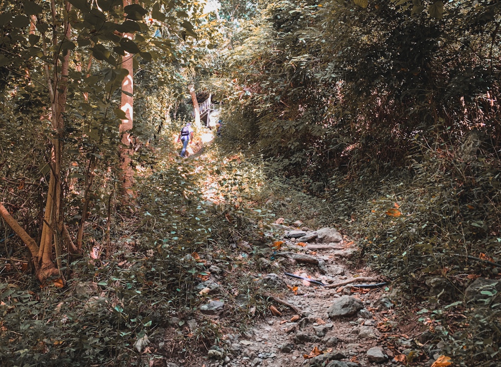
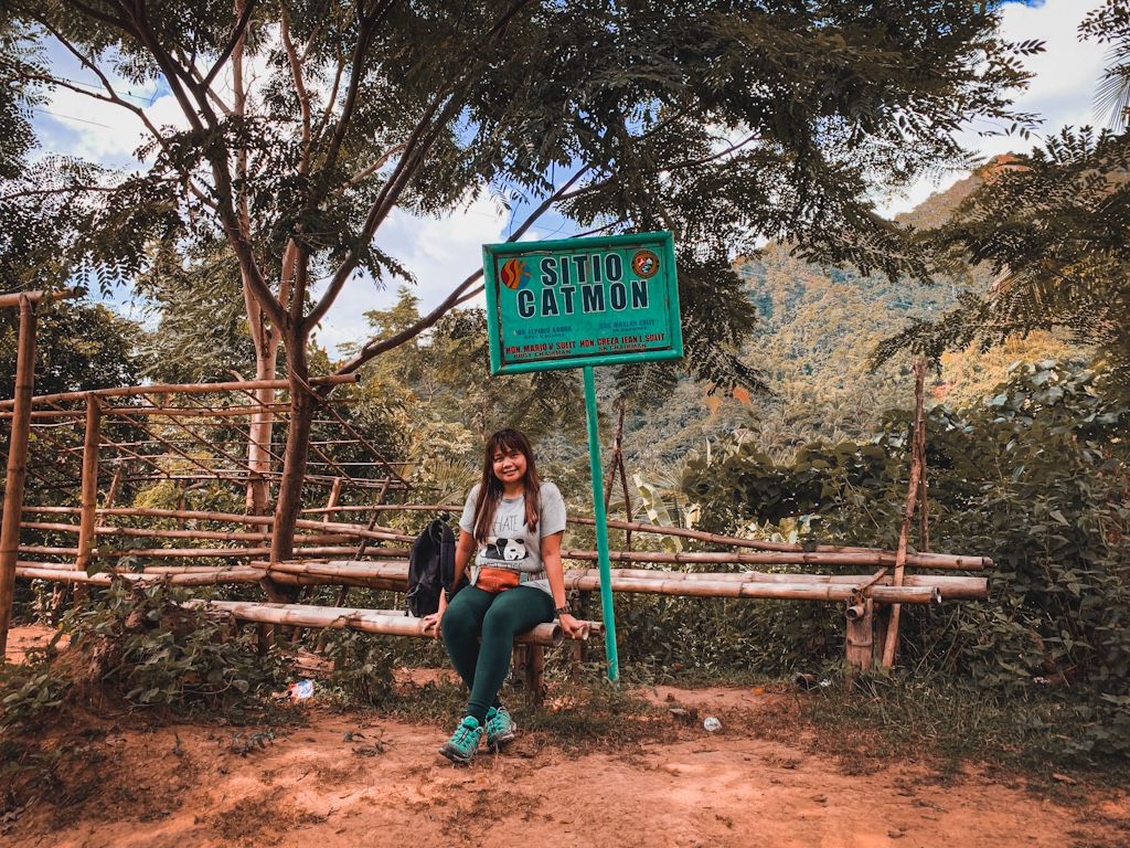
The hike will continue along moderate slopes of soft earth and rocks. There will still be long steep ascents but you will be rewarded with a scenic view once you reach a clearing. The first part of the hike up to the 2nd resting station is covered in trees. Only when you near the 3rd resting station will you be able to see the lush greens of the valley. Twenty minutes from the 2nd station, you will reach Sitio Catmon. Here you can have a longer break to indulge in snacks and some halo-halo. This is also the part where we first felt the wind. It was so refreshing and calming as opposed to the warm air along the trail that constricts the lungs, making it hard to breathe.
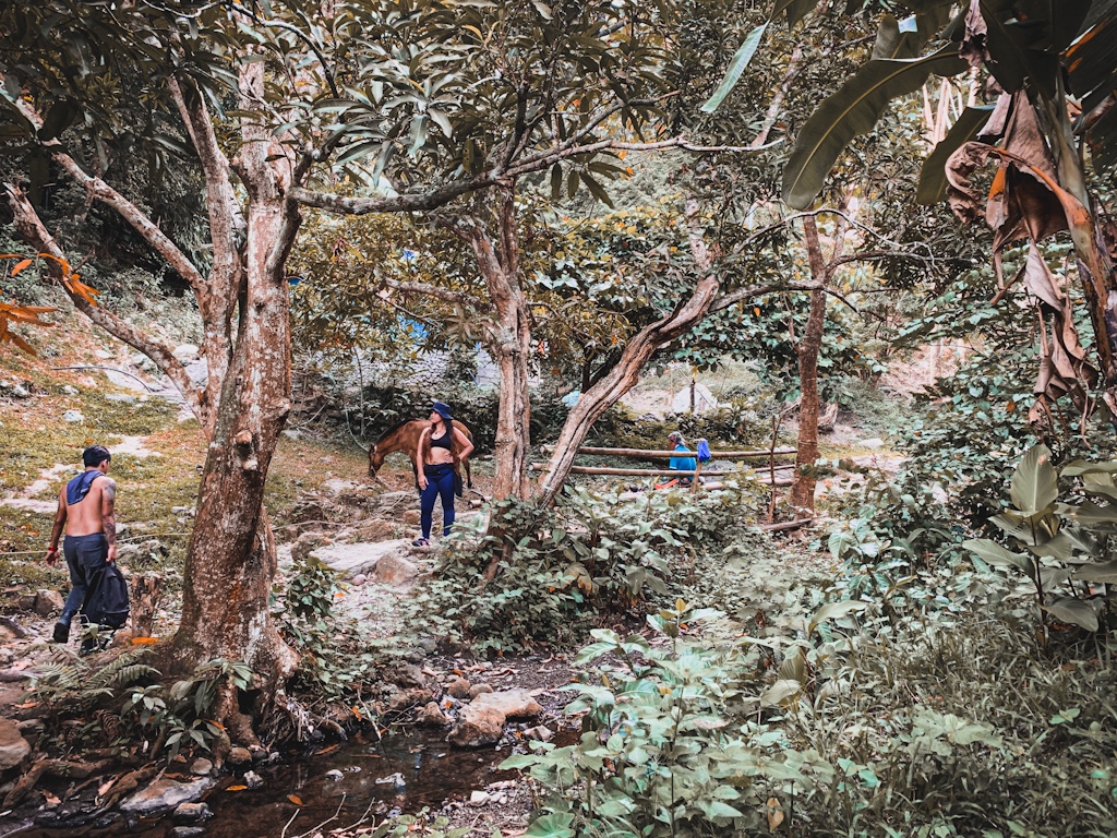
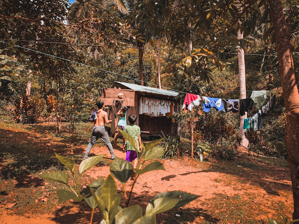
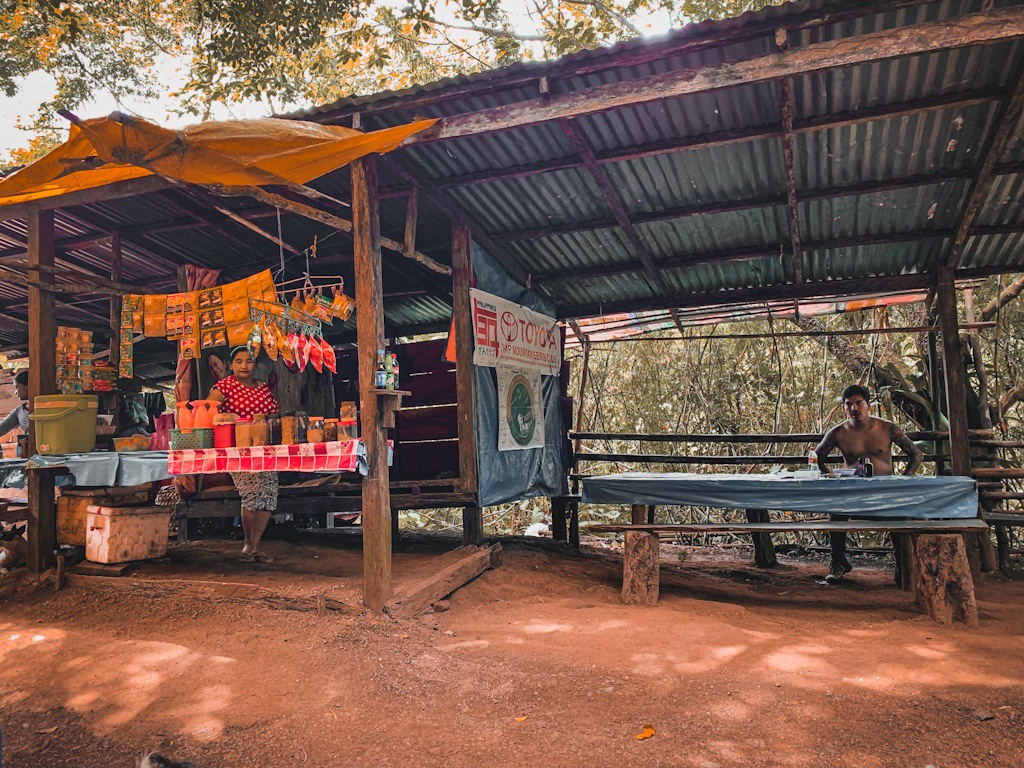
Past the resting station in Sitio Catmon, it will be uncommon to encounter houses. Most of them are empty but there are some with locals resting after a day’s work in their farms. During harvest season, you will see tons of coconut peelings piled in some parts along the trail. You’ll be lucky to encounter locals in the work who will hand you some coconut meat to snack on. Halfway before covering half of the entire hike is the first descent. It will be steep and a bit treacherous especially during rains. Once you reach the very bottom of the descent, a steep path going up follows and will lead you to another set of houses. You will be tempted to rest here but I suggest that you continue the hike for another 10 minutes, you will reach this mountain’s famous bulalohan.
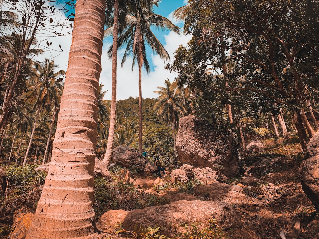
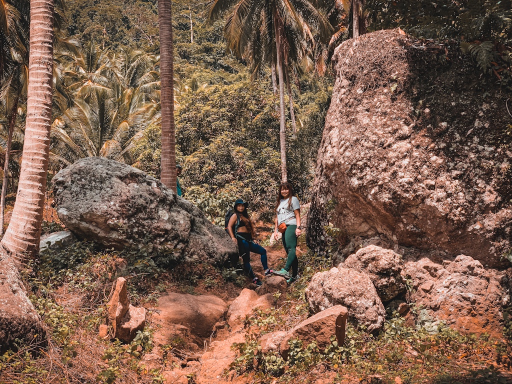
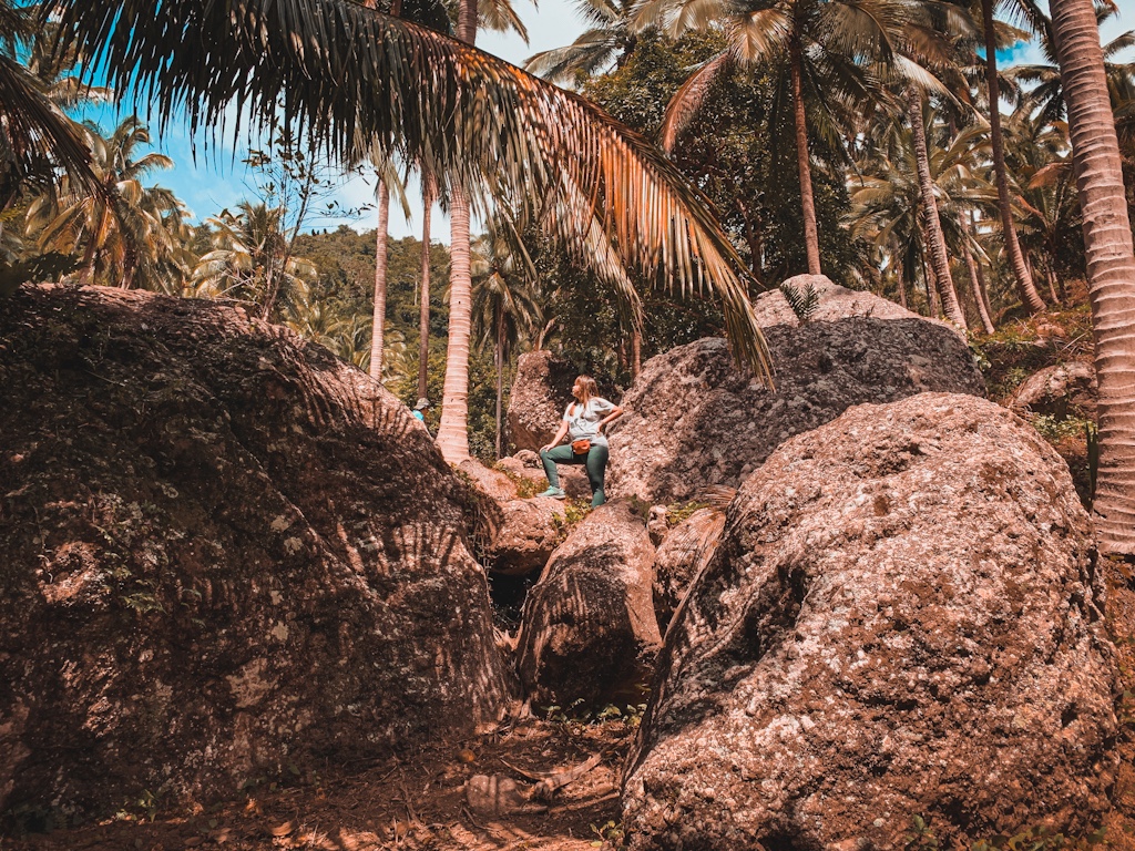
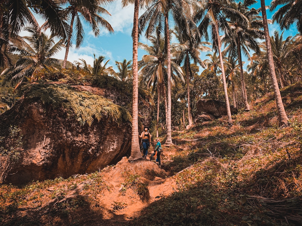
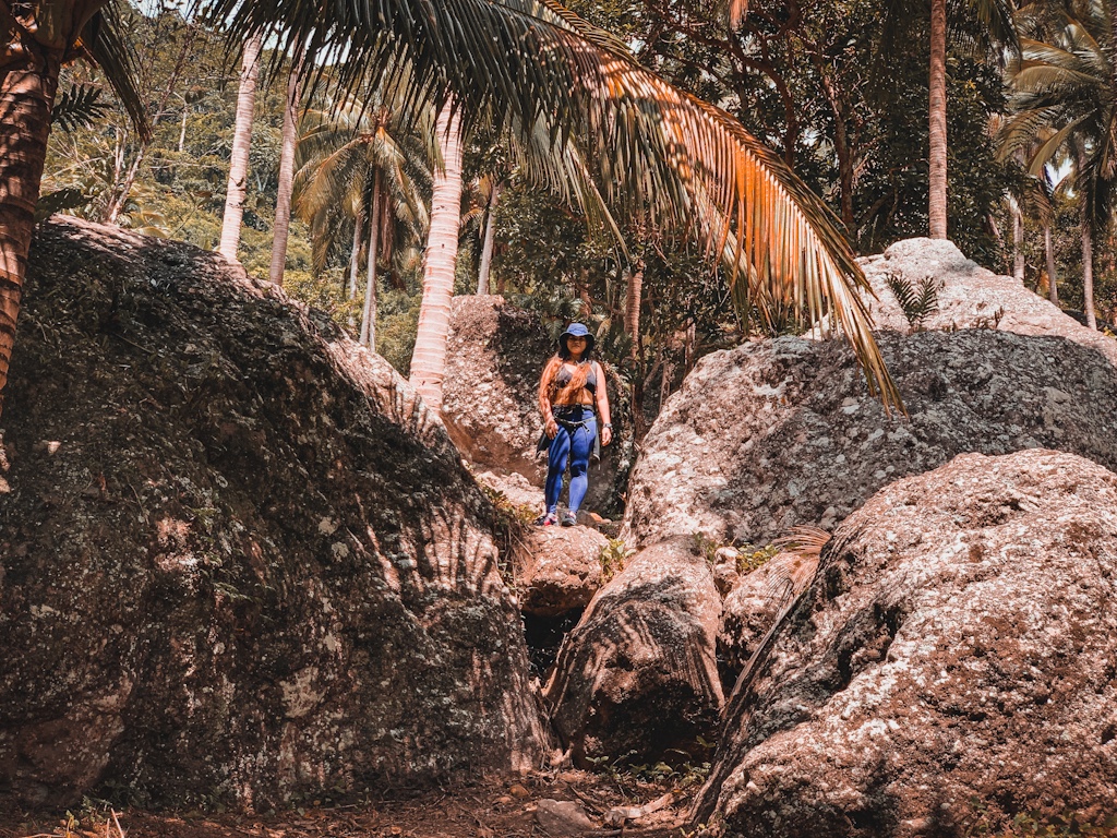
The bulalohan is the halfway mark of the hike. It will be packed with hikers but not during off peak times. If you reach it hours before lunch, you can reserve a bowl or two which you can indulge in after coming back from the summit. If you have rested enough, brave yourself for what awaits are the most difficult parts of the hike. Covering a short distance from the bulalohan are towering coconut trees. But the most astonishing sight of all are the boulders, gigantic ones, scattered all over like they were some kind of meteors thrown to earth from skies. This part may be the most difficult but also the most entertaining. Can’t help but be in awe. It’s such a beauty and the kind you would like to behold in a time when the hike is at its trickiest.
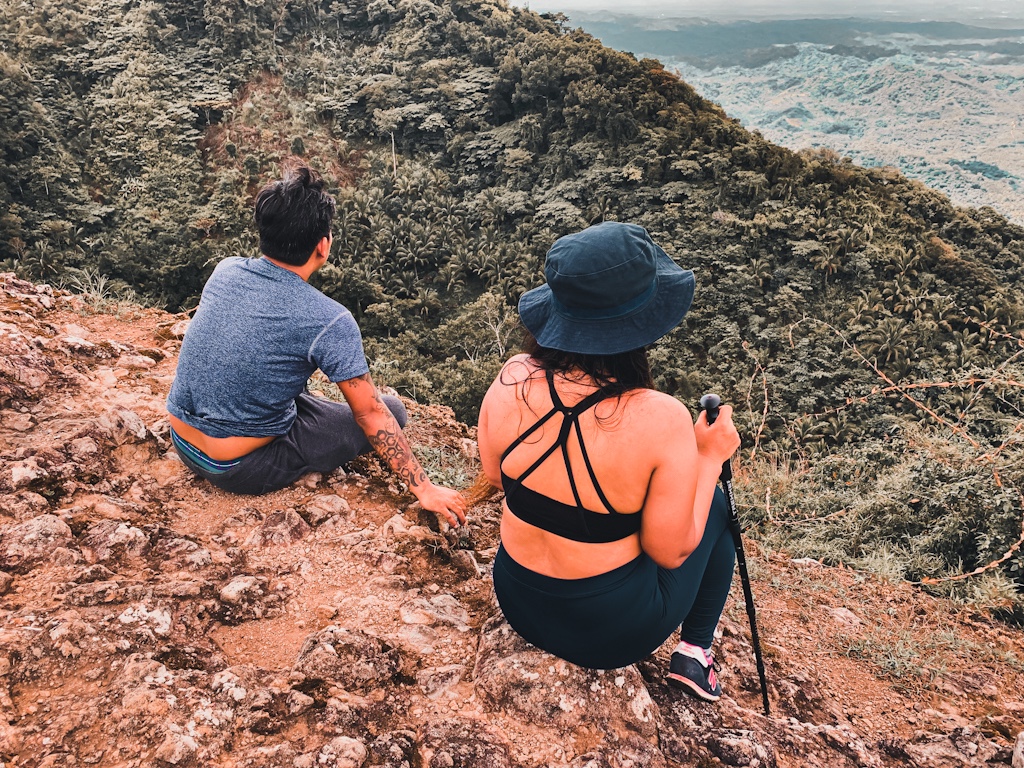
There will be no room for breathers past the halfway mark of the hike. It will be steep ascents all the way to the summit with the final assault to the summit being the steepest. You can stop to rest but no amount of rest could ever relax your knees from shaking. All there is to do is to go on before exhaustion finally takes its toll. To make it more bearable for us, our guide decided to take the easier route, taking the trail going to the campsite first instead of the one directly to the summit. He actually didn’t tell us about it until we have rested well and have snacked on another glass of halo-halo. Only when he asked us to continue that I realized the torture was far from over.
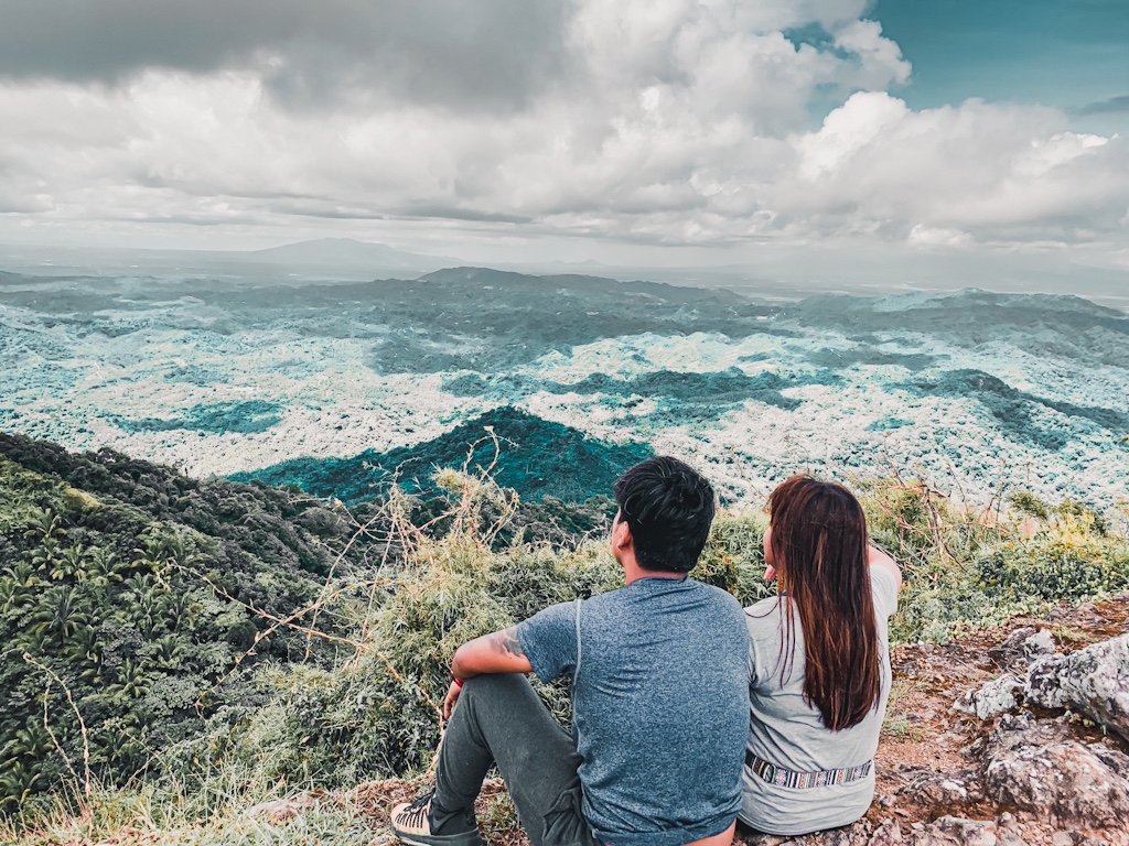
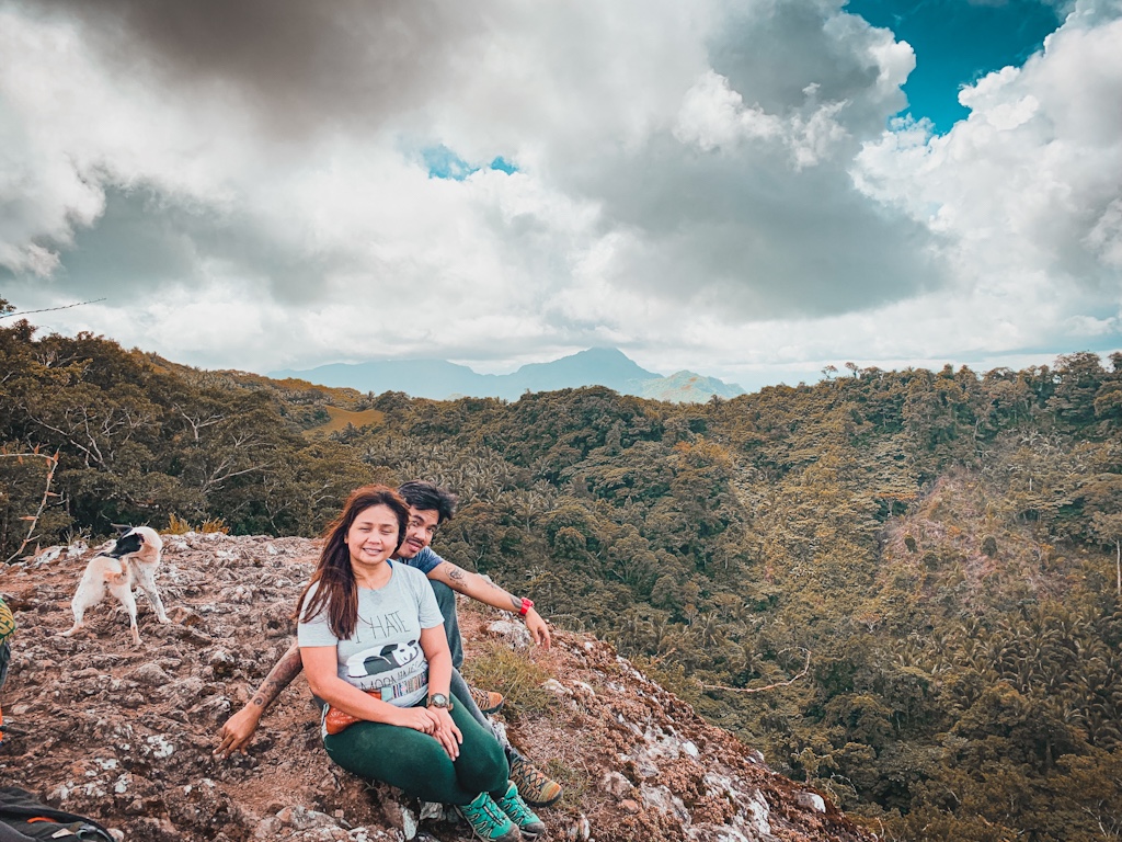
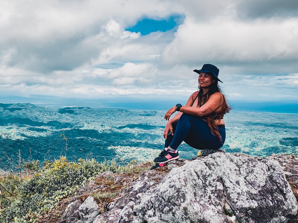
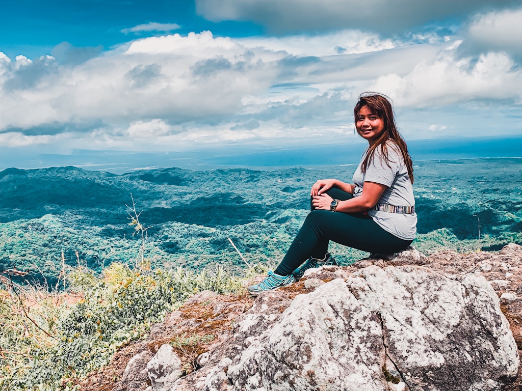
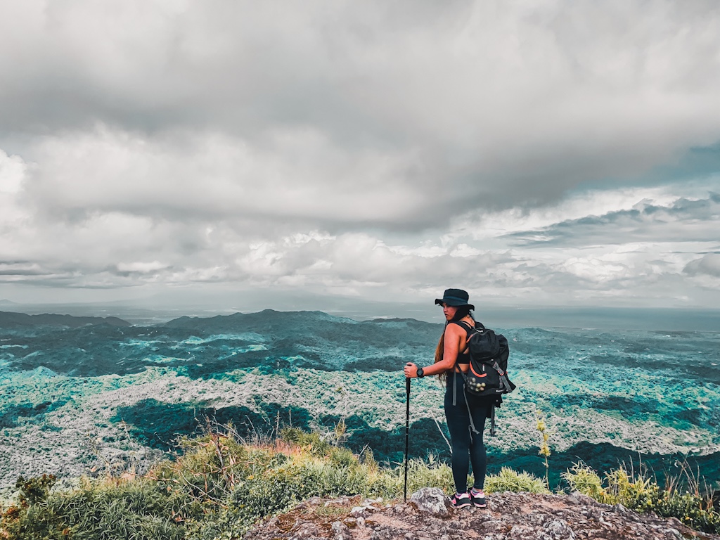
We went to continue the hike to the summit. Our guide directed us to a steep and slippery trail leading down. It went on for about 100 meters then we were led to another of Mt. Daguldol’s peaks. Another short descent followed. And when it was over, the steepest ascent of the hike finally showed up. I was short of breath and exhausted. Felt like my energy had depleted rather quickly even after just having a snack. But I persevered. Quitting wasn’t an option since we had already come too far. The assault to the summit was steep and never-ending. It was one of the longest ascents of this mountain’s trail. Once it’s over, a short walk on a flat surface follows. After that is the humongous piece of rock protruding from the mountain like a hunchback. Climbing it would allow you to witness the most scenic views Mt. Daguldol has to offer. It’s similar to Mt. Manalmon. Only the latter is easier.
Going down from the summit is a steep and long trail. The same is used to assault the summit but if you want an easier route, you better use it in reverse. Past the steep descent is the same trail we used in hiking up. Going down should be quick and easy as you will just trace your way back using the same trail until the bulalohan. The ascent to the summit took us almost two hours but reaching the bulalohan after coming down from the summit only took barely an hour. I was dead tired and could barely move a limb but the bulalo soothe my misery away. I spent about an hour singing to Moonstar 88’s Torete and Session Road’s Cool Off on a karaoke while both my friends dozed it off. When all of us got enough rest, we started descending to the trailhead. This hike took us 8 hours to finish but with plenty of stops for breathers and snacks.
In Cubao/Buendia Bus Stations, ride an Alps bus to San Juan (3Hrs ; P230/way). From the bus terminal in San Juan, walk to the jeepney terminal to Brgy. Hugom. Ride the jeepney to Brgy. Hugom (45Min ; P30/way). In Brgy. Hugom, ride a trike going to the registration site (20Min ; P50/way/person).
Alternatively from San Juan, ride a trike all the way to the registration site (P400/way).
- The total hike to and from the summit of Mt. Daguldol takes eight hours in moderate pace and with plenty of breathers. Some can finish this within five but I suggest you take it slow especially the newbies.
- Start the hike early to finish early and avoid the sun. I tried the scale Mt. Daguldol last summer but the heat got me all nauseated that I decided not go on anymore.
- The trail is rugged but there are loose soils which could easily cause slips. Wear proper hiking footwear to avoid injuries and to have better grip especially if you will be hiking during seasons with dominant rains.
- Wear comfy clothes that will allow you to move freely.
- Bring plenty of drinking water and trail snacks. The hike is so taxing that you will need to replenish your energy often.
- Mt. Daguldol will make a perfect overnight hike since it has a spacious campsite.
- Hiking in Mt. Daguldol doesn’t require reservation. Walk-ins are most welcome.
- There’s a waterfall that will make a perfect side trip after the hike. Sadly, this is only good during the rainy months from July to November. It’s totally dry during summer.
- Avoid staying late since public transportation back to San Juan is limited and may no longer be available past 4PM. Tricycles are way expensive.
- If you have the time and money, you can check some of the resorts near Mt. Daguldol for a relaxing dip.
| Basic Info | Name: Mt. Daguldol Elevation: 672 MASL Difficulty: 4/9 Location: Lobo, Batangas Jump Off Point: Brgy. Hugom, San Juan, Batangas Feature: Rugged Terrain, Coconut Fields, Coastal View at the summit |
| Summary Of Expenses (3Pax) | 2-Way Bus Mla-Sn Juan - P460 2-Way Jeep to & from Brgy Hugom - P60 2-Way Trike to & from reg site - P100 Registration Fee - P30 Guide Fee - P167 Food - P200 Total - P1017/Person |
| Sample Itinerary | 0300 Assembly Buendia Bus Terminal 0400 ETD To Sn Juan 0600 ETA Sn Juan 0630 Brgy Hugom 0700 Register 0730 Breakfast 0800 Start Hike 1000 Bulalohan 1100 Summit. Photo Ops. 1130 Descent 1300 Bulalohan. Lunch. 1400 Start Descent to Trailhead 1500 Finish Hike 1600 ETD Home 1900 ETA Home |
| What Are The Fees | Registration Fee - P30 Guide Fee - P500/5Pax |
| Contact | Ate Lorna (Brgy) - 09075034435 |


There you have it lovelies!
Mt. Daguldol may have not been easy on me but I certainly had the best of time trying to overcome myself and my weakness. I hope you give this mountain a try. It surely won’t disappoint. Until next time. Ciao!


4 Comments
Hi, I just want to ask if you have the contact number of any guide for Mt Daguldol?
Thank you 🙂
Hello. i don’t have the number of the guide. I only have the number of the barangay in charge which is already on the blog.
Hi Keza, ^_^
Can I ask what exact date you hike Mt. Daguldol? Kasi nag ask ako sa Tourism of San Juan hindi pa adaw open as of the moment.
Thank you and keep safe!
Hello Joshua. Our climb was pre pandemic po. Ask na lang po kayo dun sa number na nakalista sa blog when ulit allowed maghike.